If you have items like this you wish to consign, click here for more information:
Selling with Case- Low Estimate: $800.00
- High Estimate: $1,000.00
- Share this:
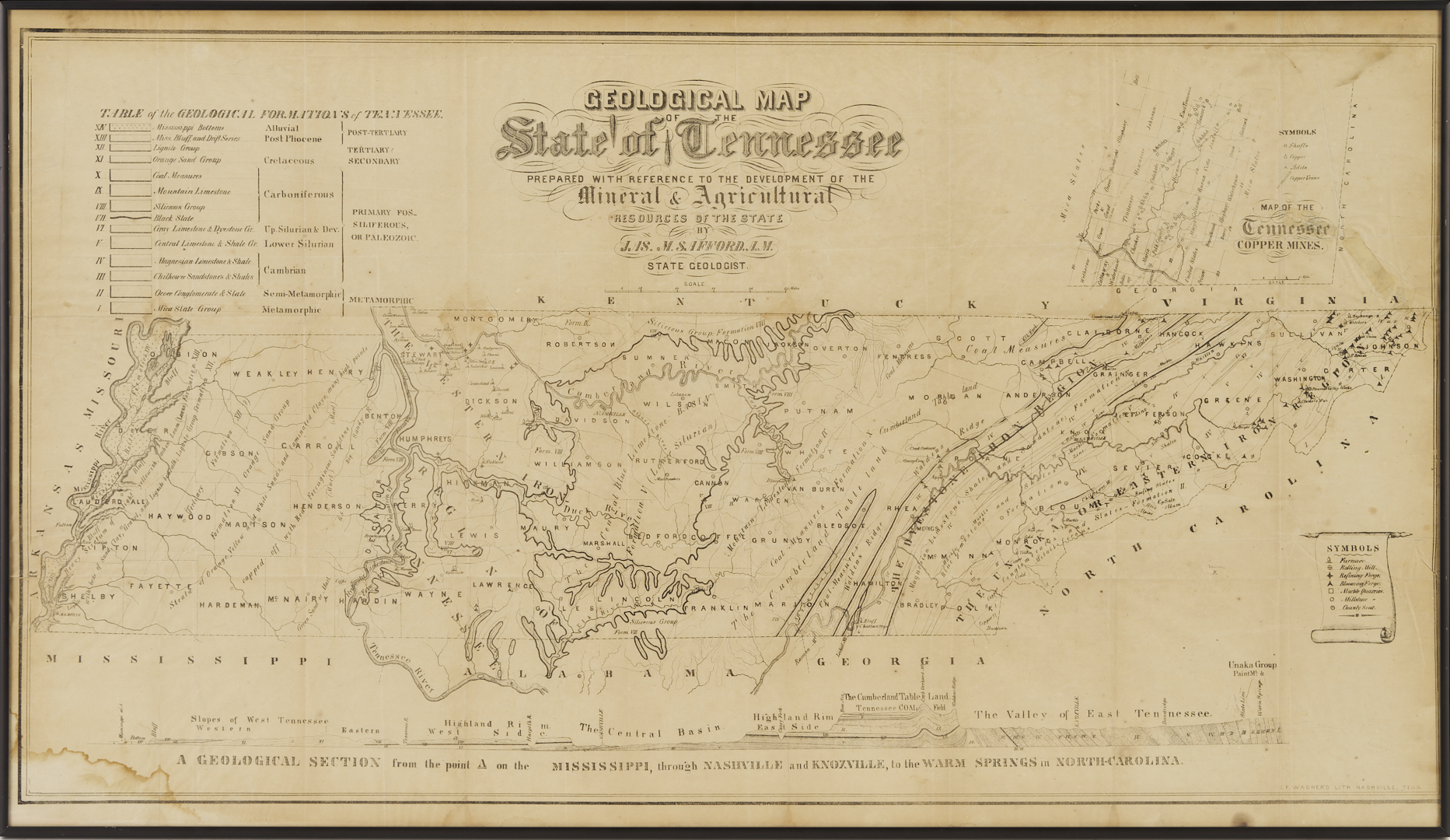
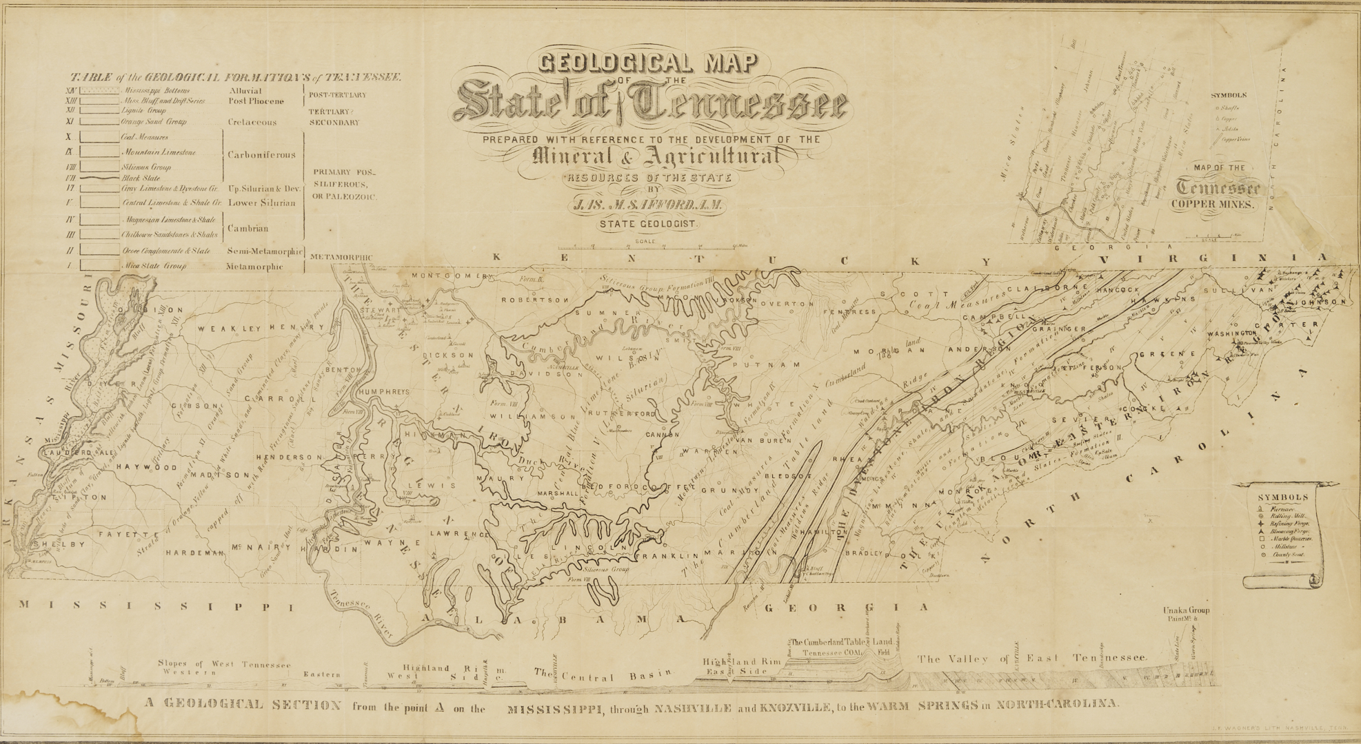
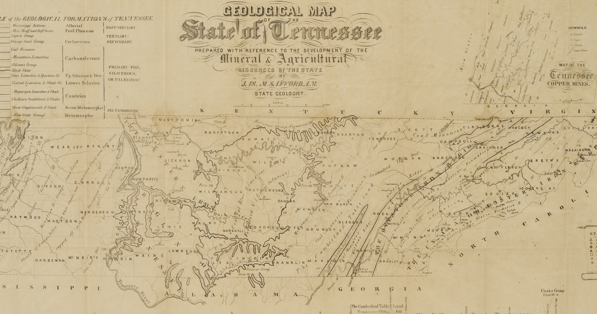
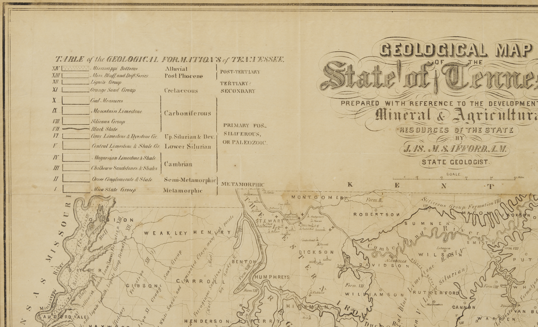
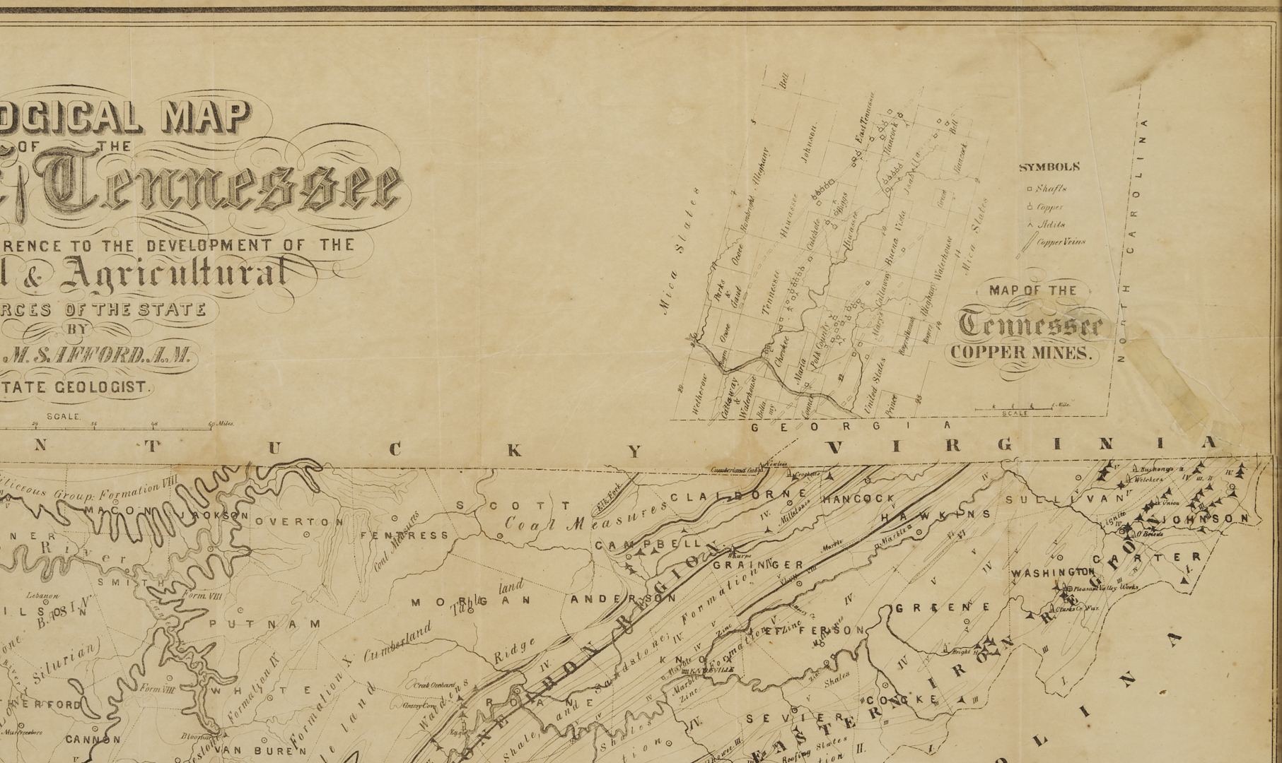
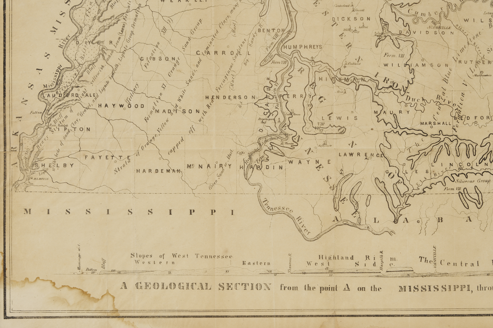
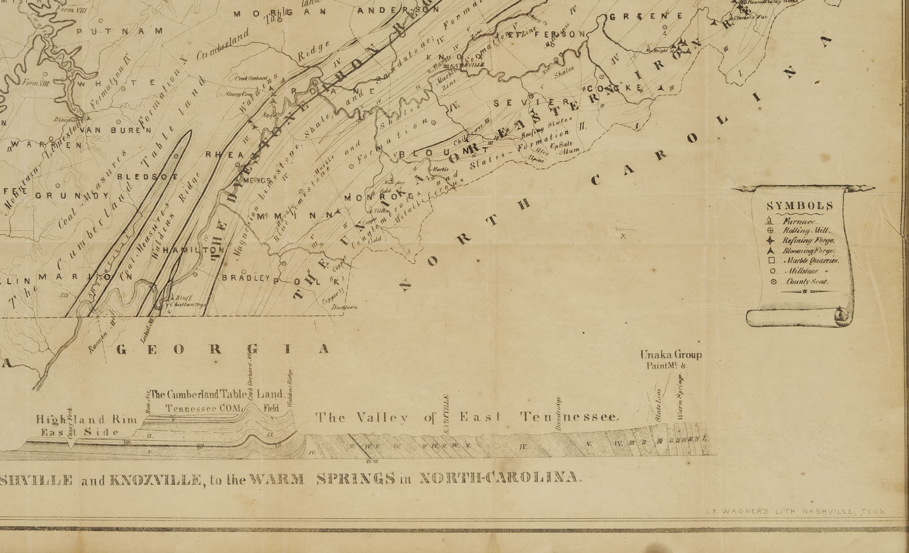
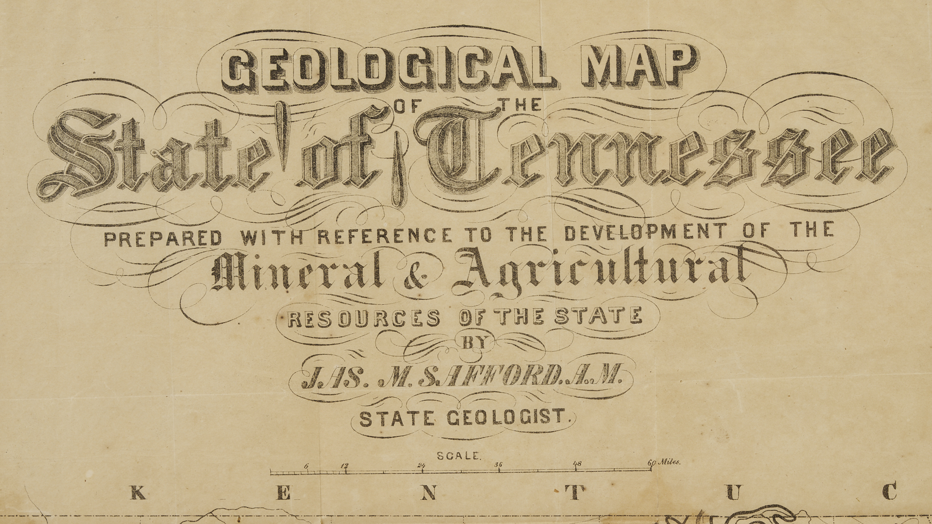
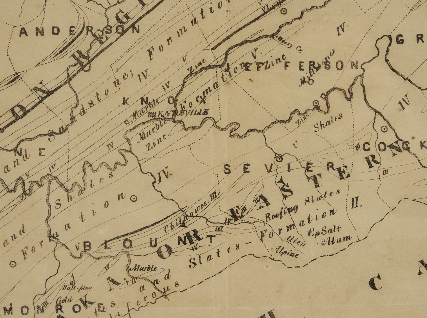
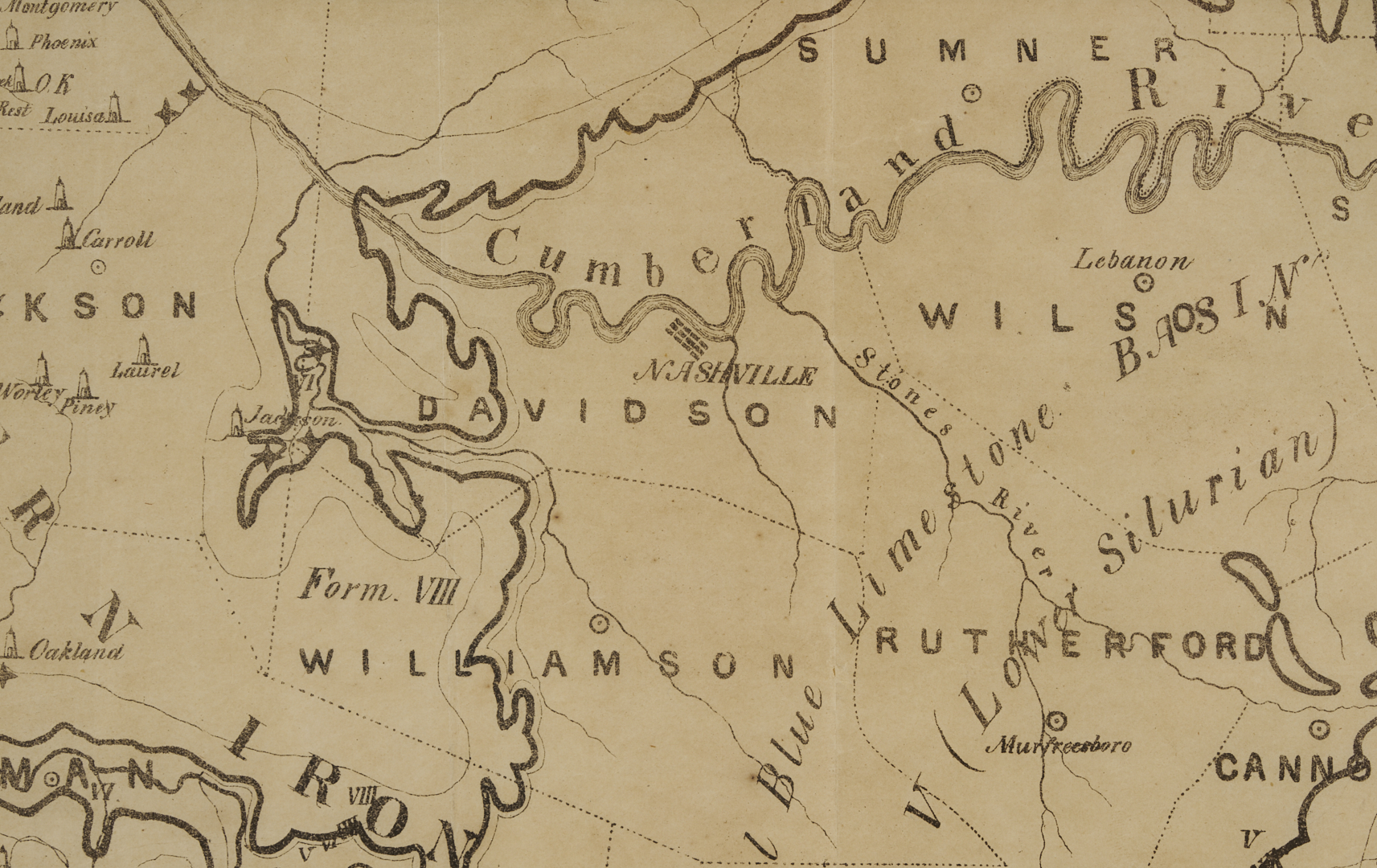
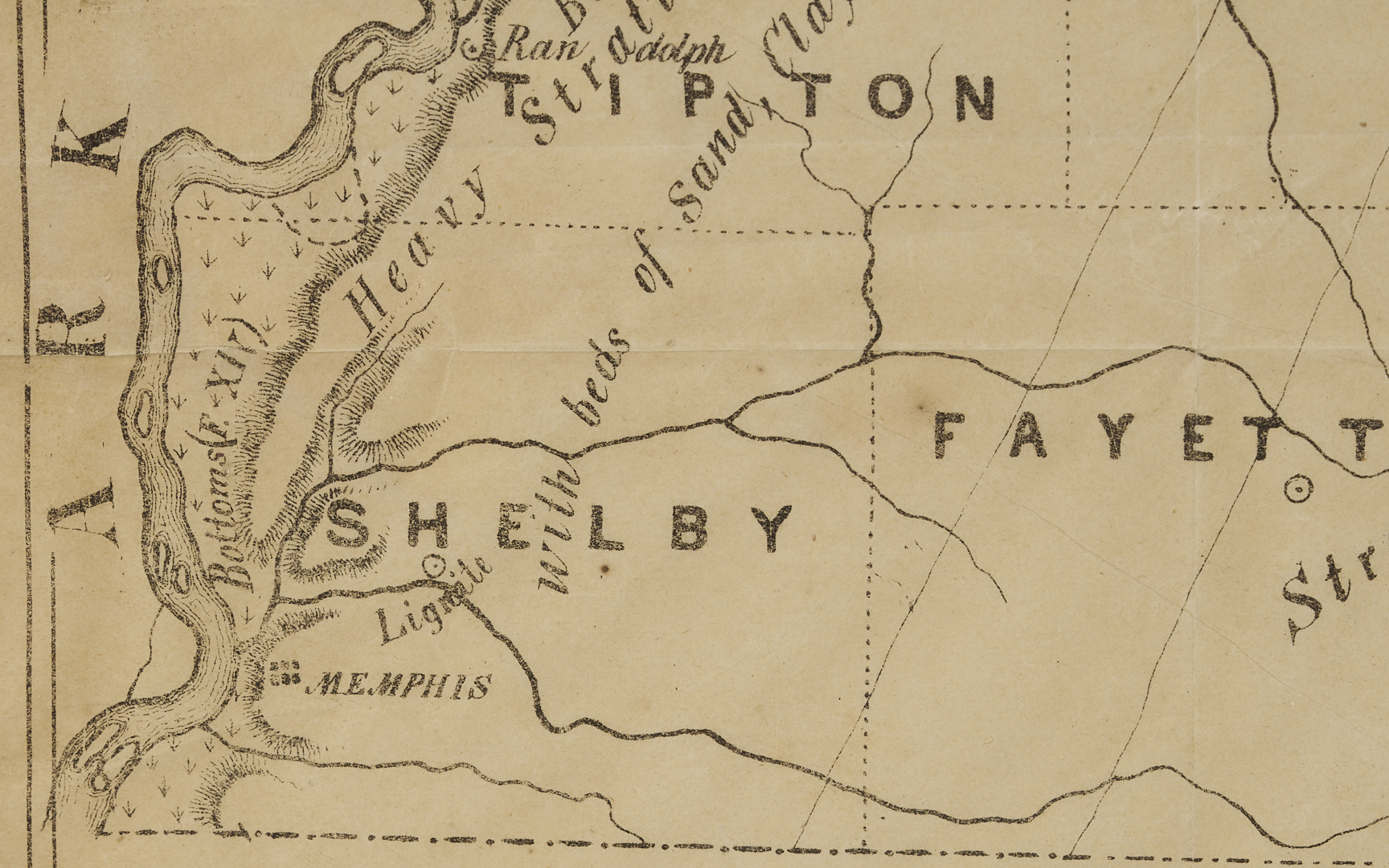
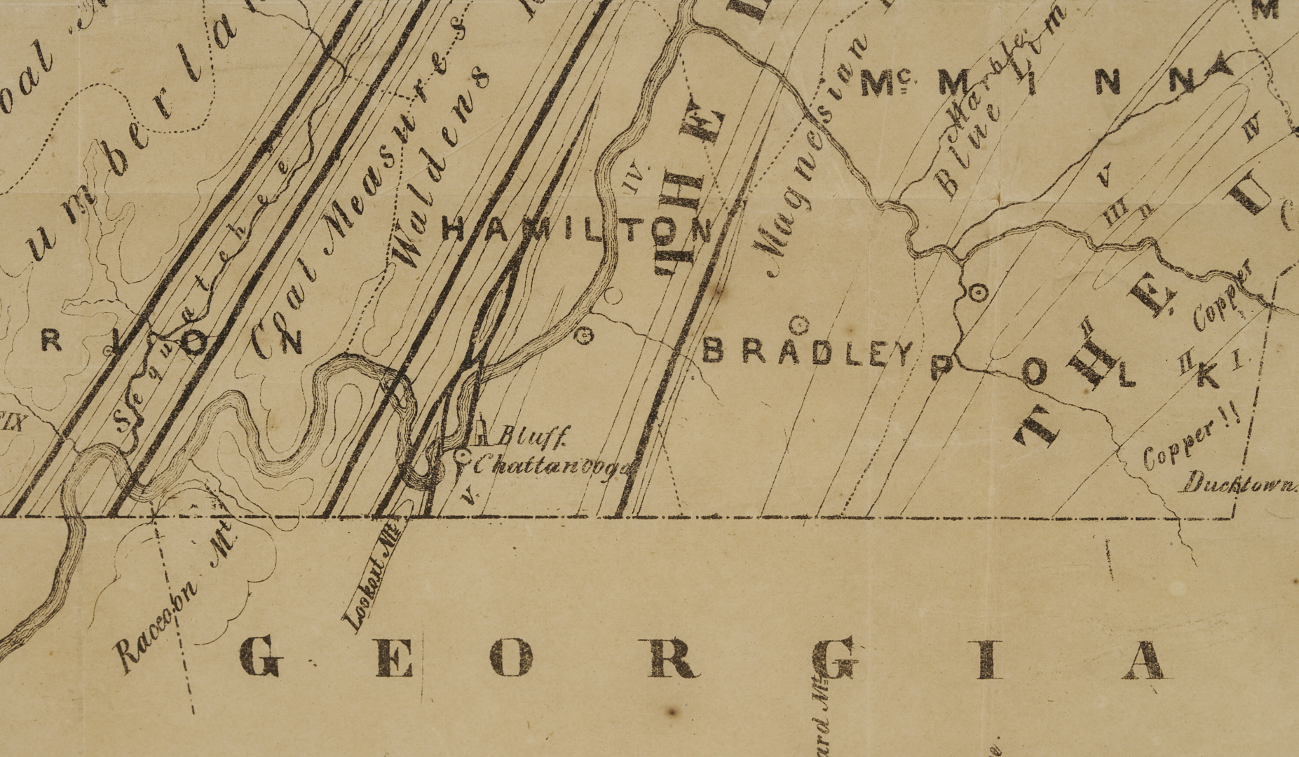
James Merrill Safford (American/Tennessee, 1822-1907) GEOLOGICAL MAP OF THE STATE OF TENNESSEE, lithograph on wove paper. Published in Safford’s A GEOLOGICAL RECONNAISSANCE OF THE STATE OF TENNESSEE (Nashville: G.C. Torbett & Co., State Printers, 1856) and printed by James F. Wagner of Nashville. Map includes a table of geological formations, an inset of copper mines, and marks key industrial sites such as furnaces, rolling mills, forges, and marble quarries. Housed under glass in an ebonized wood frame. Sight: 22 1/4 in. x 39 in. Frame: 22 3/4 in. x 39 1/2 in. Circa 1856. Note: This map, which very rarely appears on the market, was a groundbreaking effort to catalog the state’s economic potential by highlighting the state’s mineral and agricultural resources. Safford also produced a later, somewhat more common geological map of Tennessee published by Taintor Brothers in 1869. Biographical Note: “The creator of this map, James M. Safford (1822-1907), was appointed state geologist of Tennessee in 1854 and held this position until 1899. His classic work, THE GEOLOGY OF TENNESSEE, was published in 1869 and was later adapted as a secondary school textbook.” Source: Tennessee State Library and Archives, Tennessee Virtual Archive.
PROVENANCE: Private Kentucky Collection.
CONDITION: Multiple fold lines as issued. Tape repair to the right side, approximately 5 inches long. Tide line to bottom left and scattered liquid stains especially along upper center fold line, at each corner fold. Small stain outside the border at the bottom. Minor foxing throughout. Not examined out of frame.