If you have items like this you wish to consign, click here for more information:
Selling with Case- Low Estimate: $800.00
- High Estimate: $900.00
- Share this:
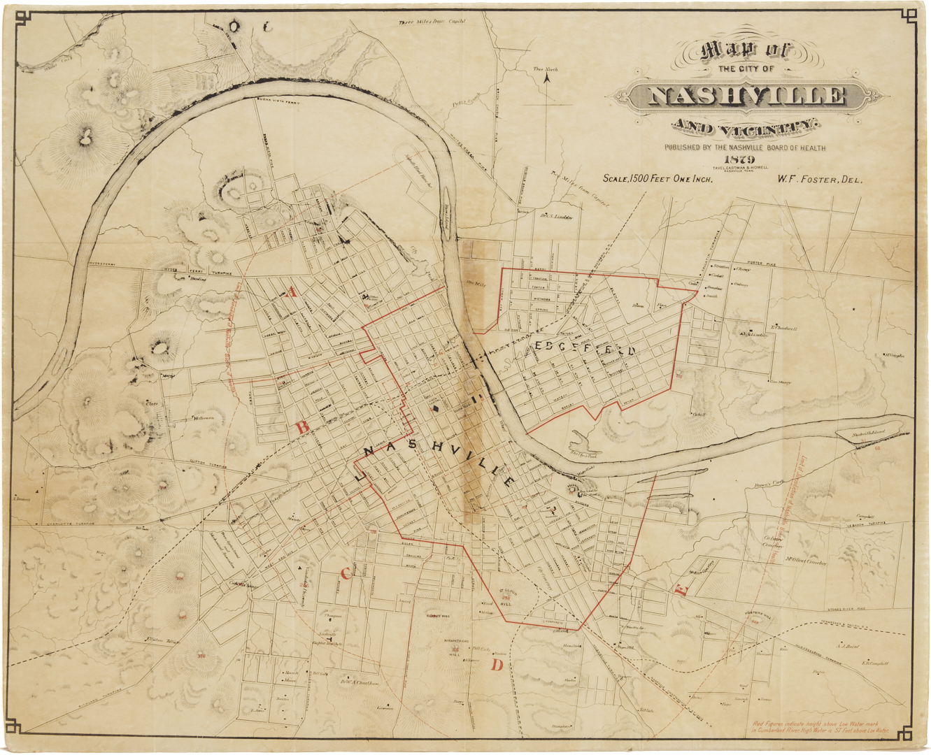
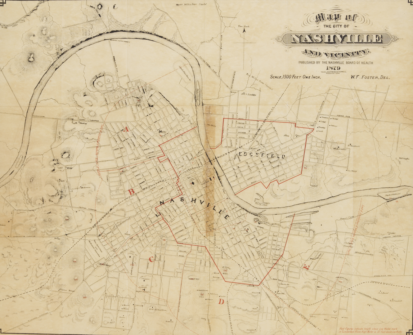
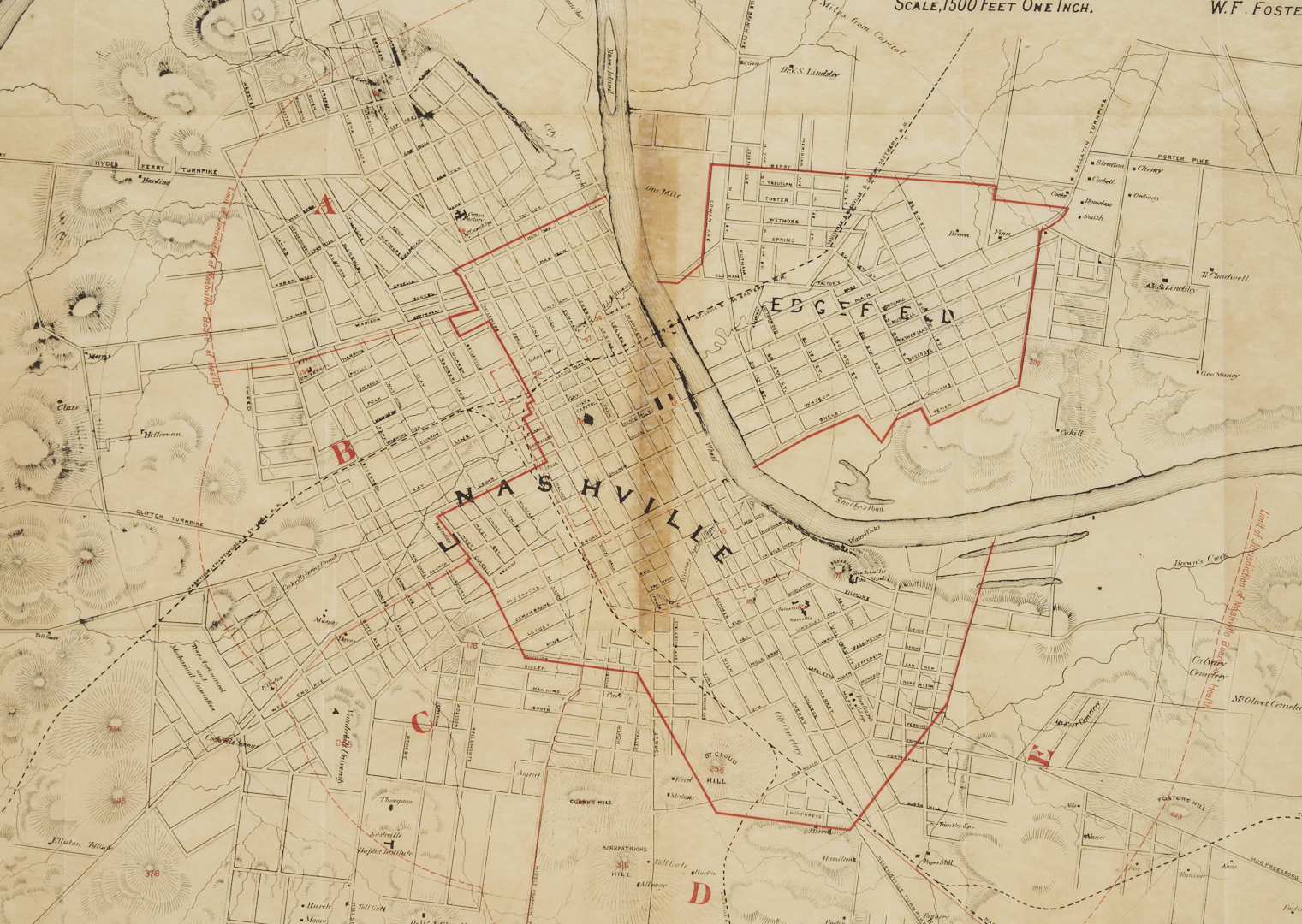
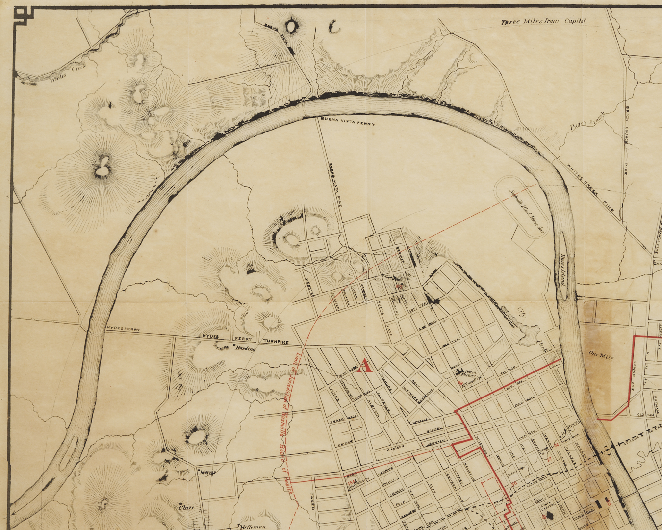
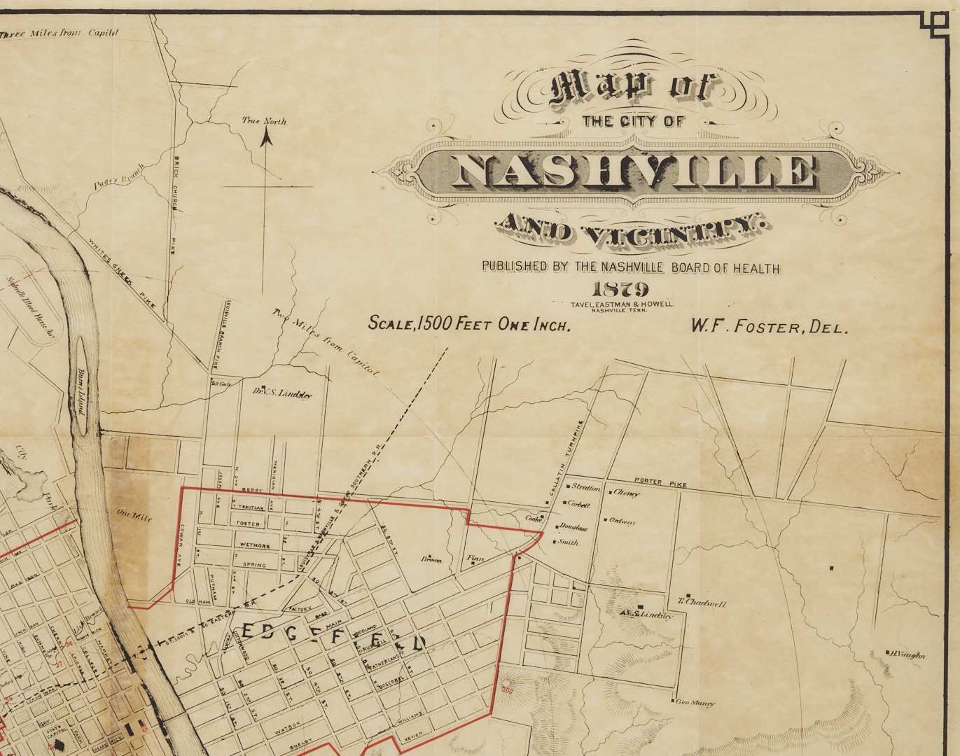
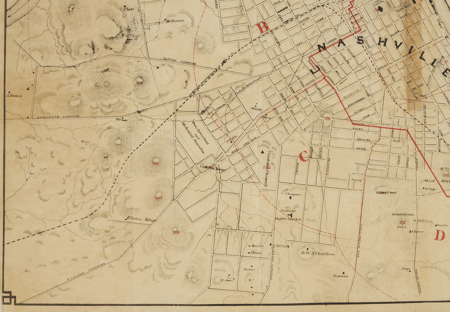
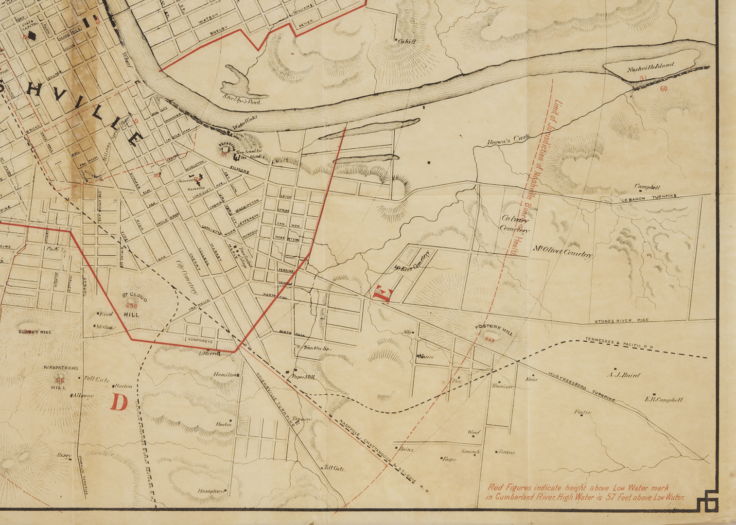
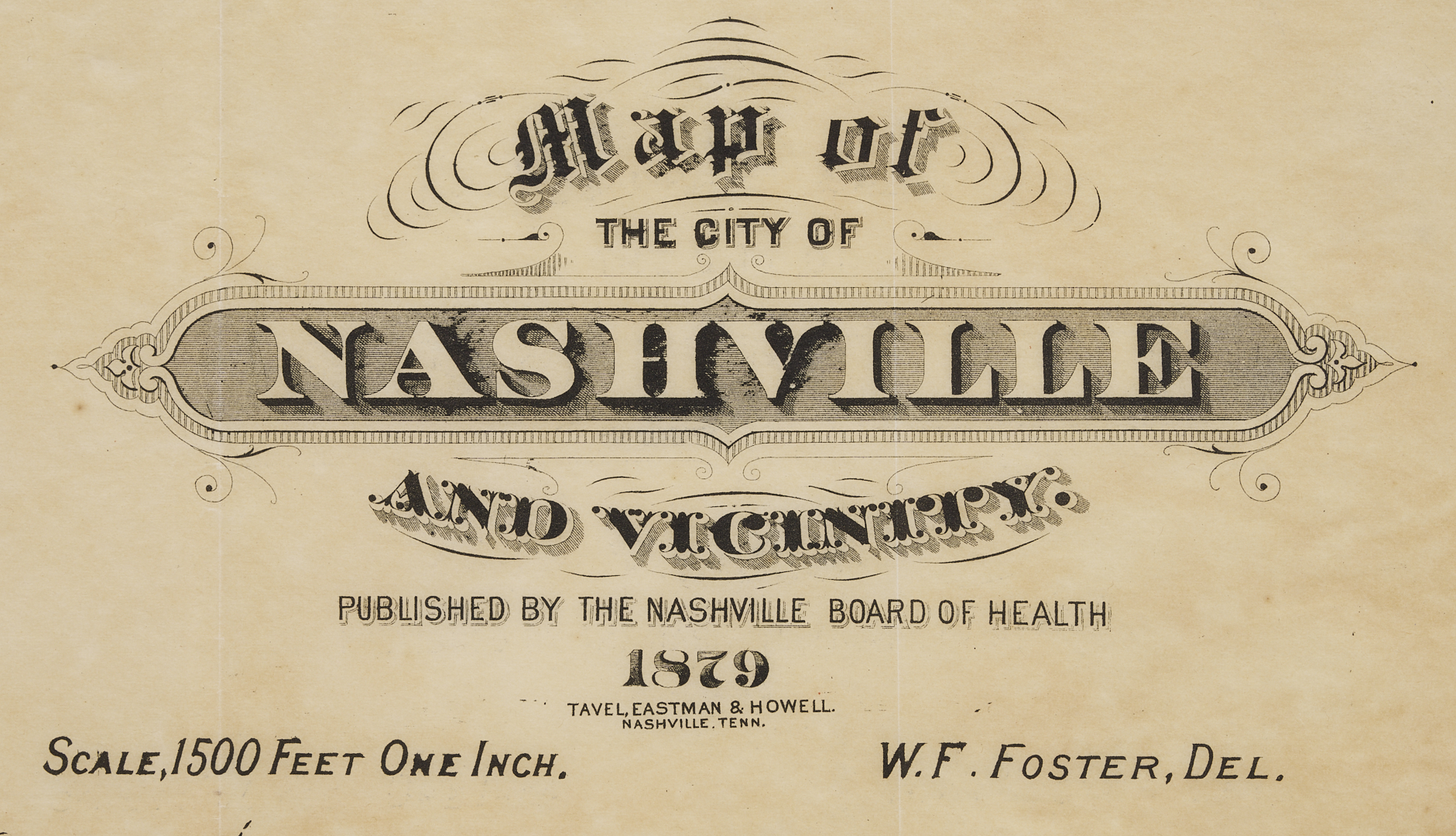
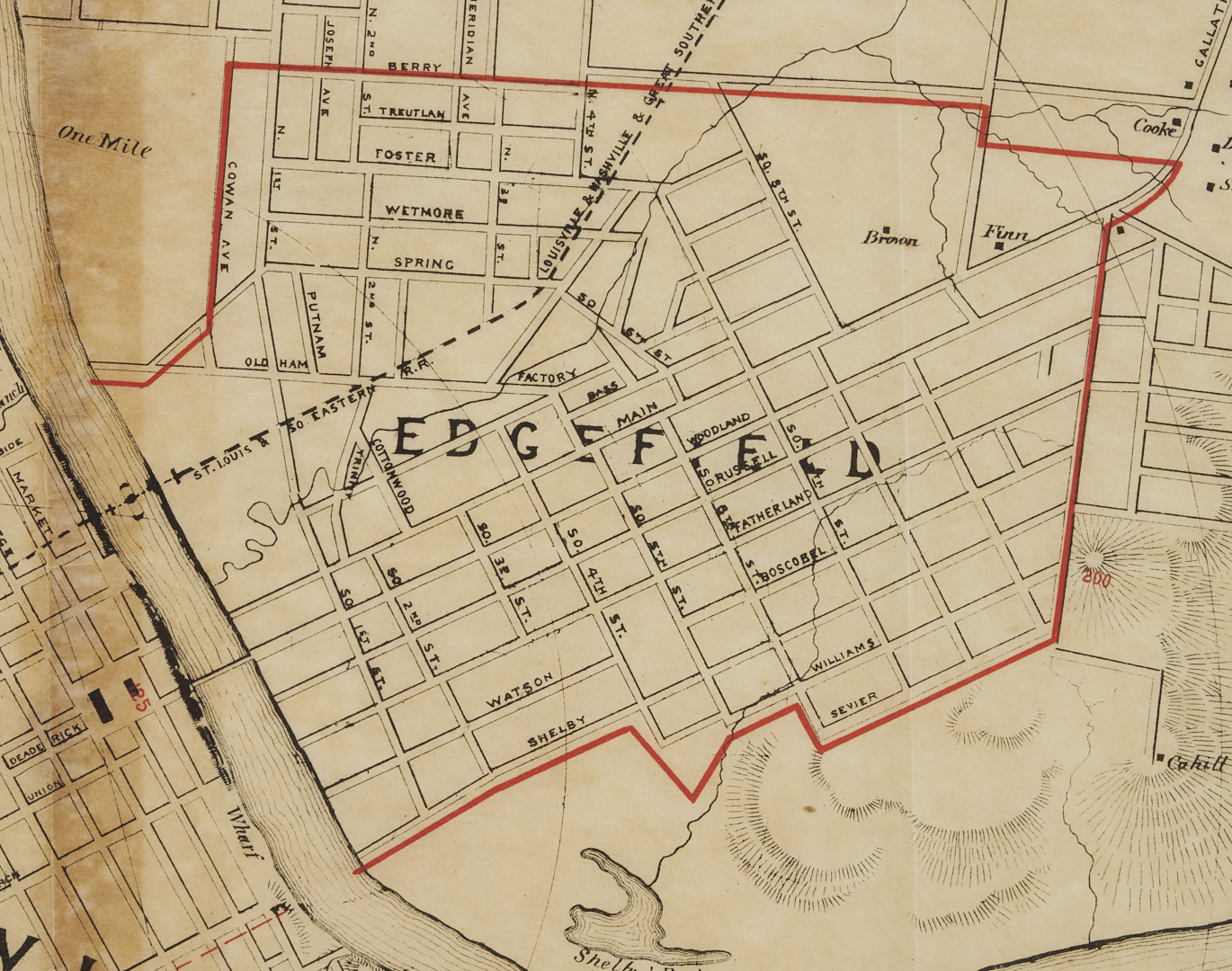
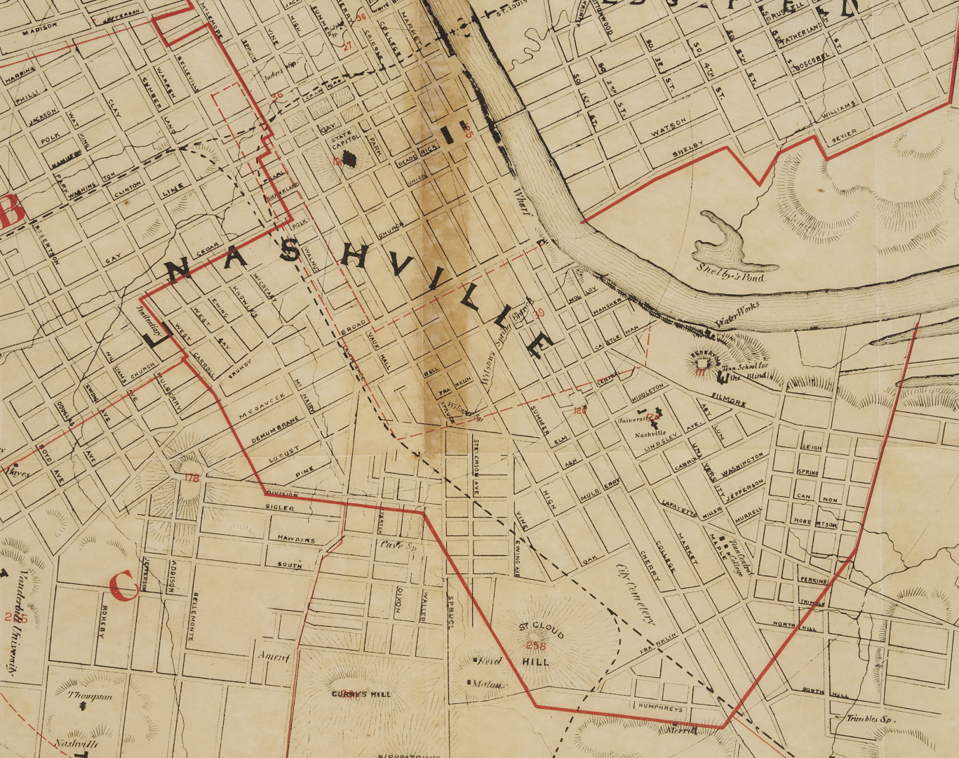
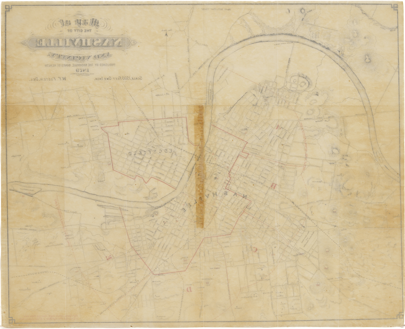
MAP OF THE CITY OF NASHVILLE AND VICINITY by Wilbur F. Foster, City Engineer, published by Tavel, Eastman and Howell, Nashville, TN, 1879. Created for the Nashville Board of Health 1879 report. Map of Nashville detailing street names, toll gates, colleges, railways including the Louisville & Nashville & Great Southern, St. Louis & So. Eastern, Nashville, Chattanooga & St. Louis, Tennessee & Pacific, and sites such as the Capitol, a cotton factory, and cemeteries. It also names some farm owners on outskirts of Nashville. Red lines indicate “height above low water mark in the Cumberland River” and the limits of jurisdiction of the Nashville Board of Health. Title and scale, top right. Surrounded by a decorative line border. Sheet: 19 1/2 in. H x 24 1/8 in. W. Unframed. Note: This scarce map was produced on the heels of the devastating Memphis yellow fever epidemics of the 1870s and indicates growing awareness in Tennessee municipalities of the need for better public sanitation to prevent disease. Wilbur F. Foster served as city engineer from 1865 to 1884. He also served as a chief engineer during the Civil War under General Alexander P. Stewart. (source: http://teva.contentdm.oclc.org/cdm/ref/collection/p15138coll23/id/426).
PROVENANCE: The collection of Hank and Mary Brockman.
CONDITION: Overall good condition with light handling wear and toning; 7 1/2 inch x 1/2 inch rectangular-shaped area of discoloration to center. A couple of scattered small spots of foxing.