If you have items like this you wish to consign, click here for more information:
Selling with Case- Low Estimate: $18,000.00
- High Estimate: $22,000.00
- Share this:
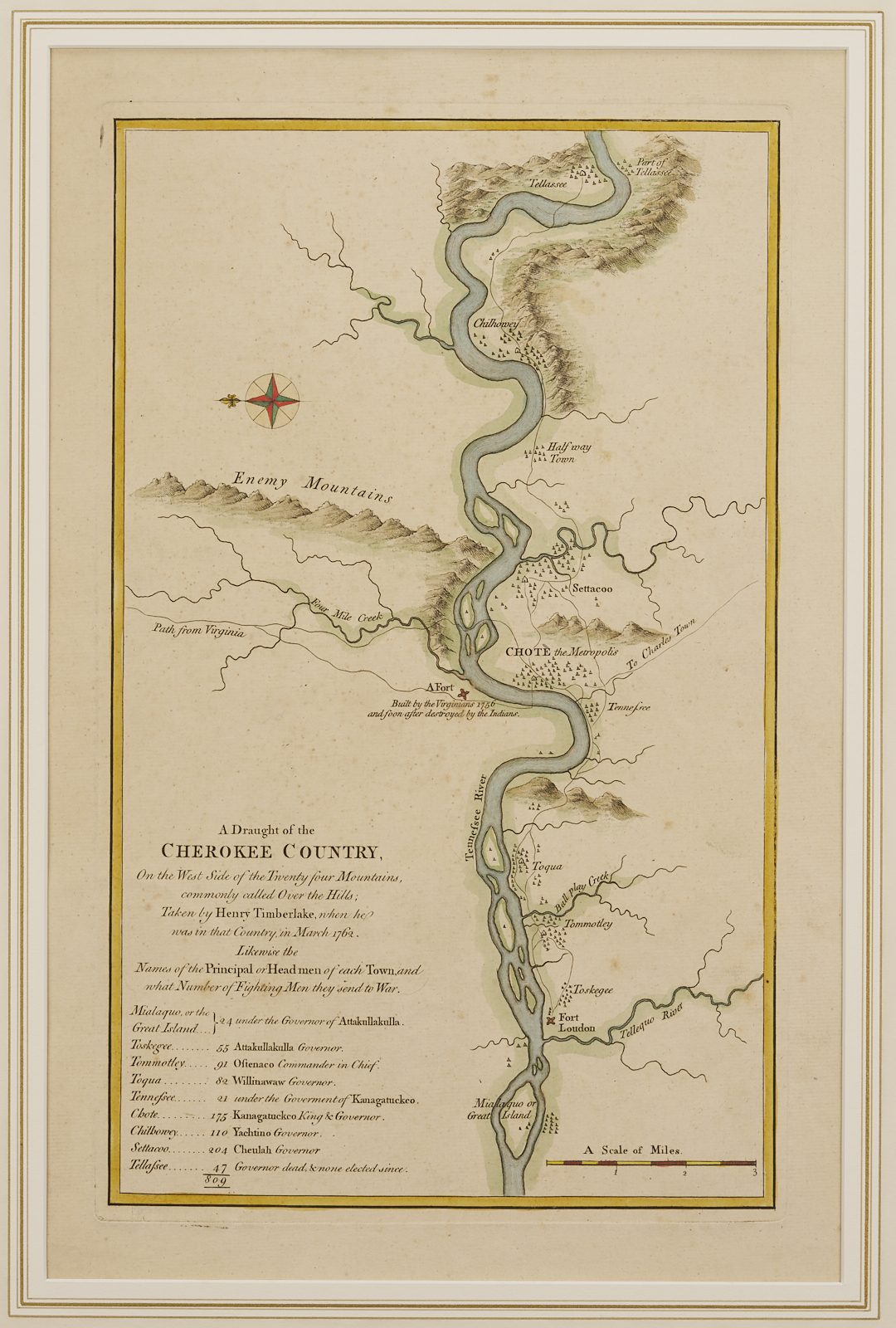
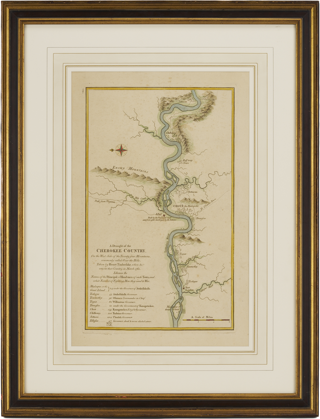
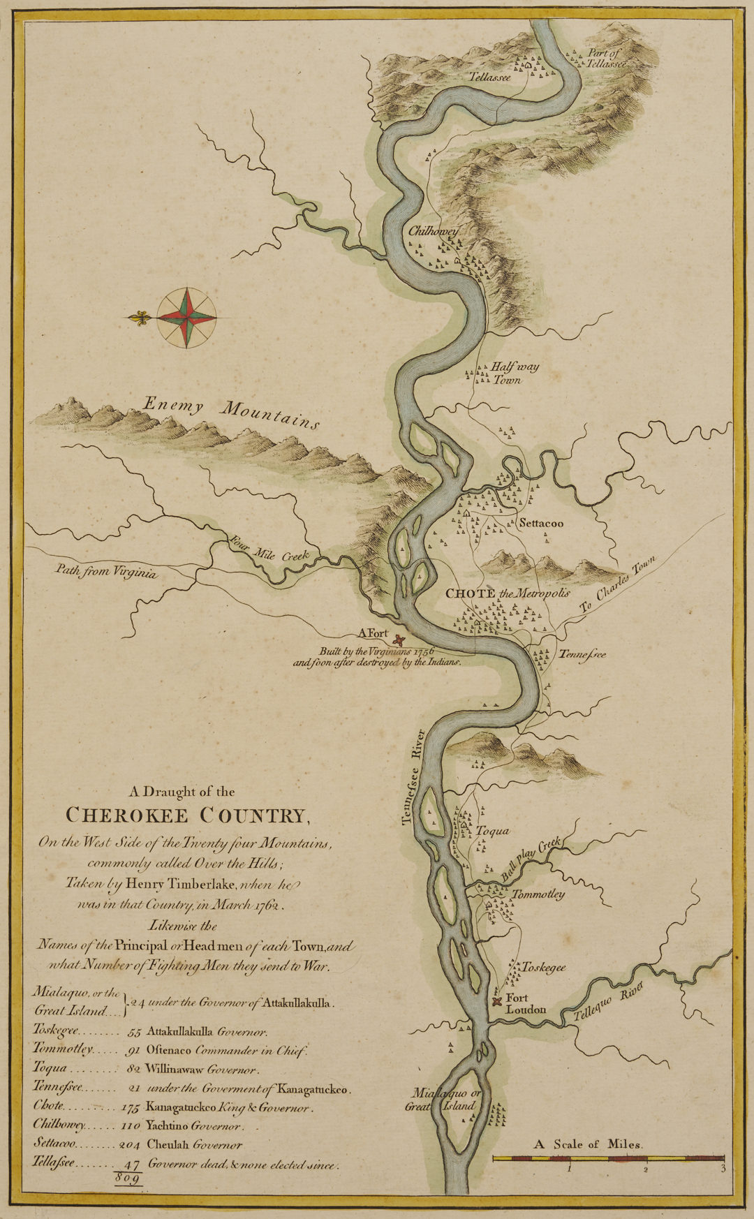
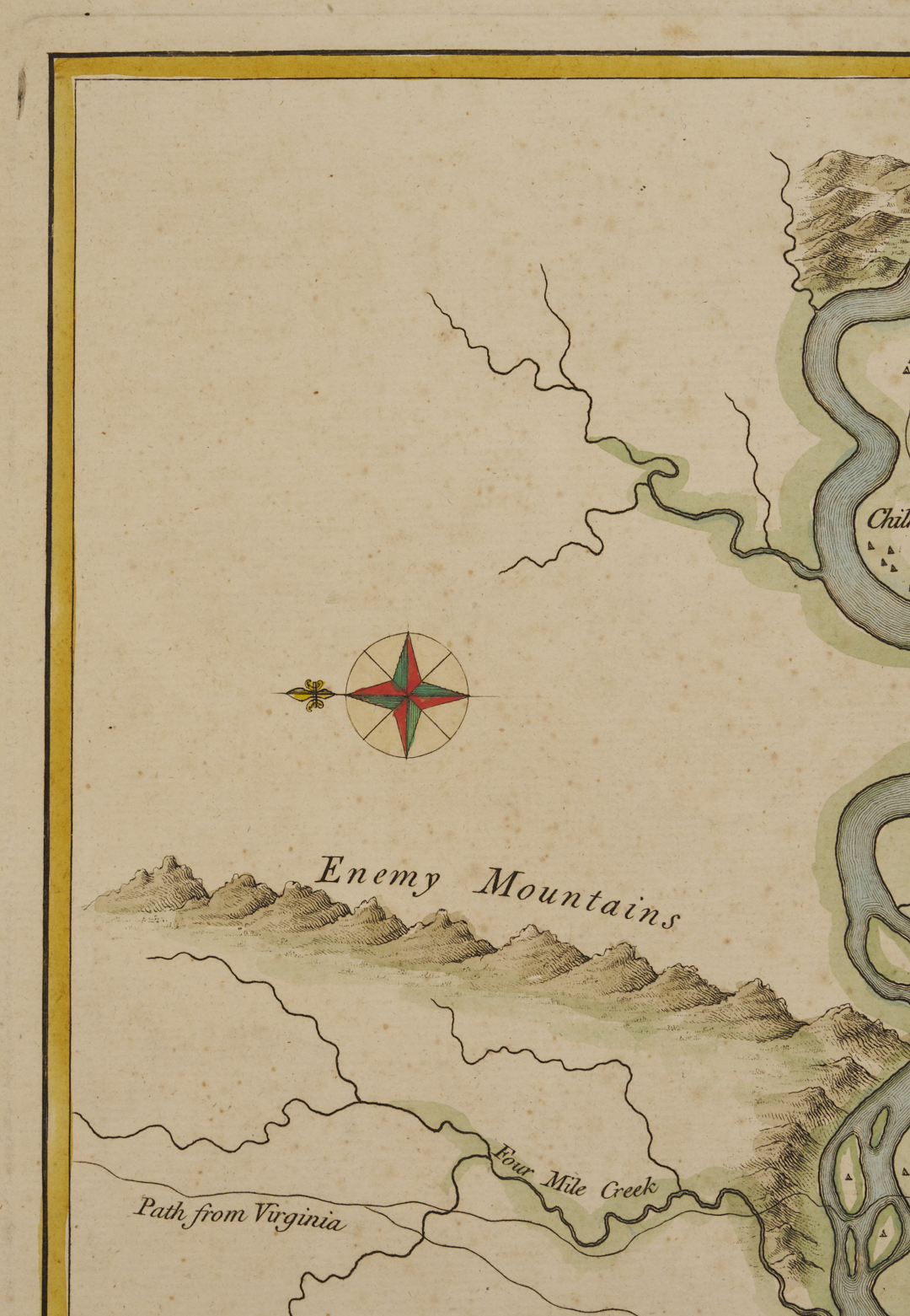
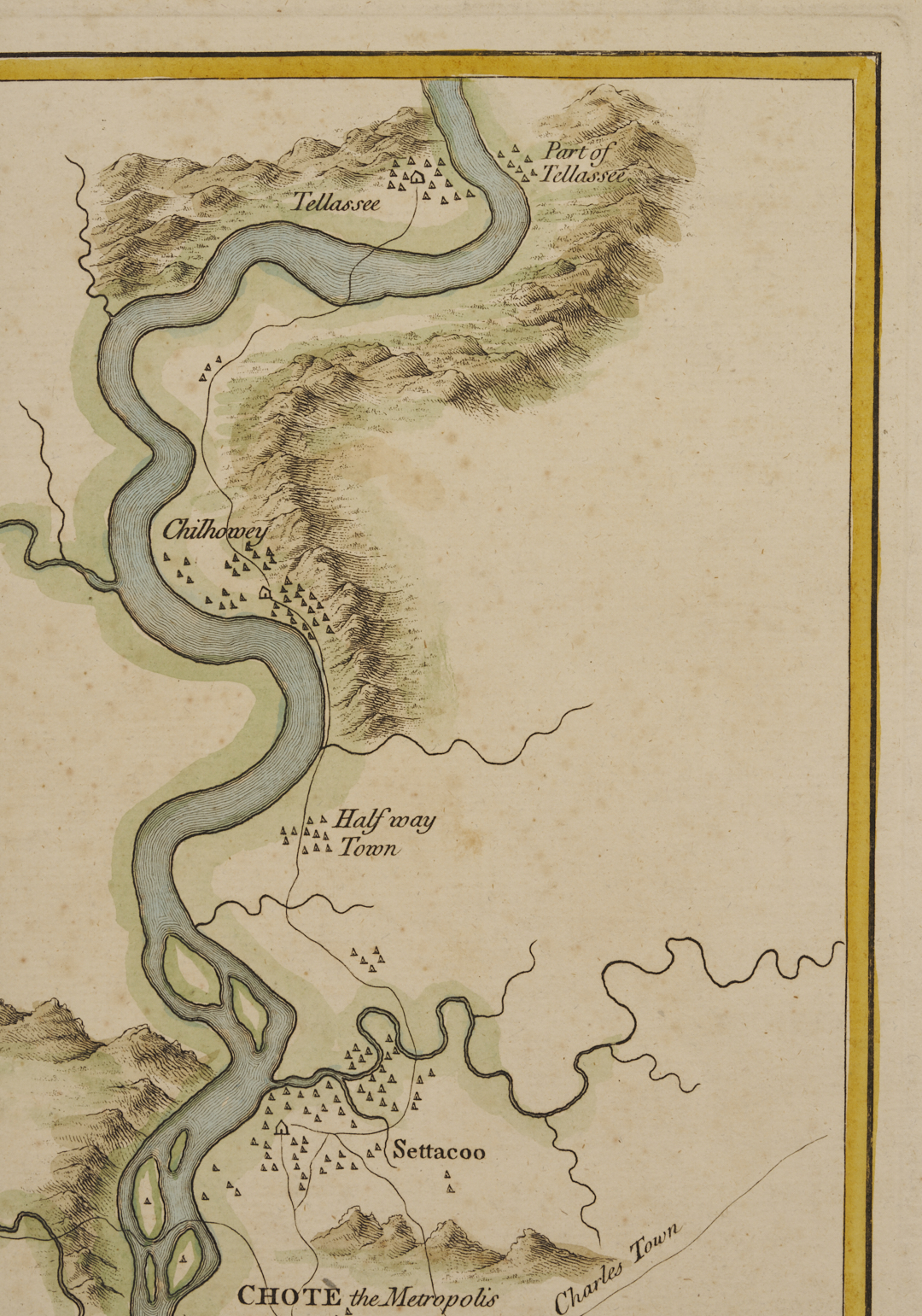
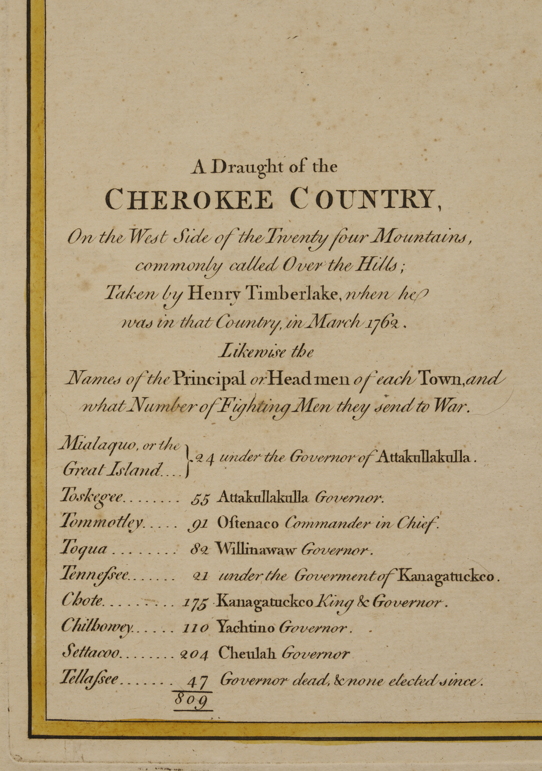
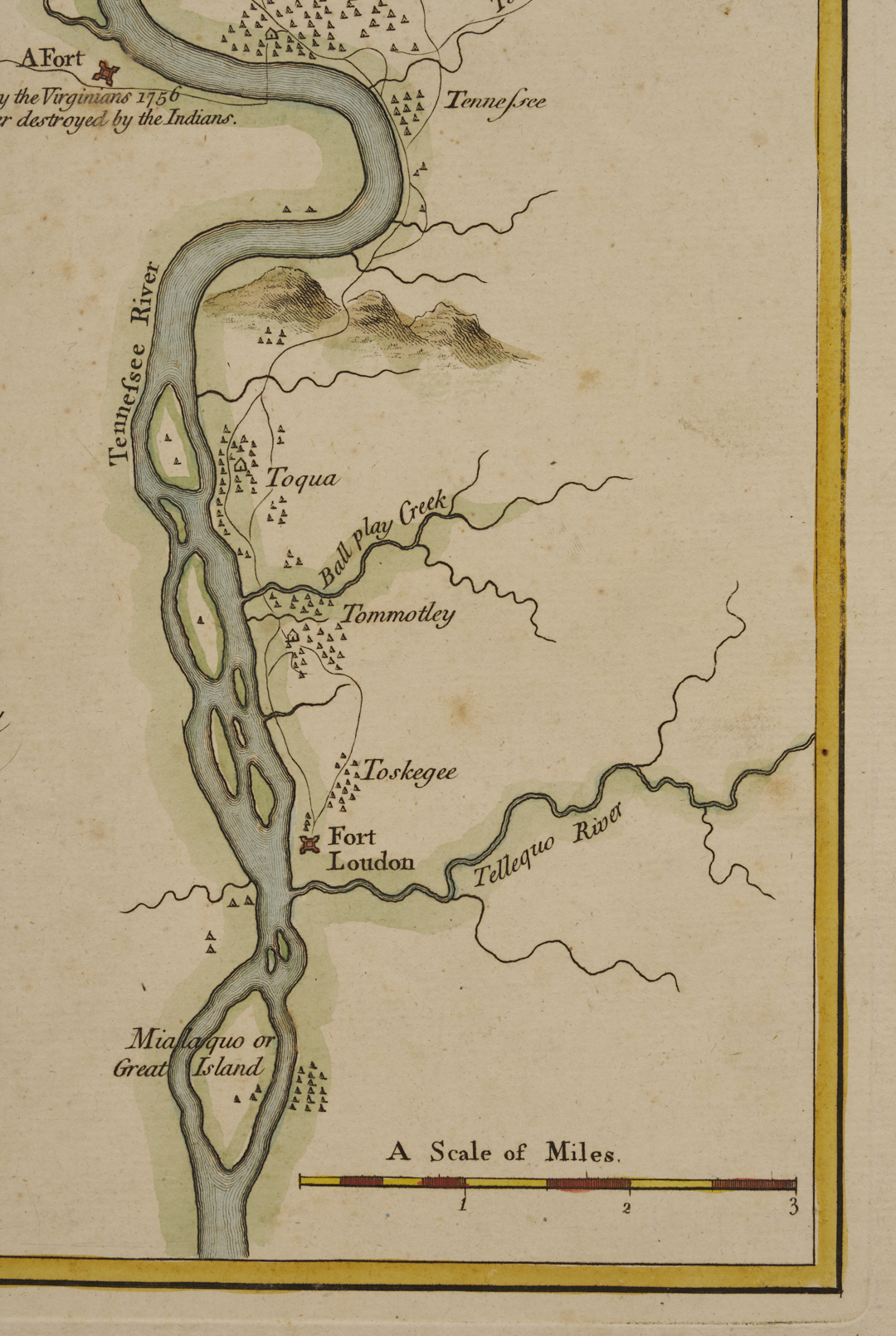
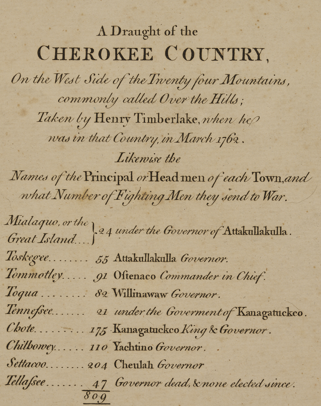
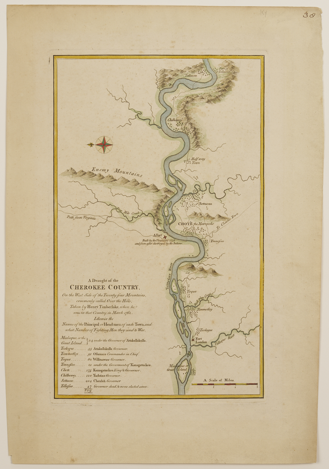
Timberlake, Henry: A DRAUGHT OF THE CHEROKEE COUNTRY on the West Side of the Twenty Four Mountains, Commonly Called “Over the Hills”; taken by Henry Timberlake when he was in that Country in March 1762; likewise the Names of the Principal of Head men of each town, and what Number of Fighting Men they send to War. Engraved map on laid and watermarked paper. London, 1765-1768 (only state). Matted and housed under glass in an ebonized and parcel gilt wood frame. Plate: 15 1/2 in. x 9 5/8 in. Sight: 17 1/4 in. x 11 1/8 in. Sheet: 20 1/4 in. H x 13 7/8 in. W. Frame: 26 in. x 20 in. A scarce, pre-Revolutionary War era map. Ref: Pritchard & Taliaferro, DEGREES OF LATITUDE: MAPPING COLONIAL AMERICA, pp. 190-193; Cumming, SOUTHEAST IN EARLY MAPS, entry 349.
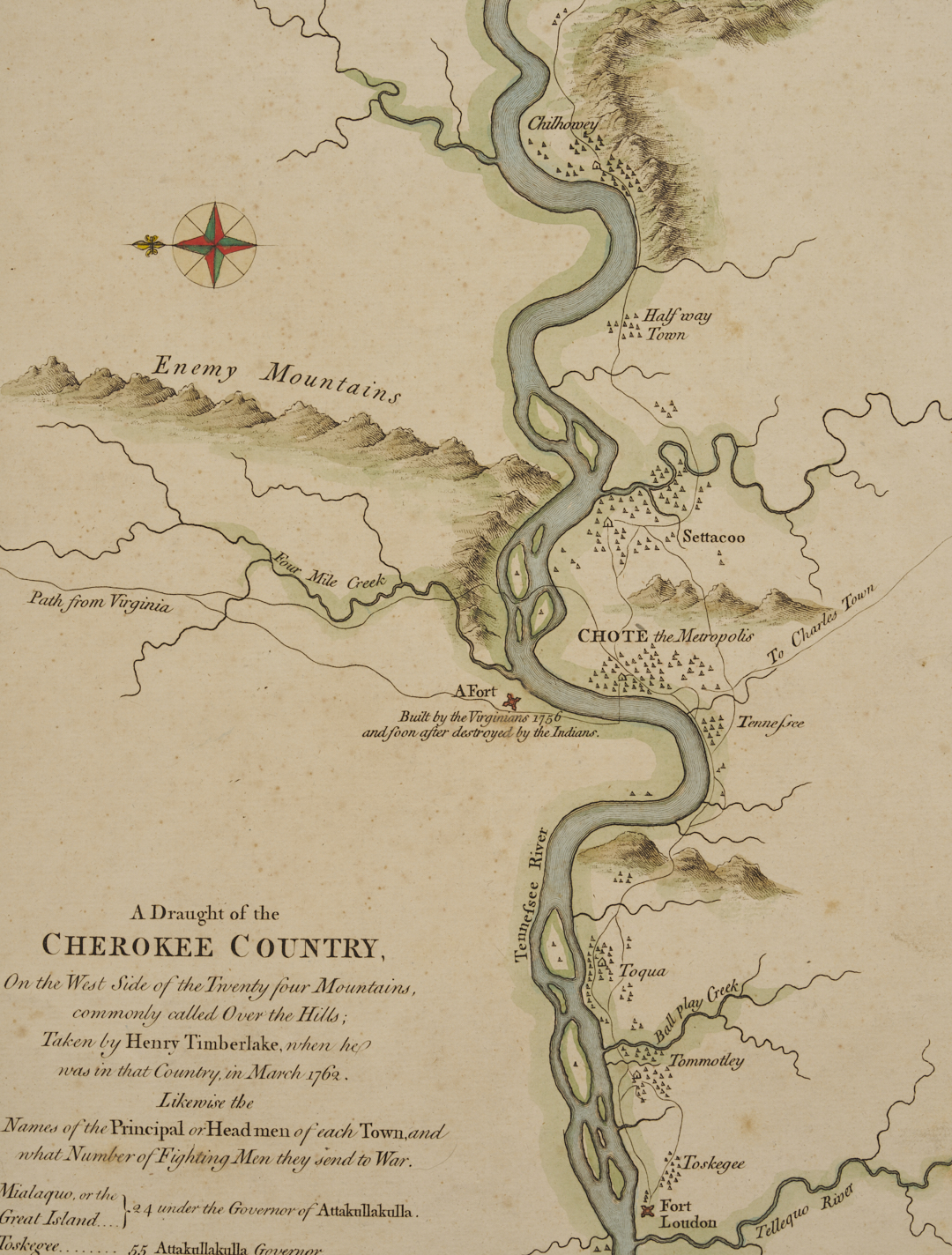
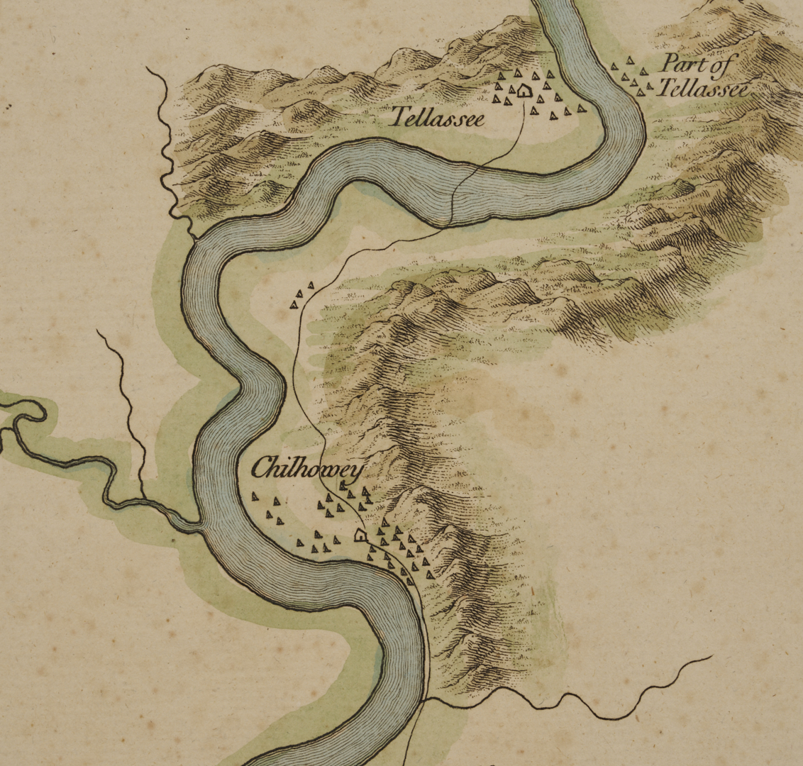
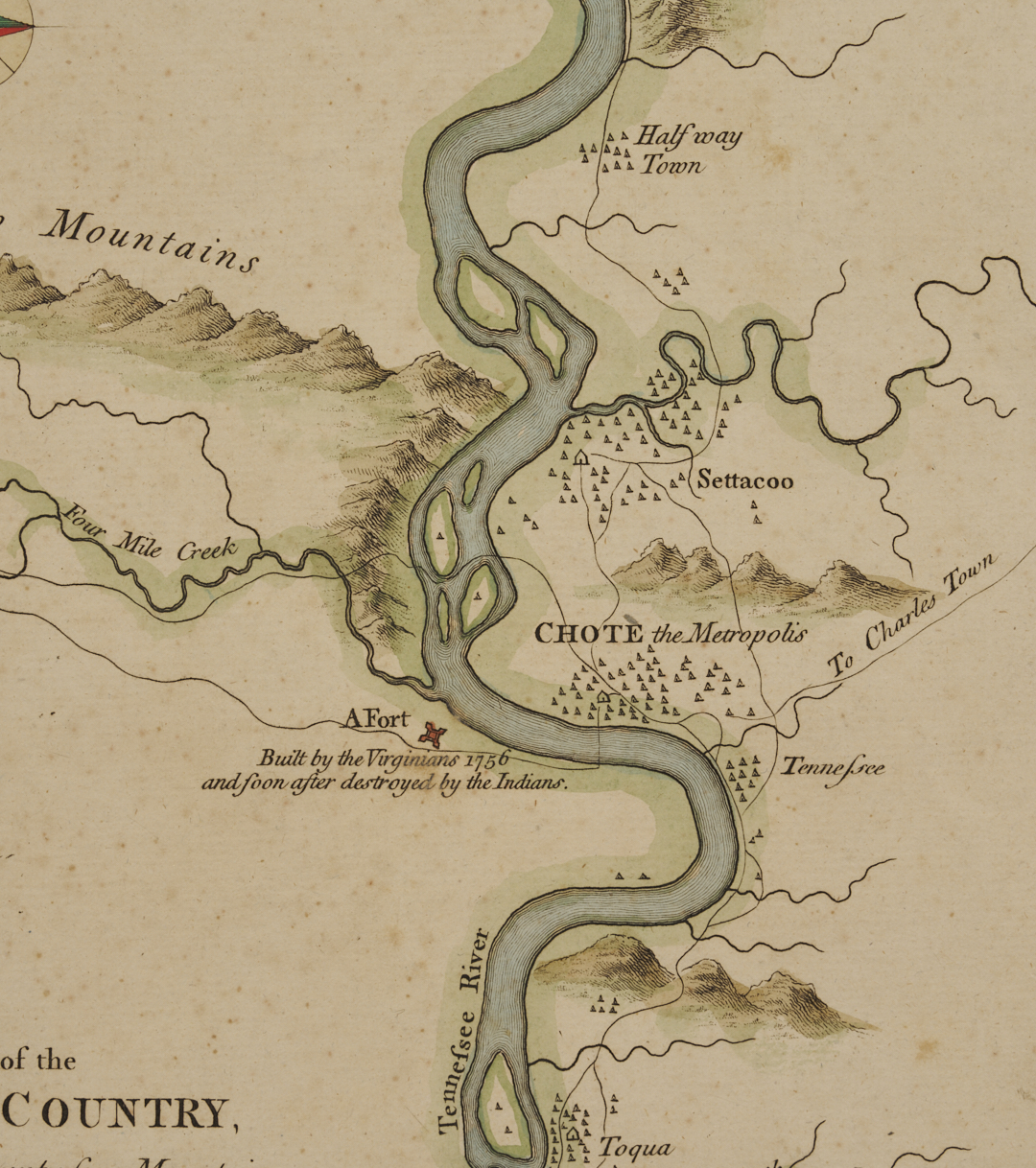
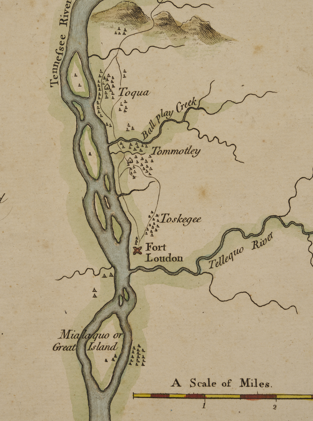
Timberlake’s map is notable as the first map devoted to Tennessee by an observer (Ref. Schwartz, THE MAPPING OF AMERICA, p. 177). It follows the Tennessee River from the Great Smoky Mountains to Fort Loudon and Great Island and was the first to name specific settlements of the Cherokee Villages on the lower Little Tennessee River (including “Tanasi,” the namesake of Tennessee). Its charting of river depths and topographical features proved valuable for the British military and settlers navigating the complex Appalachian terrain.
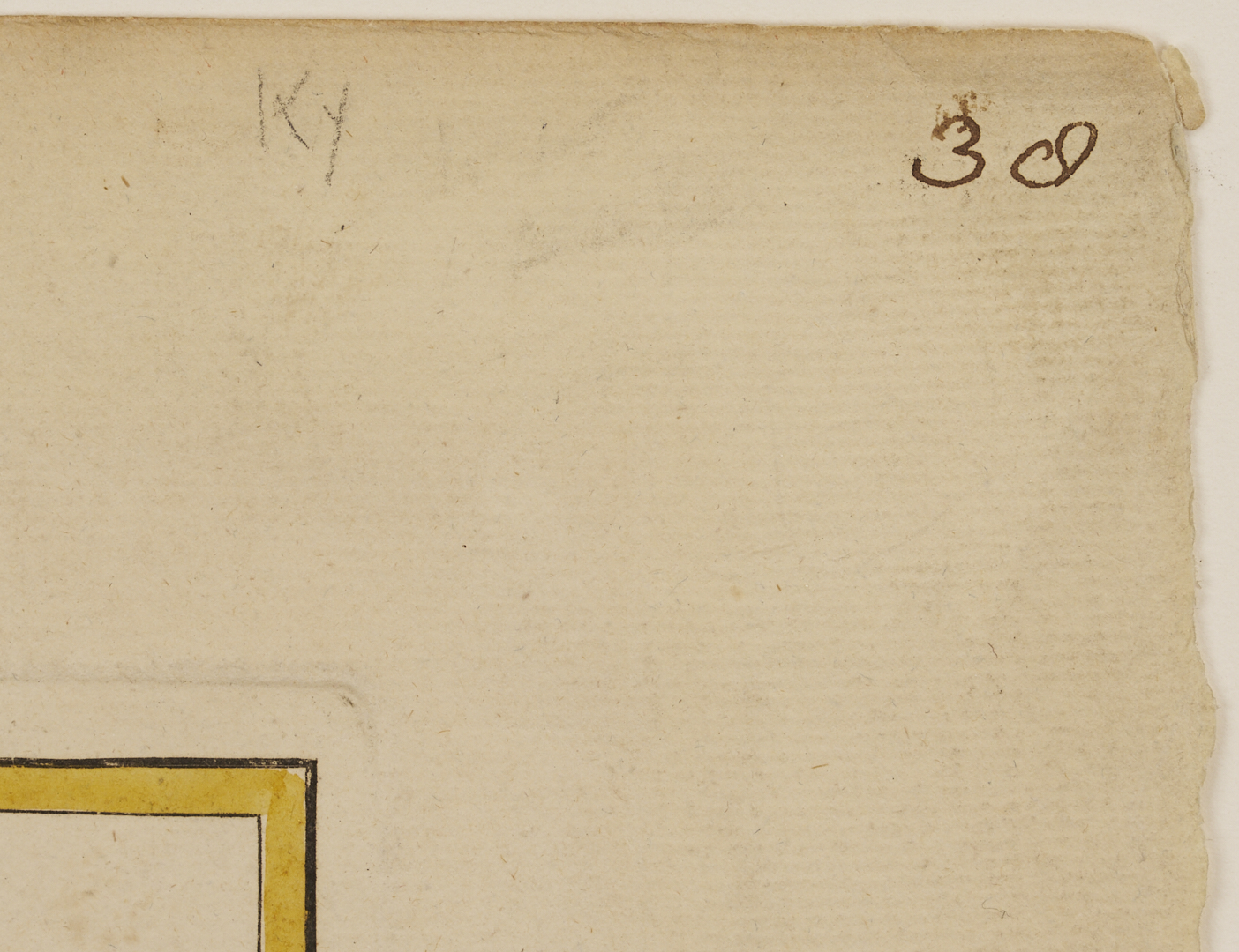
Timberlake’s map was printed in fold-out format with trimmed margins in his 1765 book THE MEMOIRS OF LIEUT. HENRY TIMBERLAKE, and also appeared in the 1768 Thomas Jefferys/Robert Sayer composite atlas, GENERAL TOPOGRAPHY OF NORTH AMERICA AND THE WEST INDIES, unfolded, with full margins, as seen on the present map. (Note: a composite atlas is an assembled collection of maps that were not originally bound together as a single book). The handwritten number “38” at the upper right corner corresponds to this map being named as #38 in the Jefferys/Sayre Atlas table of contents (p. 4), and the table of contents states on page 3 that maps were available for purchase separately. We are aware of only one other extant Timberlake map from the Jefferys/Sayre atlas. It is in the collection of Colonial Williamsburg. We wish to thank Colonial Williamsburg for their assistance in our research and for confirming the single state of this map.
BIOGRAPHY: Colonial journalist and cartographer Henry Timberlake was born in Virginia. He joined Virginia military forces in 1756 and served in several campaigns during the French and Indian War. In 1761 he was assigned to troops commanded by Colonel William Byrd III and subsequently placed under the command of Colonel Adam Stephen. Stephen’s mission was to retaliate against the Cherokees for their siege of Fort Loudoun and for their massacre of its garrison, but in November 1761 the Cherokees concluded a truce before Stephen could launch his attack. At the peace negotiations one of the Cherokee chiefs requested that an officer journey to the Cherokee villages on the Little Tennessee River to explain the treaty and provide assurances that the colonists intended to honor it. Lieutenant Henry Timberlake volunteered to go.
After a twenty-three-day journey down the Holston River, Timberlake arrived at the Overhill villages in early December. He was a guest of Chief Ostenaco at Tomotly, and he presented the provisions of the peace treaty to Cherokee leaders gathered in the Chota council house. He also visited Citico and Chilhowee, where he was welcomed with considerable celebration and respect. Timberlake left the Overhill country in early March 1762, reaching Williamsburg in April. In May he escorted three distinguished Cherokee leaders, including Ostenaco, to London, where they stayed until August. Timberlake remained in England until returning to Virginia in March 1763. In the summer of 1764, five Cherokees visited him, seeking an audience with the governor of Virginia and requesting passage to London. The governor denied their request, but Timberlake agreed to help them, and he and three of the Indians reached London in the fall of 1764. After the Indians departed in March 1765, Timberlake remained in England and died in September.
Timberlake’s primary legacy is the journal he kept while living with the Cherokees. Published in 1765, the volume was probably published posthumously. His vivid descriptions and observations contained a thorough and detailed account of eighteenth-century Cherokee life, and became a basis for all subsequent anthropological and historical studies of eighteenth-century Cherokees. Modern studies have generally confirmed that Timberlake’s map was remarkably accurate. The map was used by archaeologists in the 1970s during the Tellico Archaeological Project and it has been hailed as remarkably accurate. (Source: The Tennessee Encyclopedia).
PROVENANCE: Private Middle Tennessee Collection, acquired about 20 years ago from a private collector.
CONDITION: Overall good condition, hinge mounted, with light toning, light creasing, and scattered light foxing. Margins appear full. Tiny chip lower left margin. Pencil/pen marks to upper right corner of margin. A few abrasions to frame.