If you have items like this you wish to consign, click here for more information:
Selling with Case- Low Estimate: $700.00
- High Estimate: $900.00
- Share this:
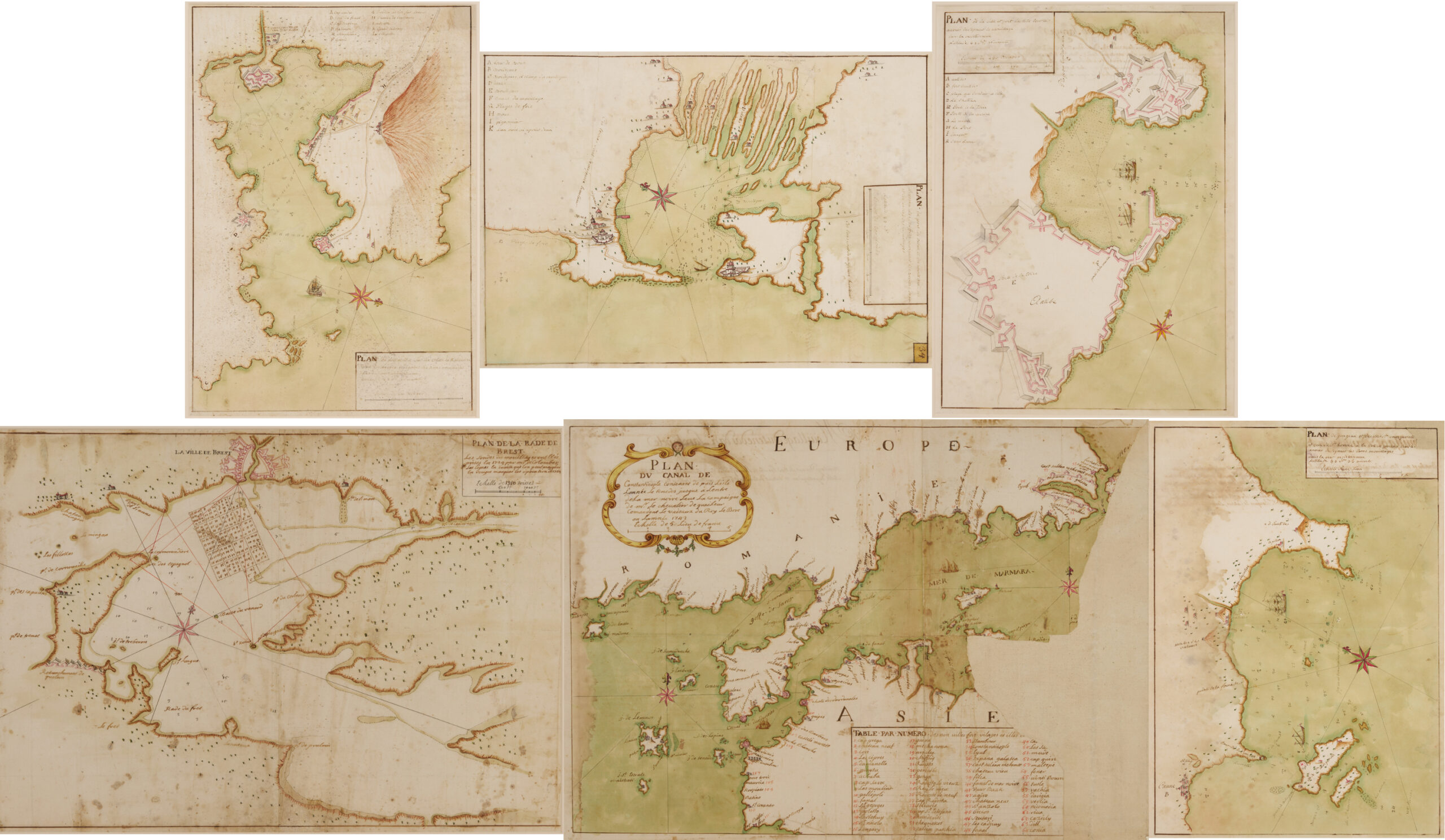
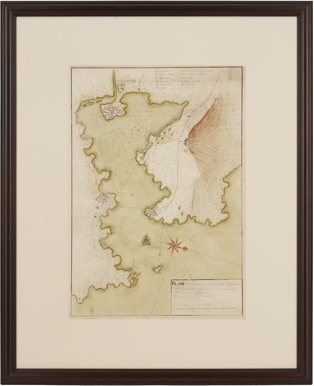
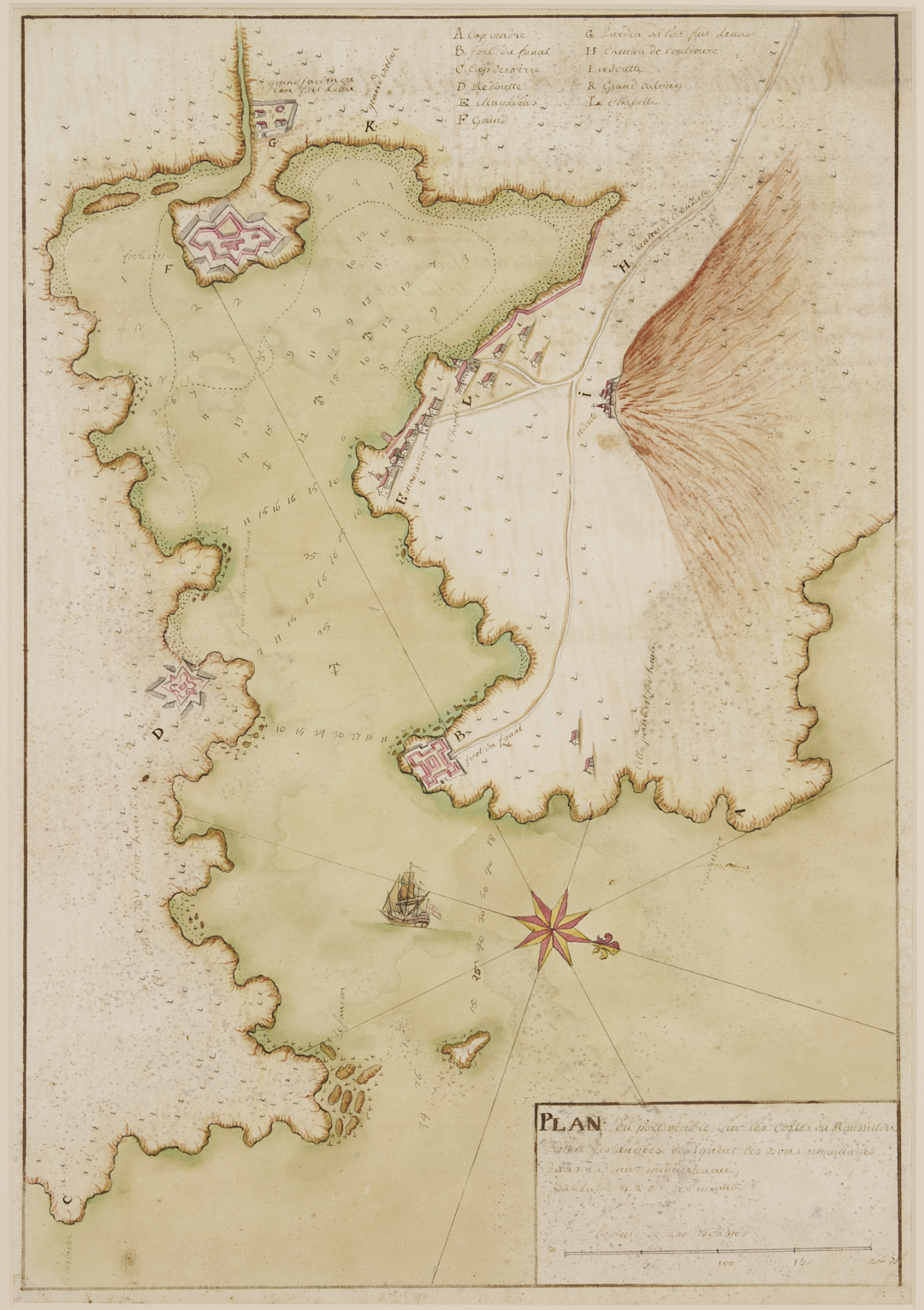
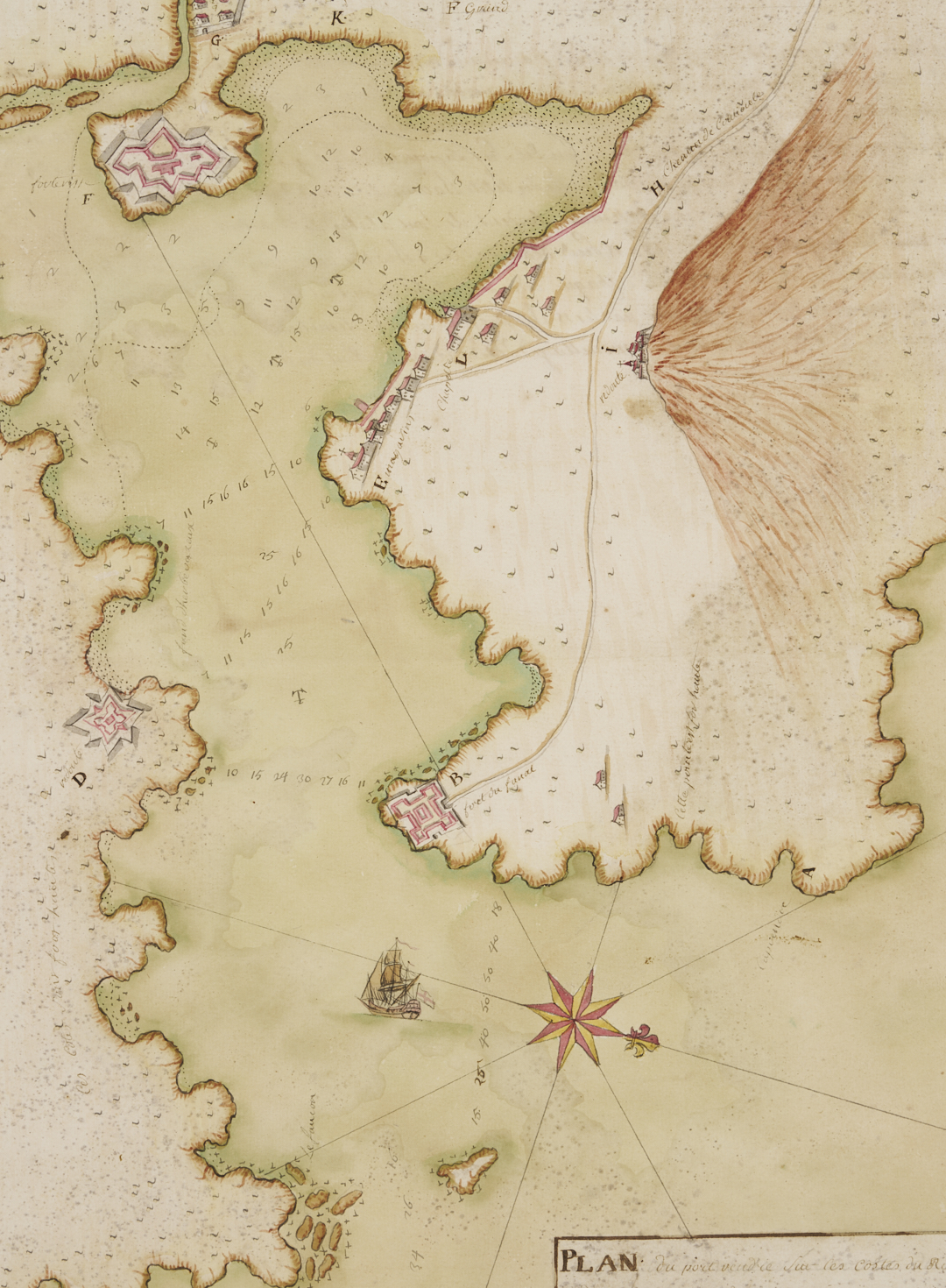
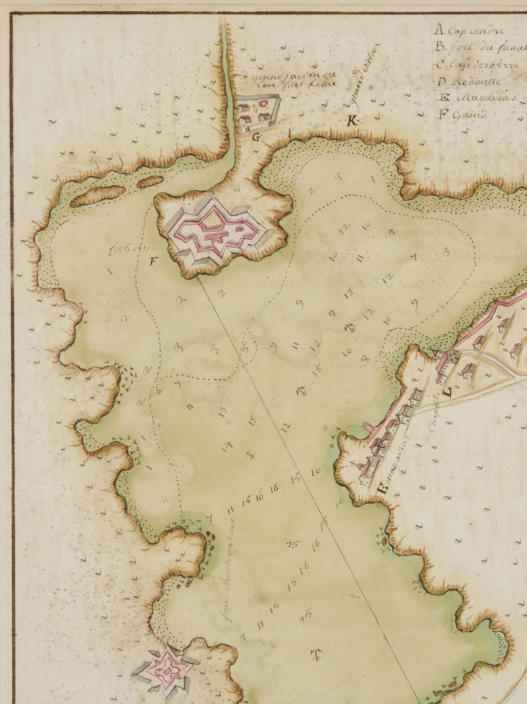
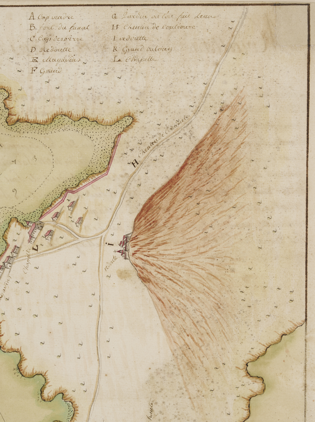
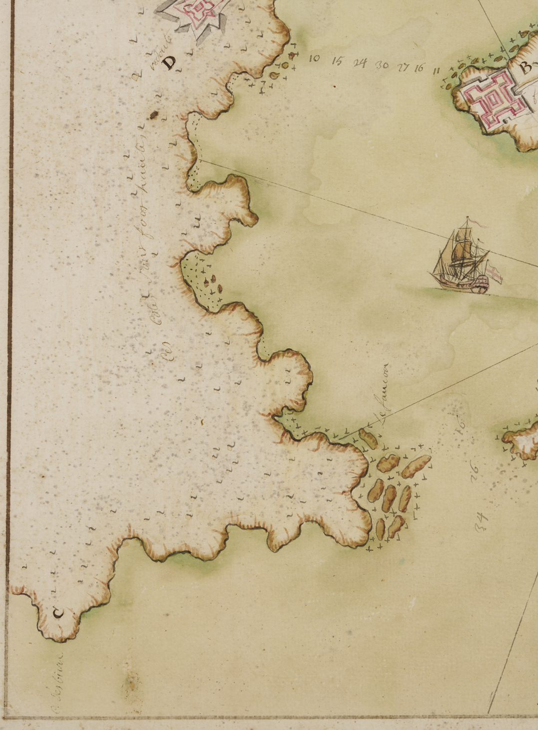
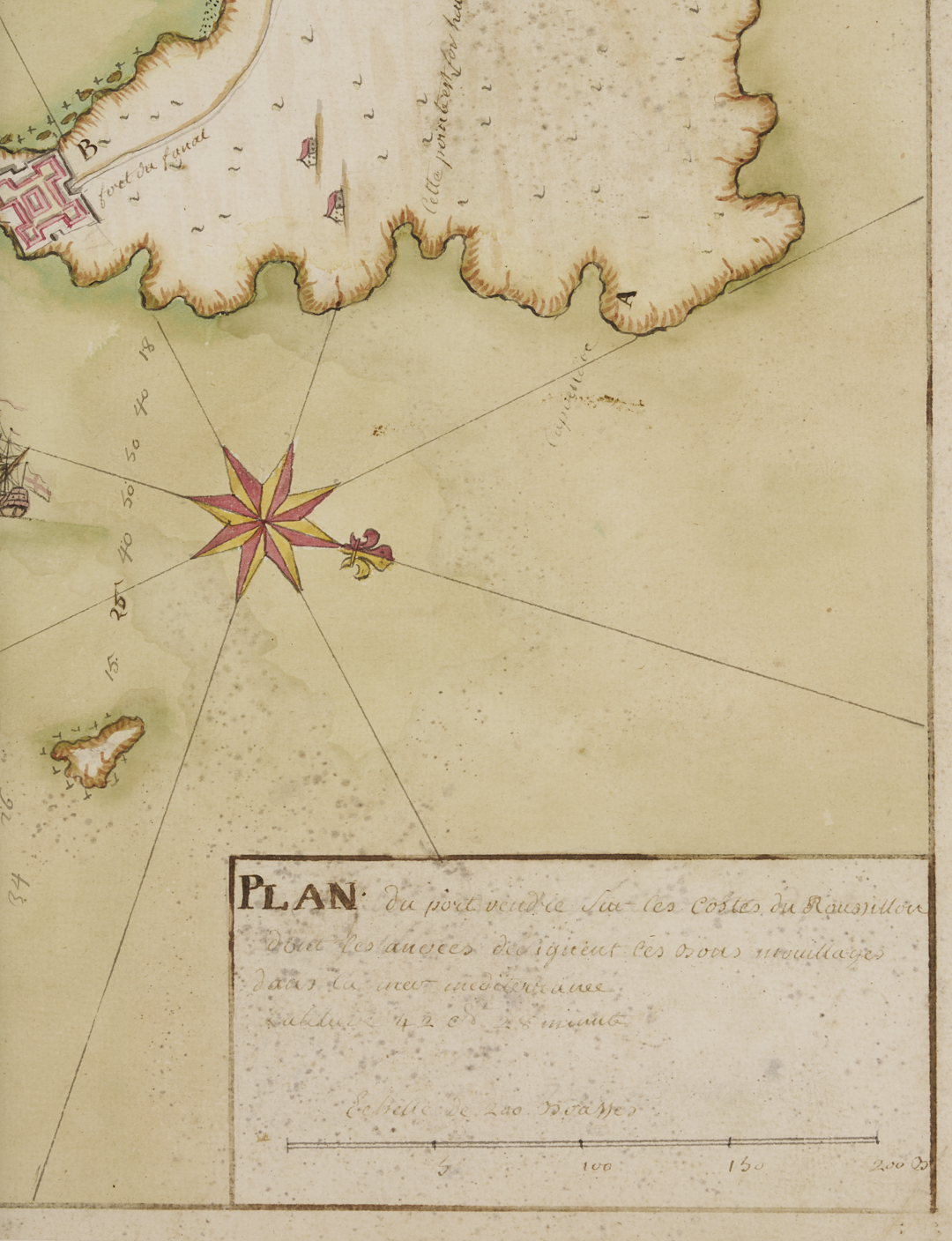
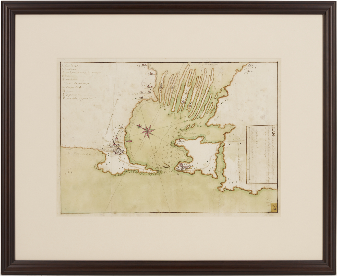
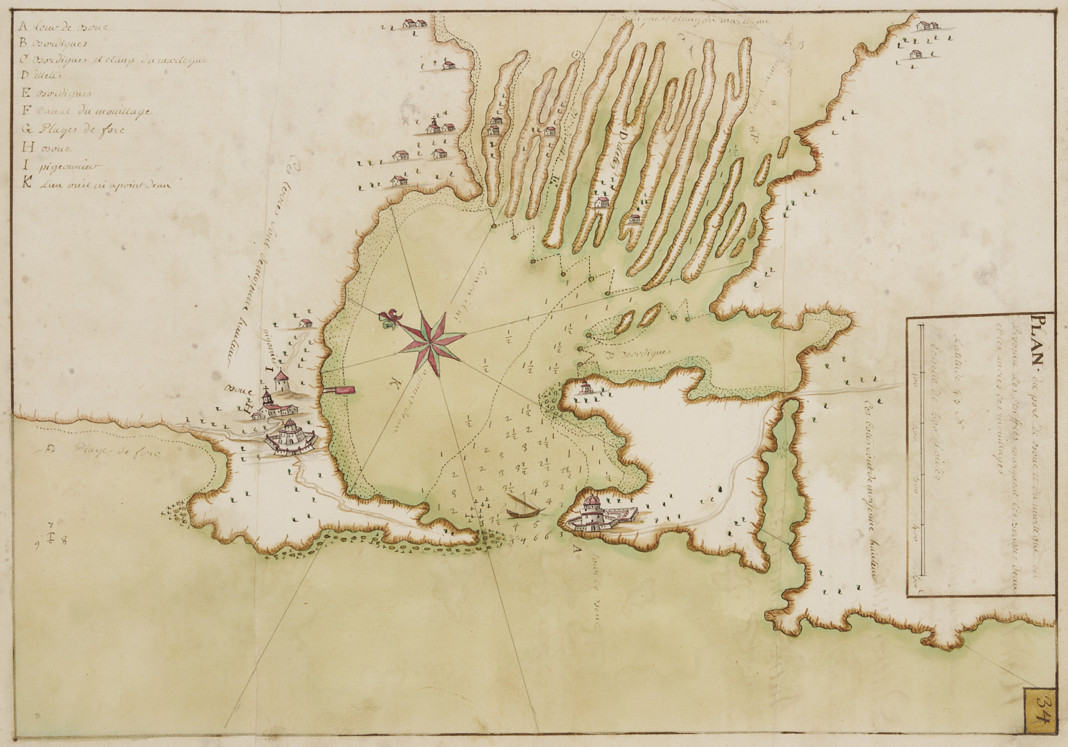
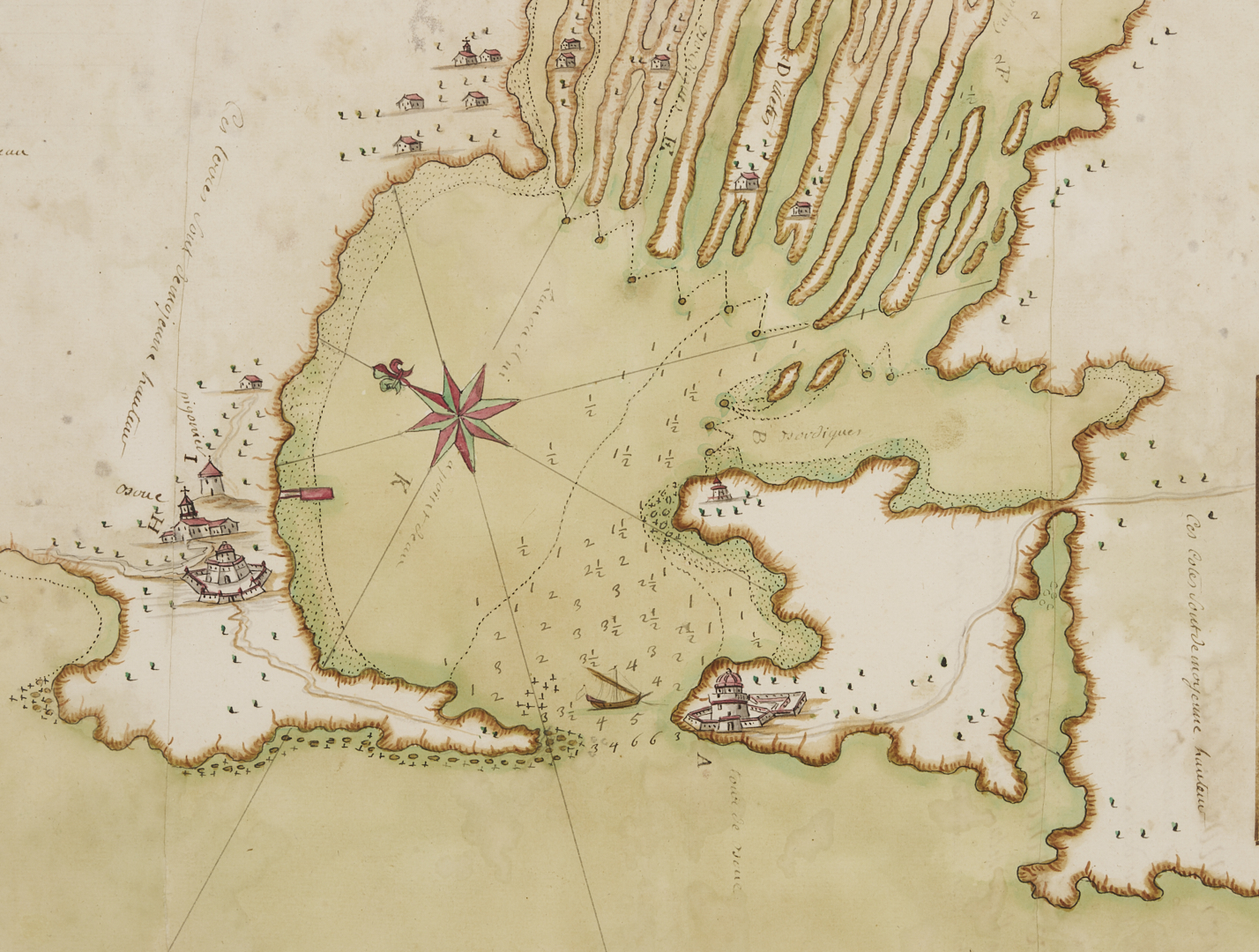
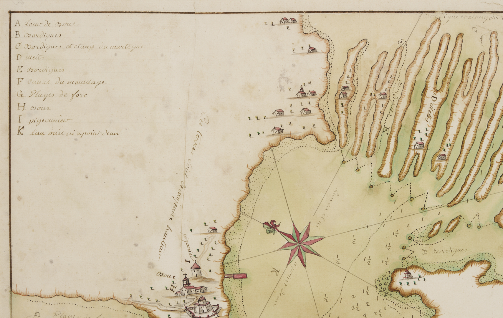
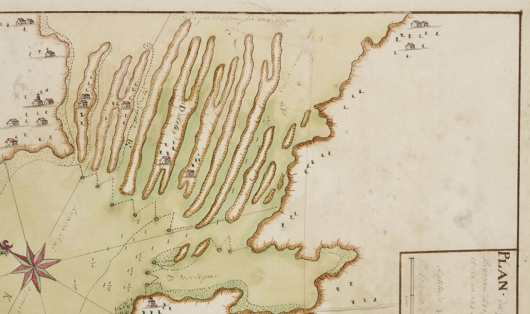
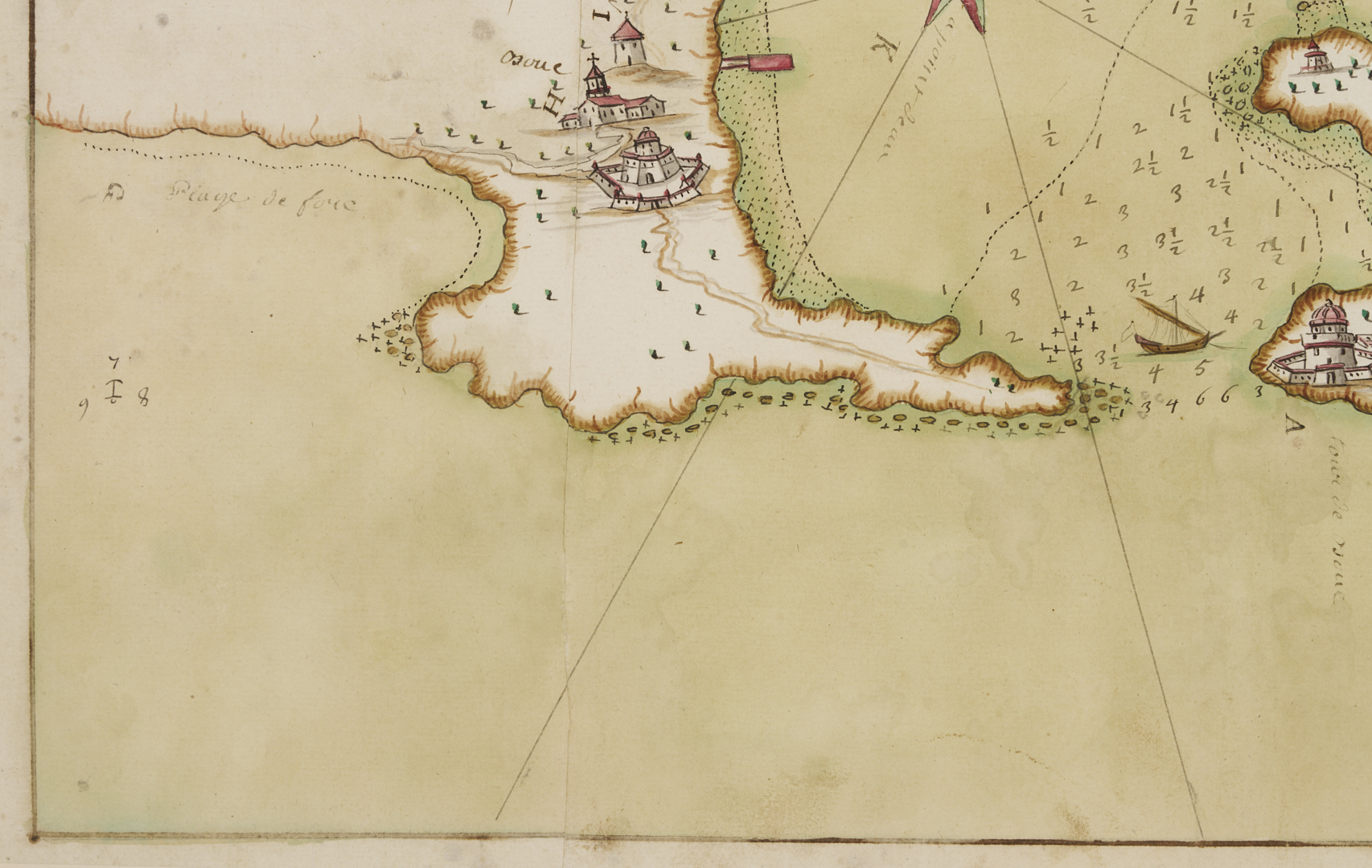
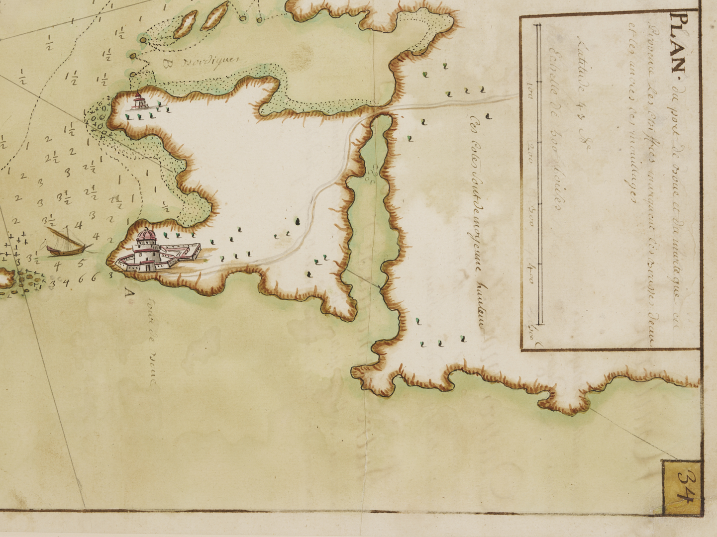
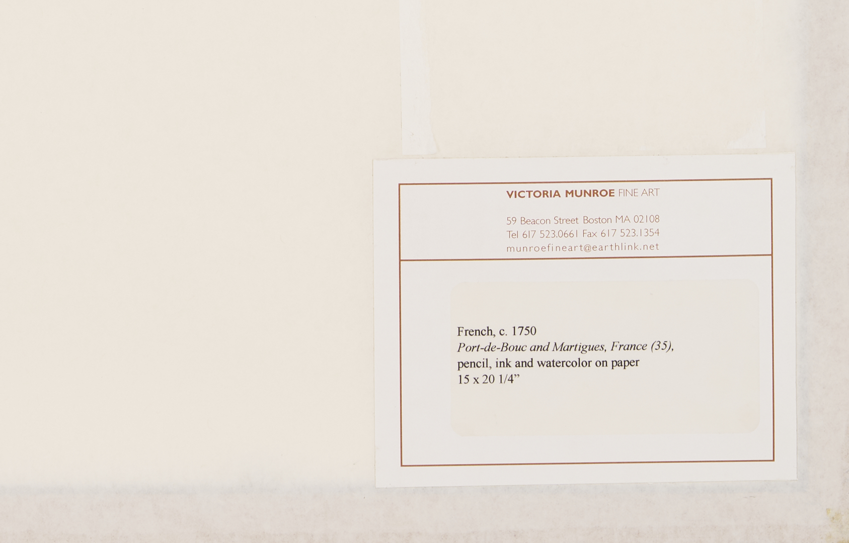
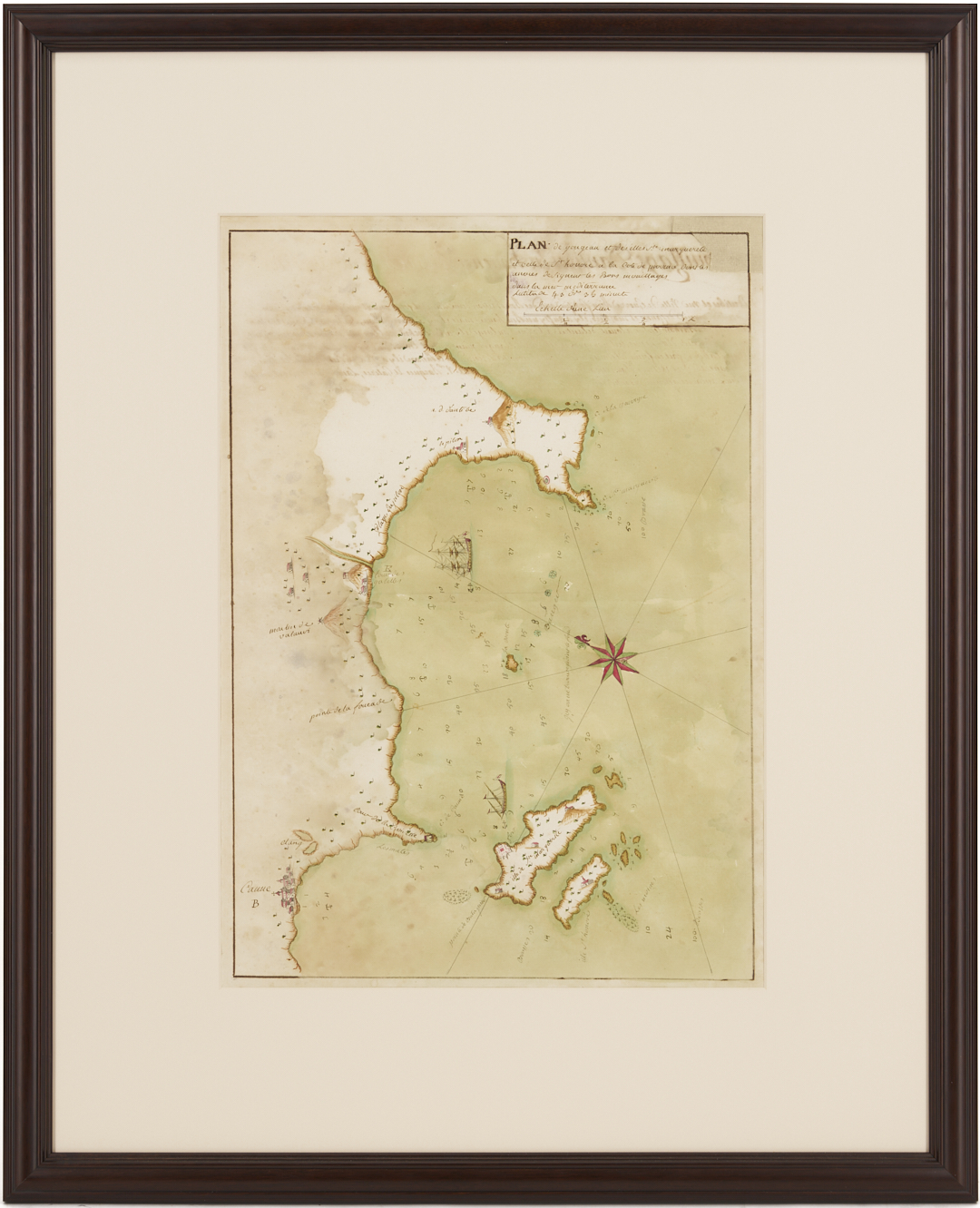
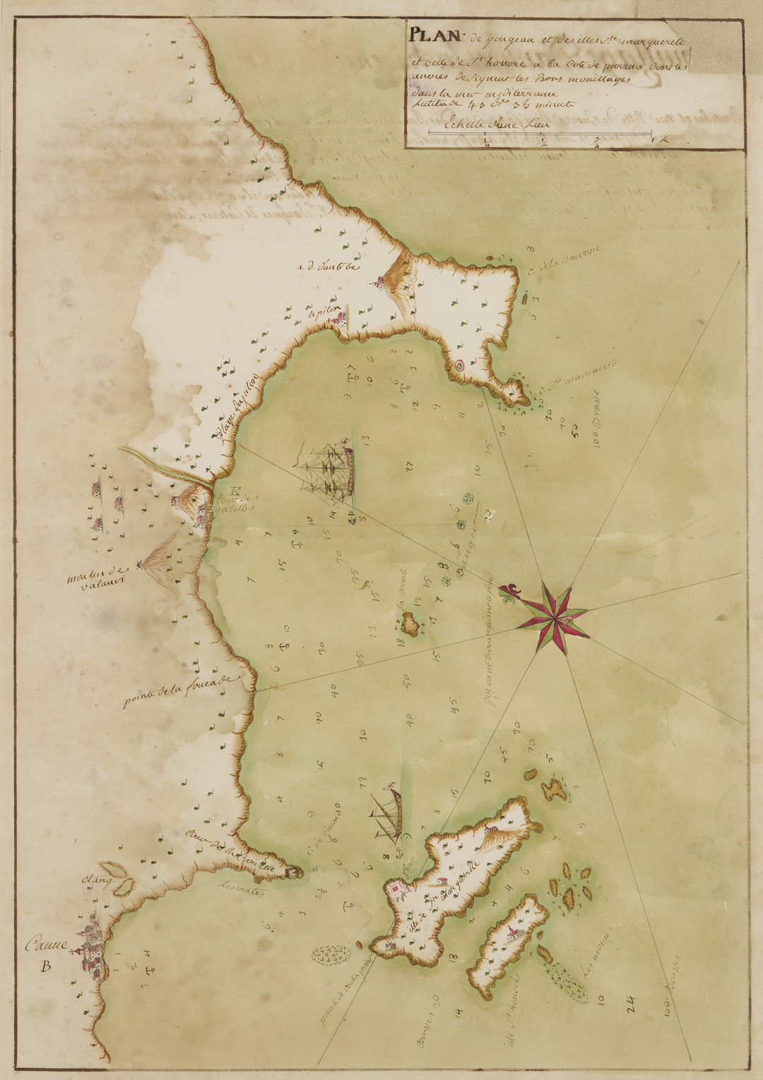
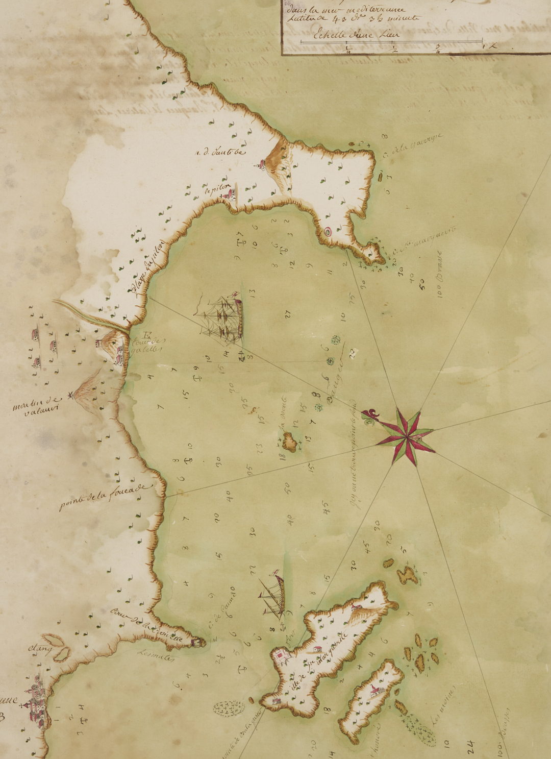
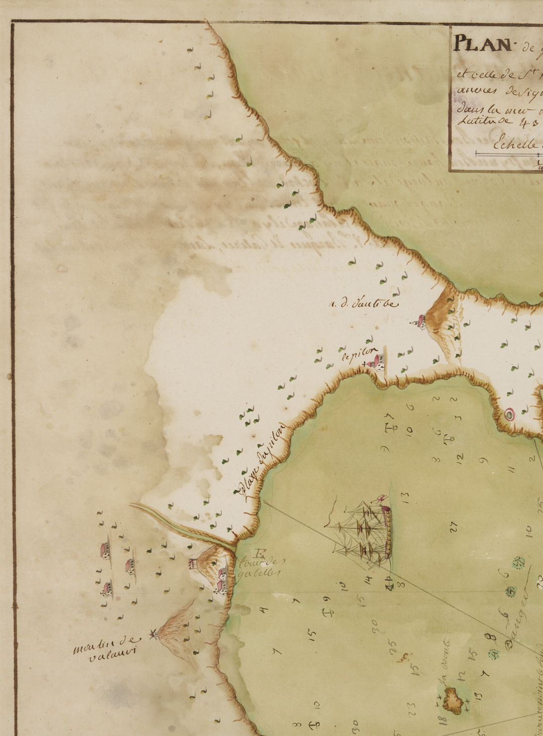
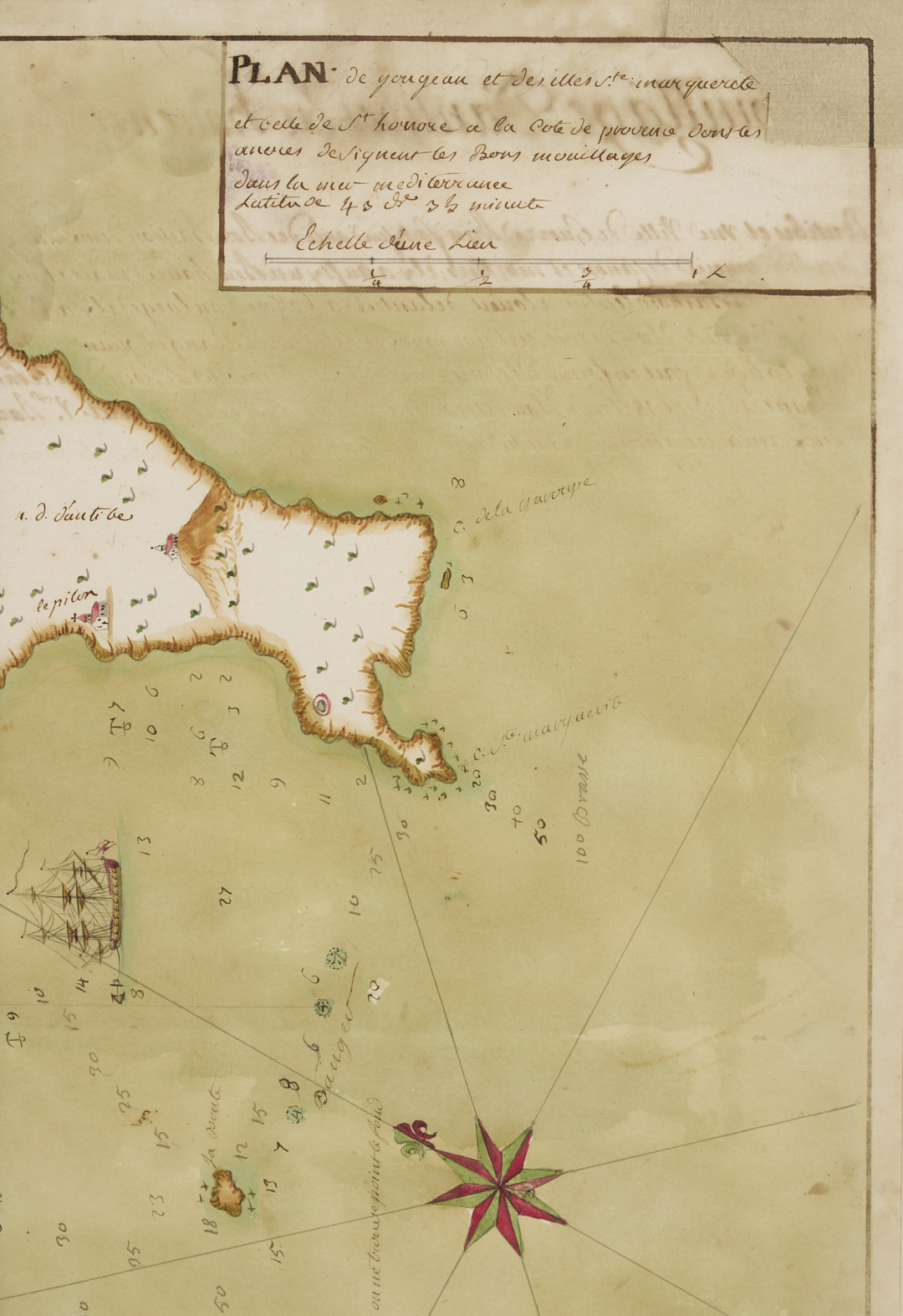
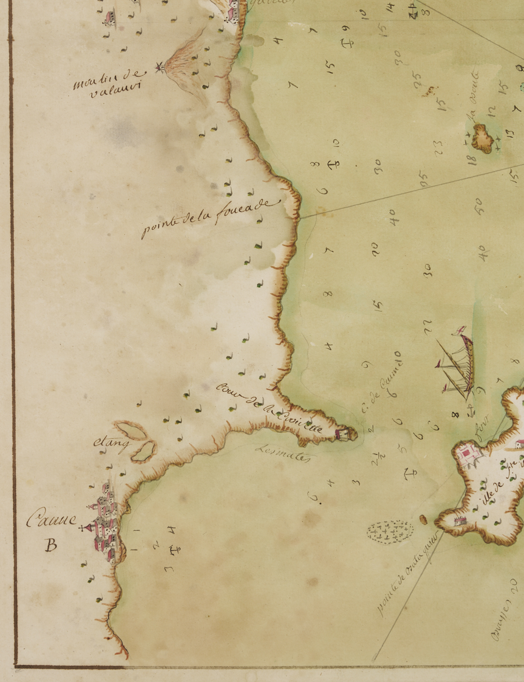
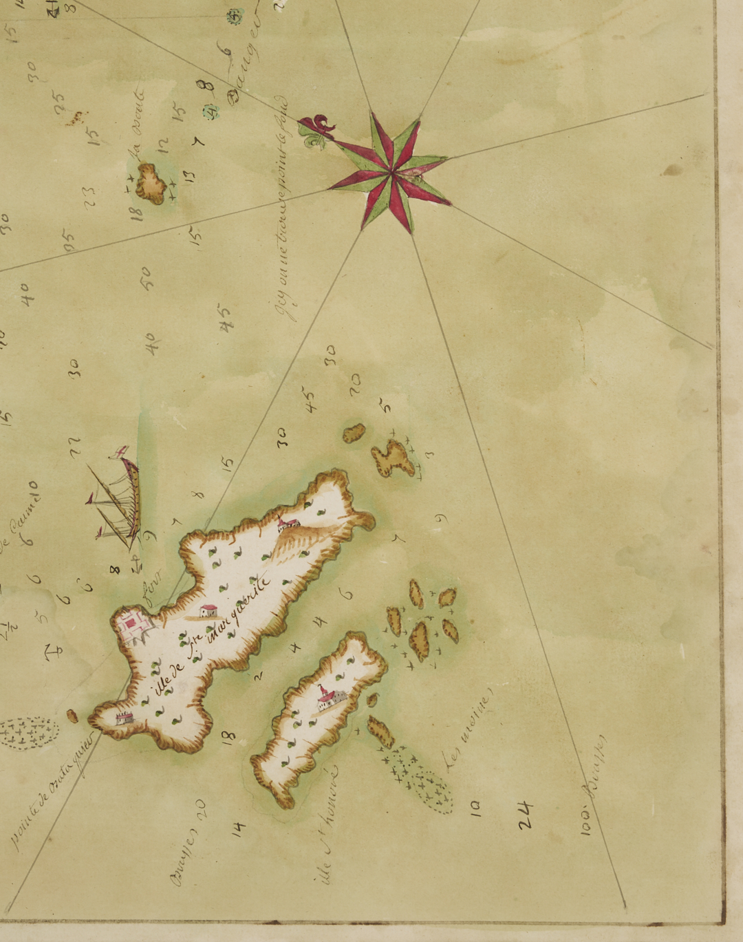
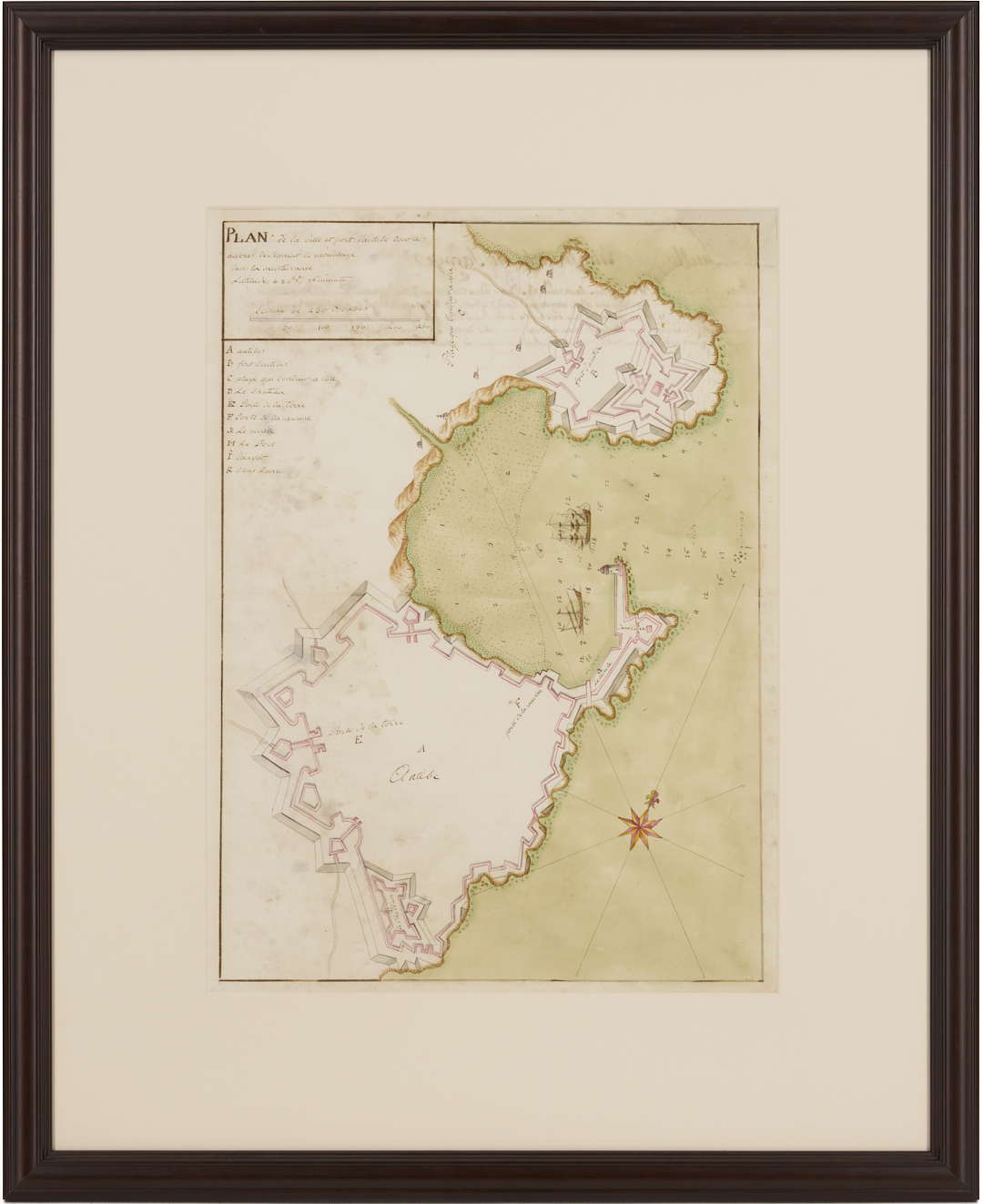
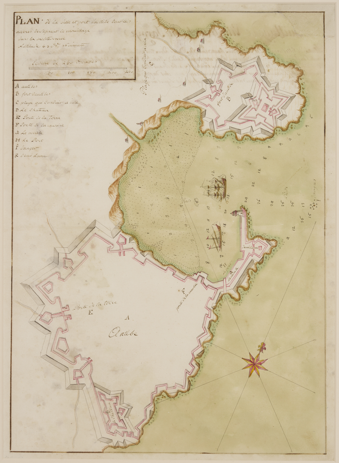
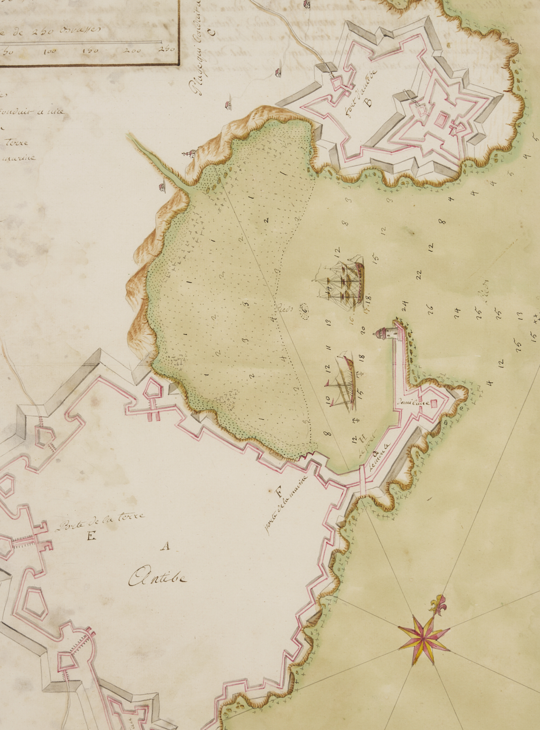
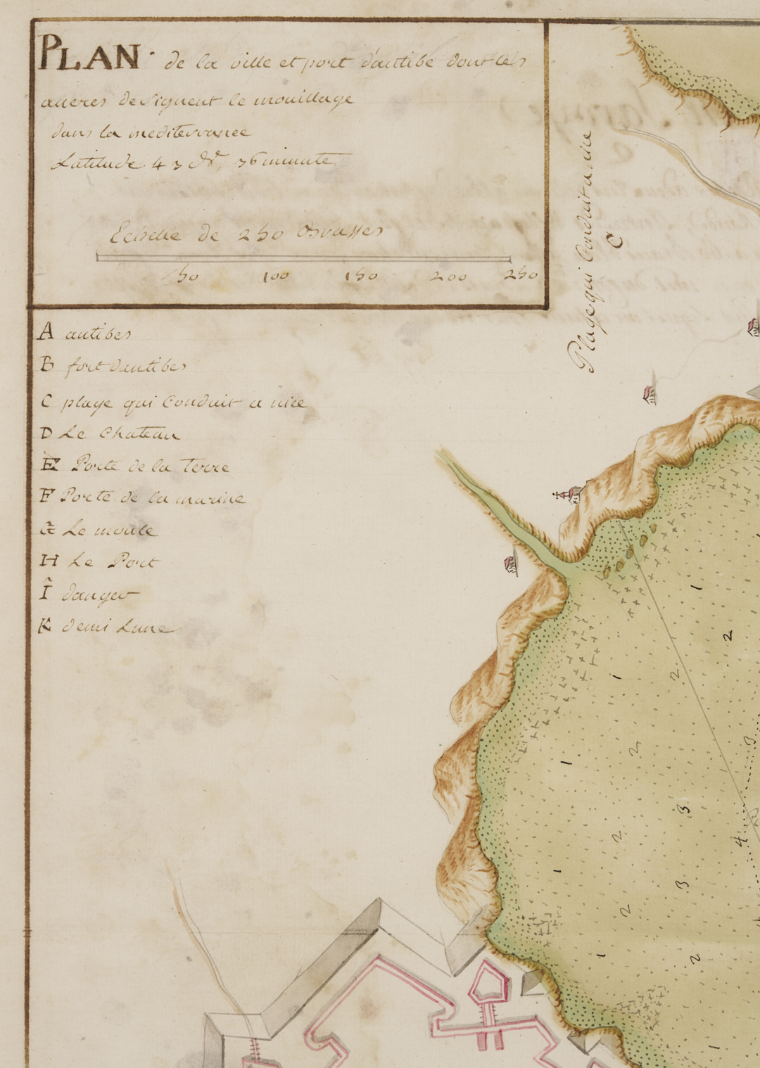
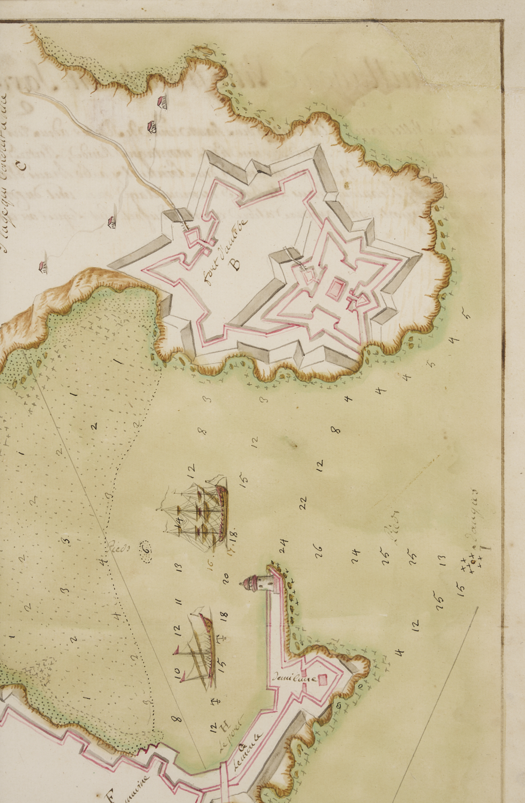
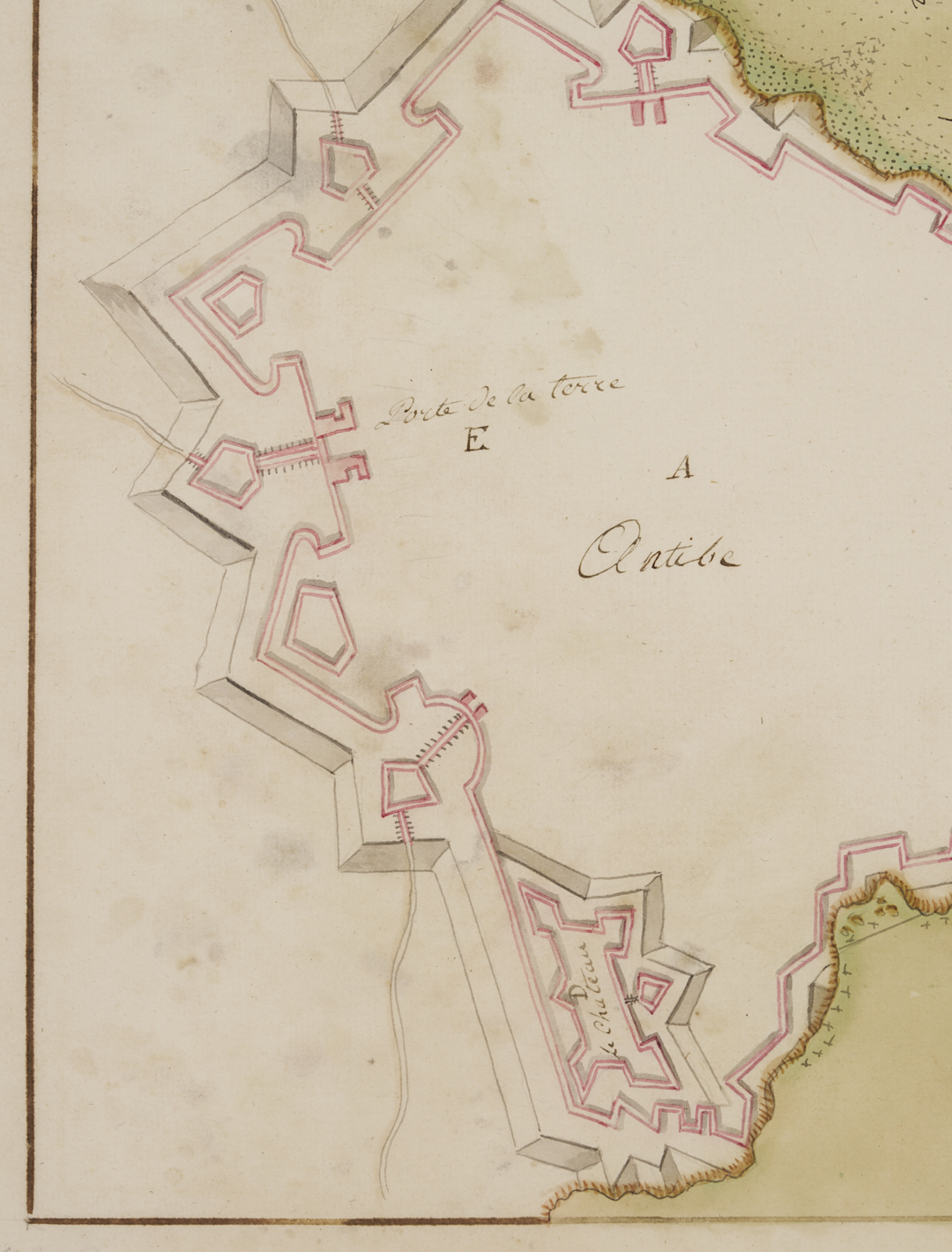
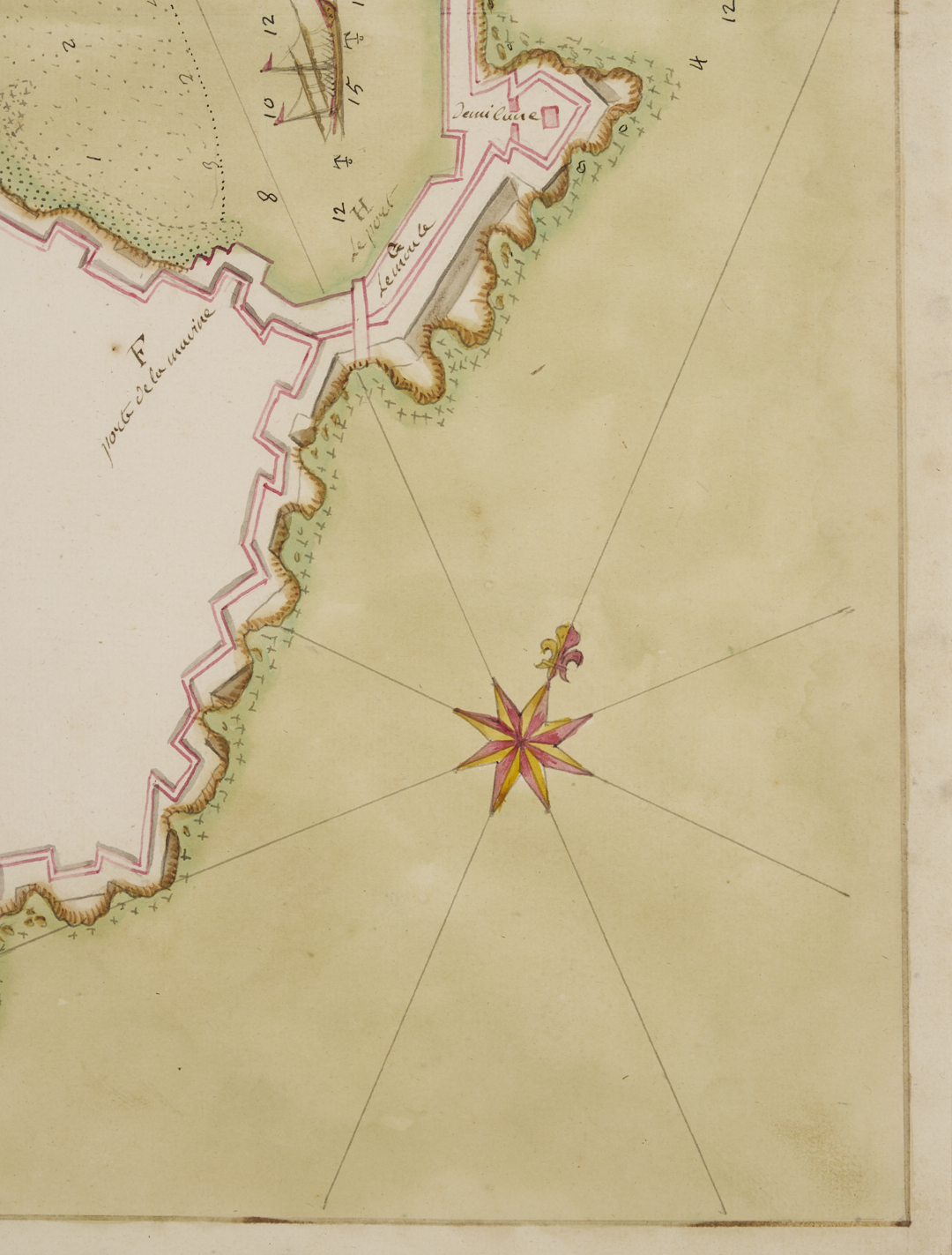
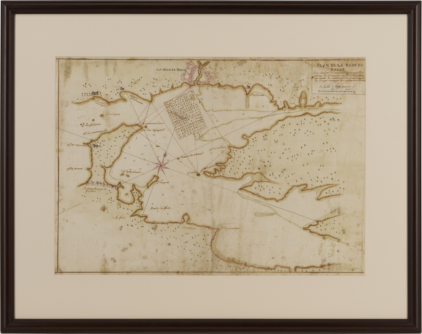
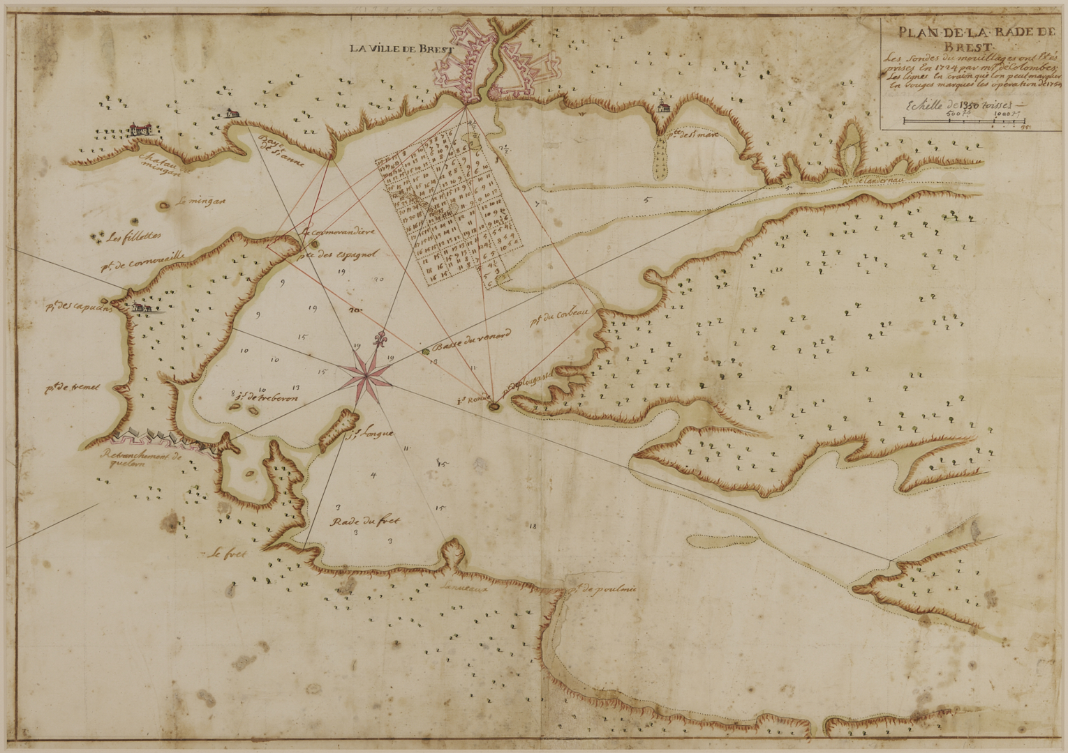
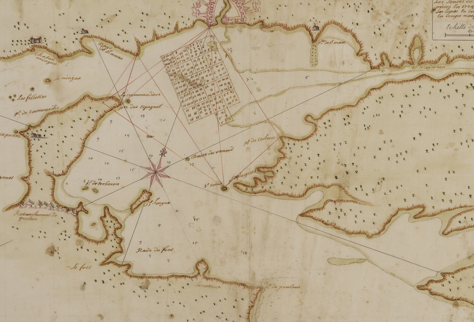
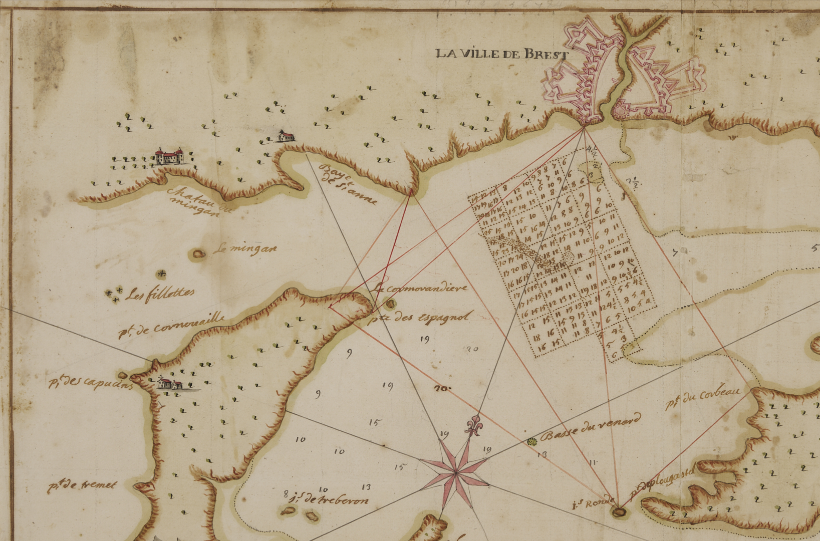
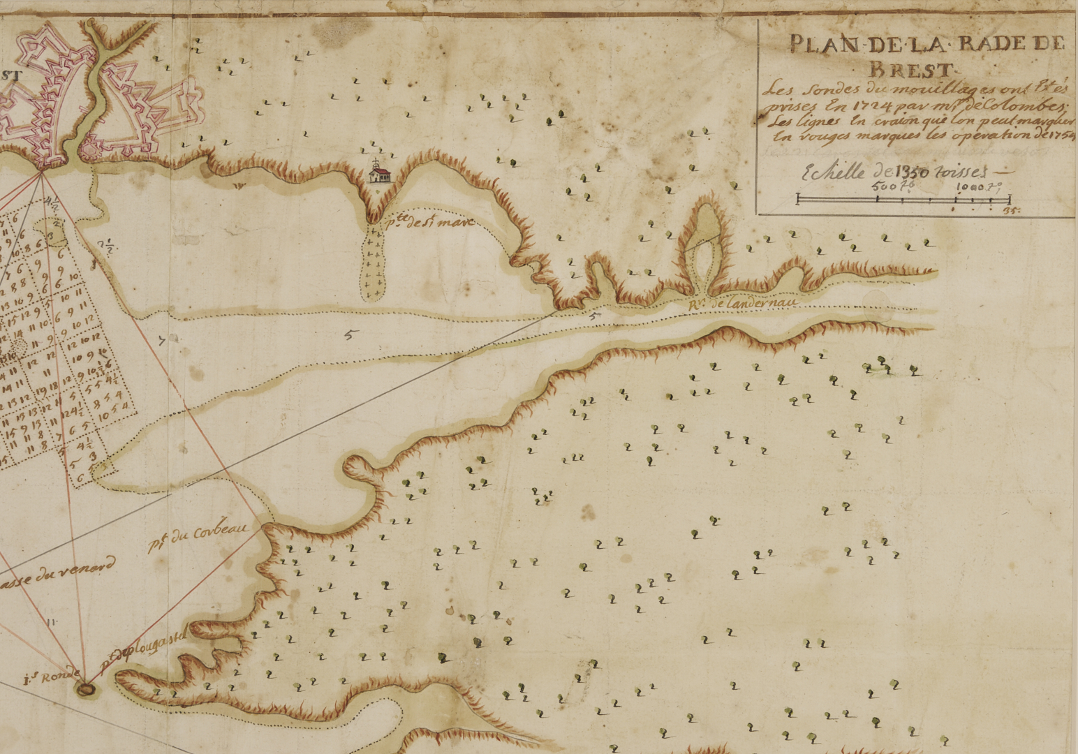
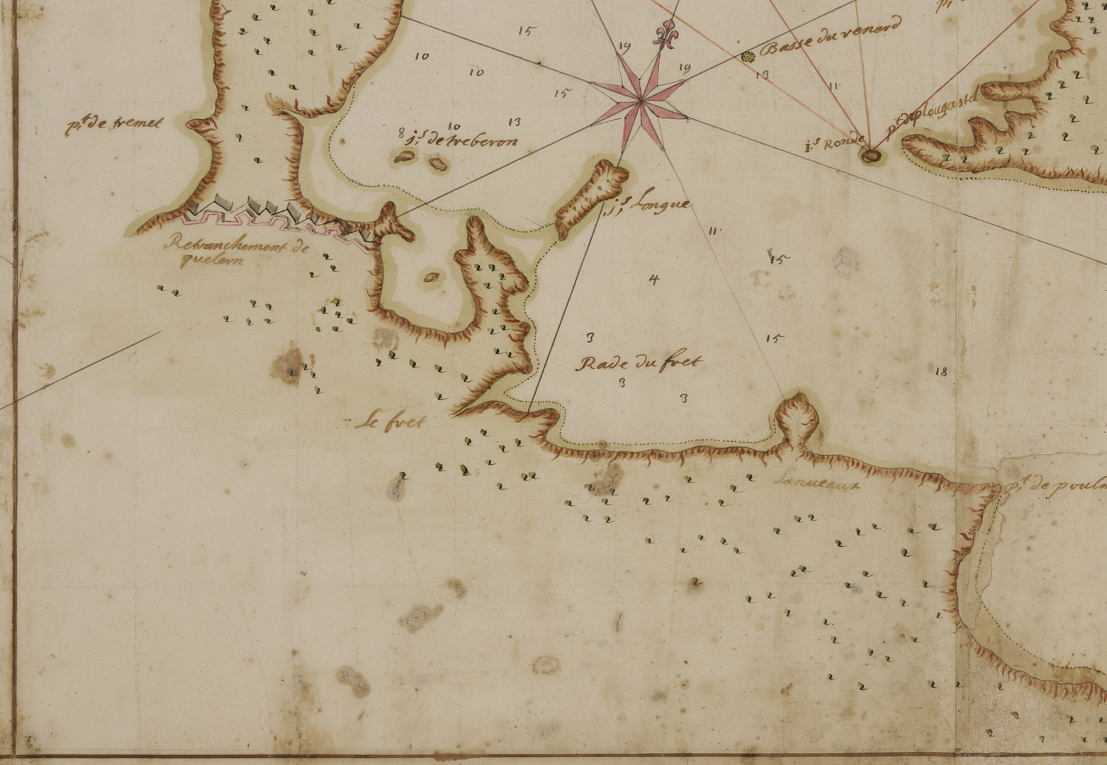
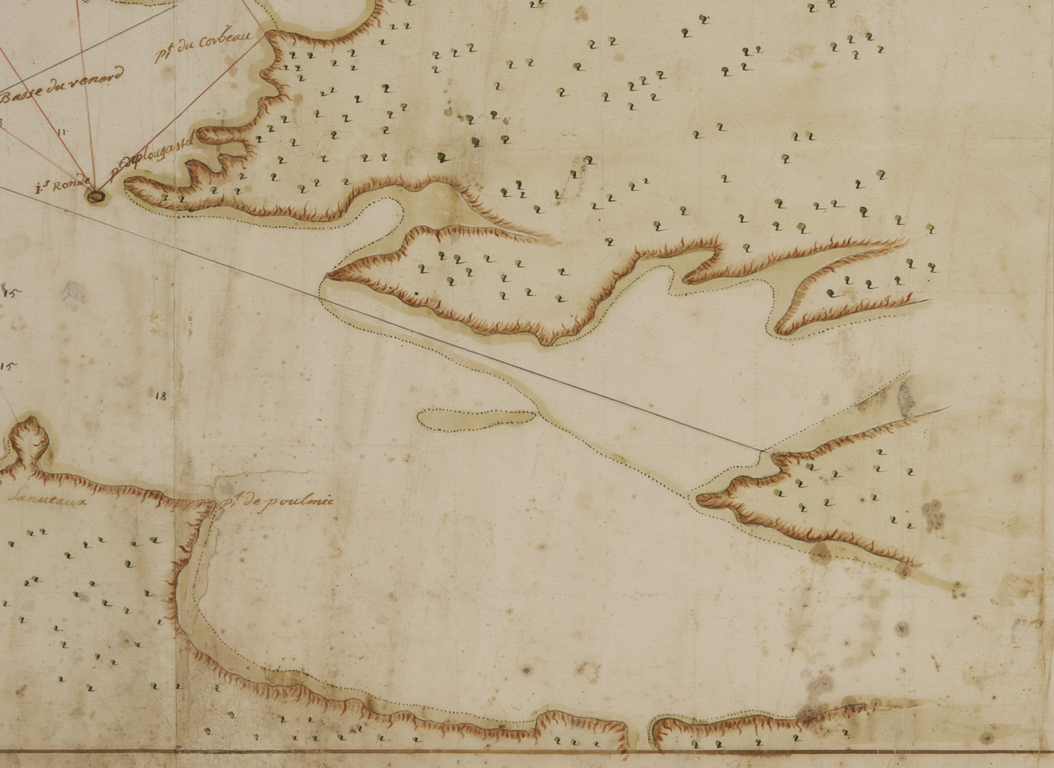
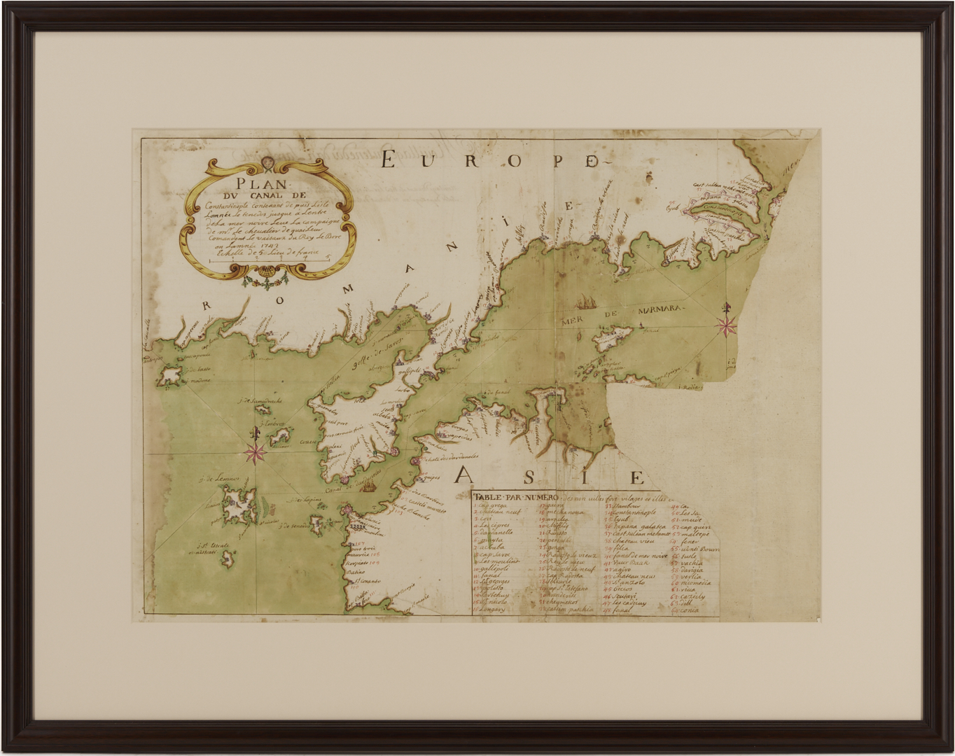
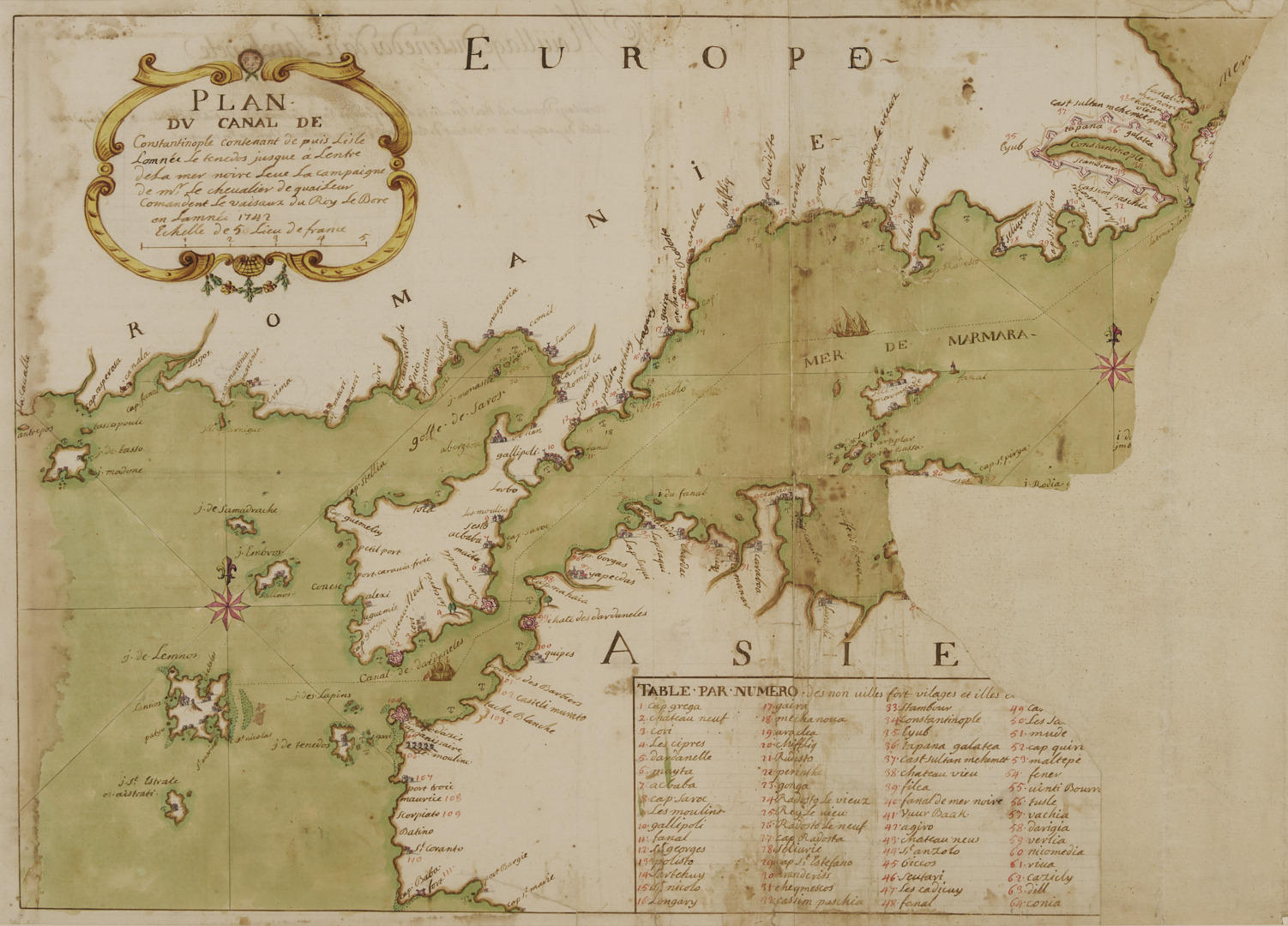
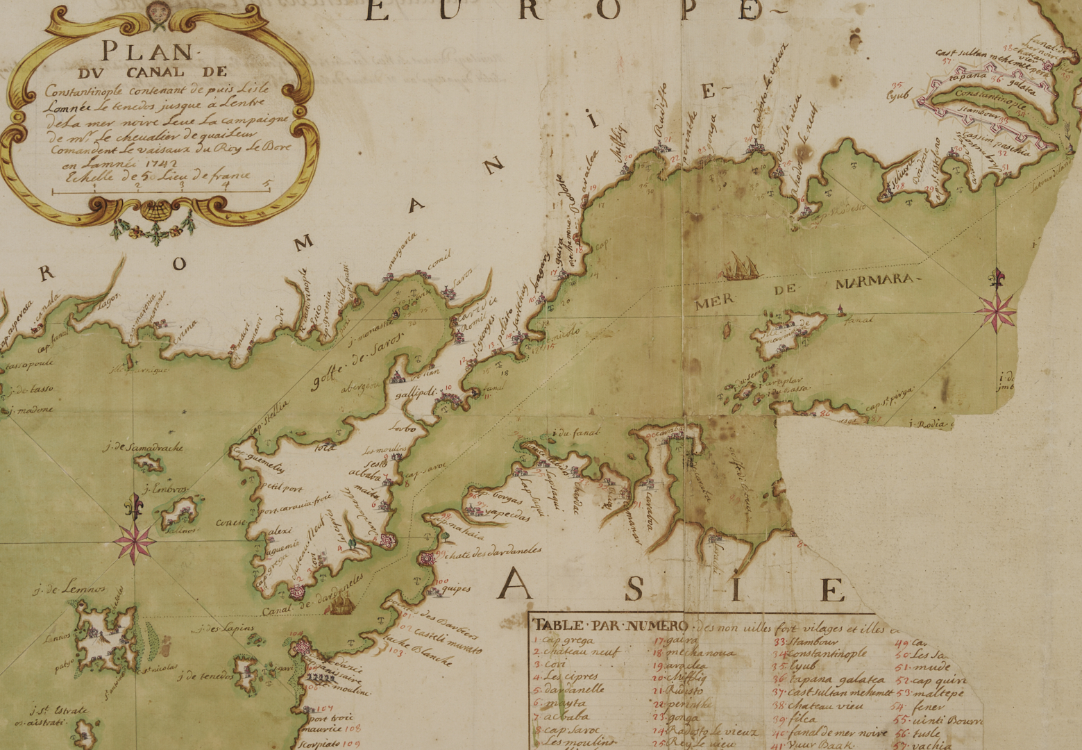
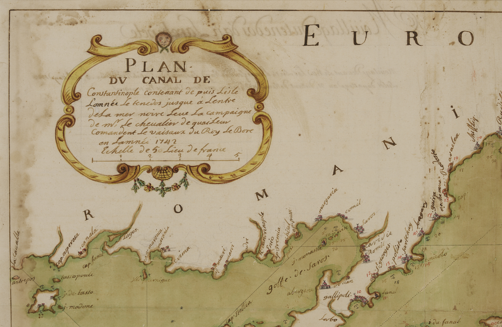
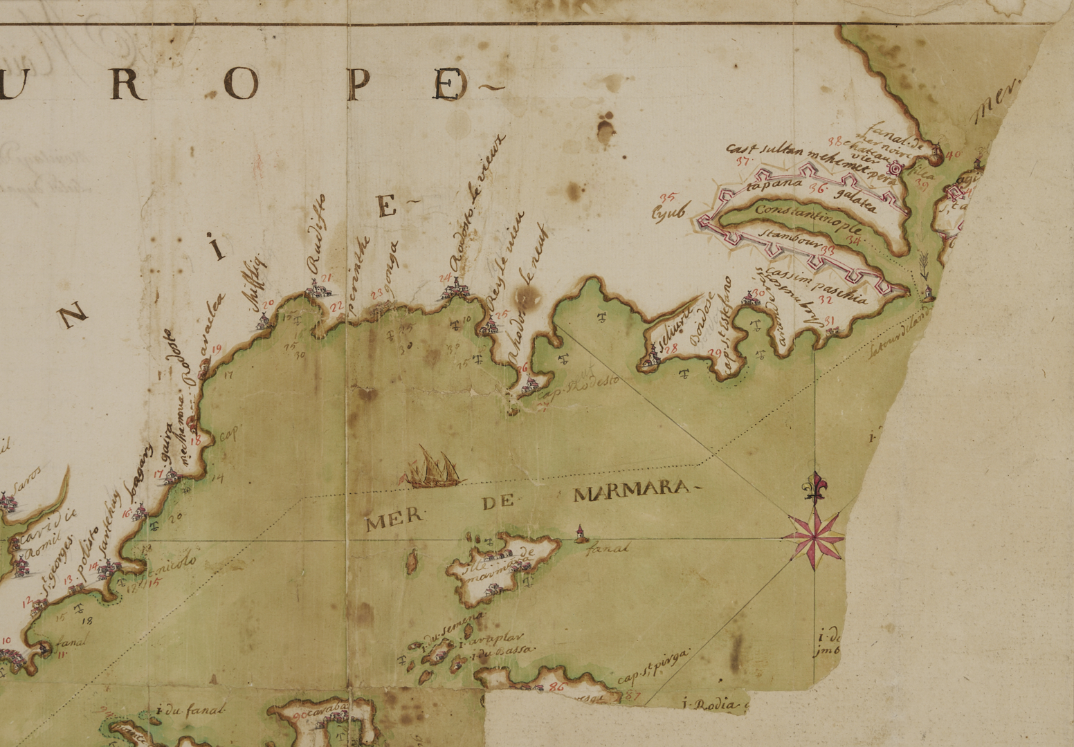
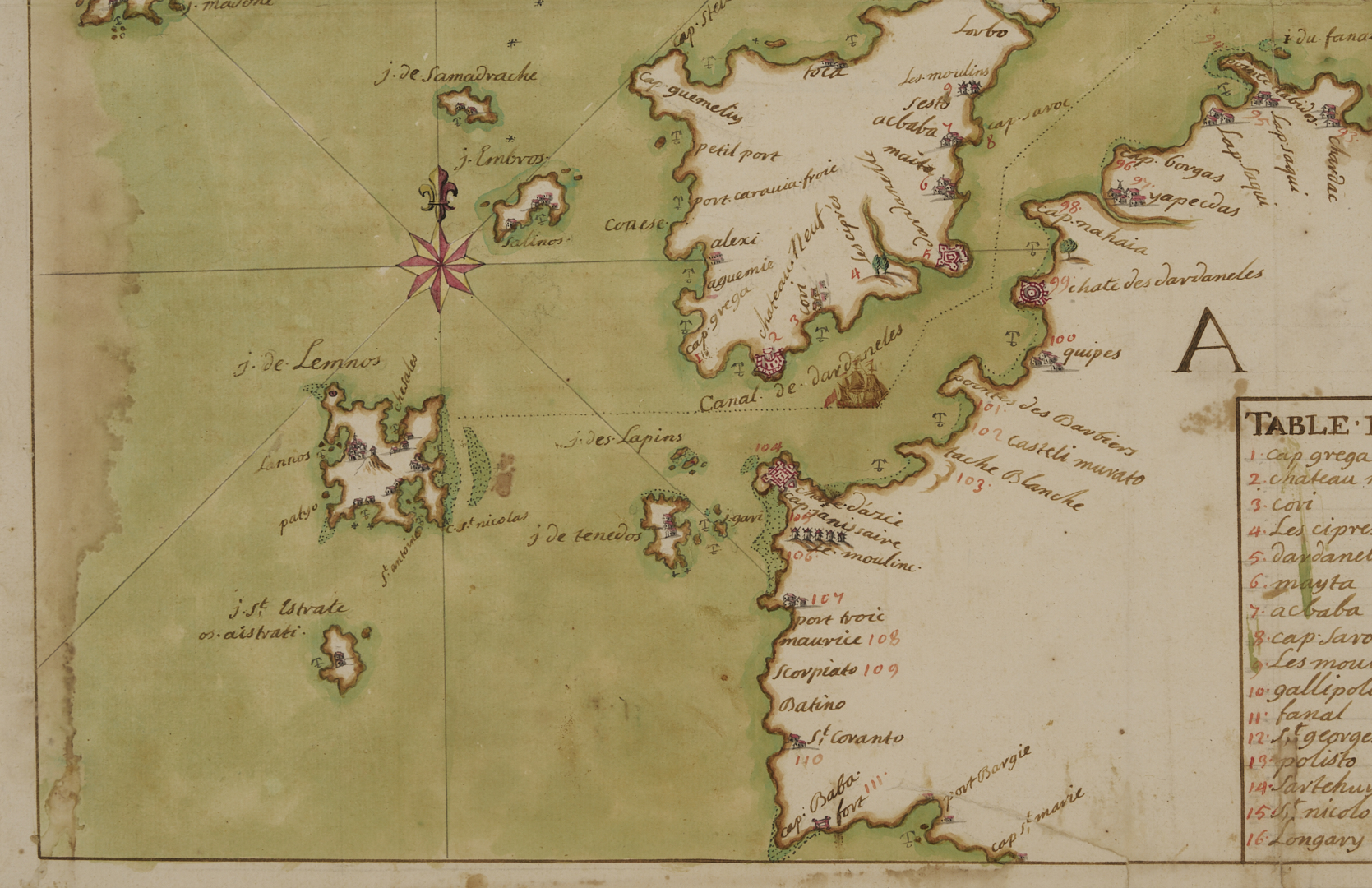
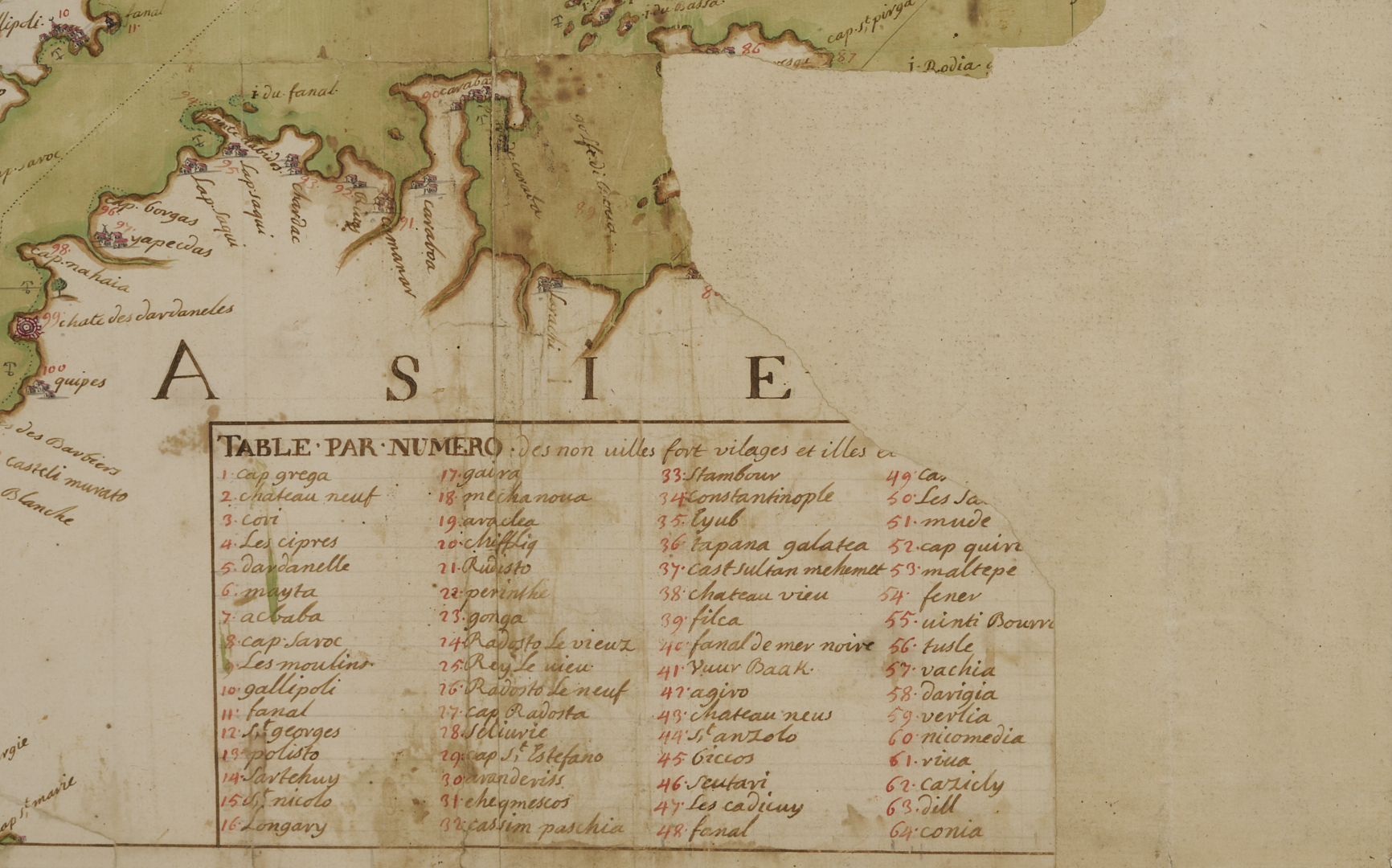
Group of six (6) French watercolor and ink anchorage charts, with place names and illustrated masted ships, forts, towns, fleur de lis and nautical rose motifs. Includes Port Vendre, France (32), c. 1750, sight: 20 1/8 in. x 15 in.; Port-de-Bouc and Martigues, France (35), c. 1750, sight: 15 1/4 in. x 20 in.; Antibes, France (43), c. 1750, sight: 20 1/8 in. x 15 in.; Brest, France (184), 1754, sight: 19 7/8 in. x 28 in.; Plan of the Canal of Constantinople, 1742, sight: 201/2 in. x 27 3/4 in.; Golf-Juan, c. 1750, 20 1/8 in. x 15 in. Note: These nautical charts were used by mariners to identify safe designated spots to drop anchors.
PROVENANCE: Arkansas Museum of Fine Arts Foundation.
CONDITION: Overall very good condition, not examined out of frames.