SOLD! for $336.00.
(Note: Prices realized include a buyer's premium.)
If you have items like this you wish to consign, click here for more information:
Selling with Case- Low Estimate: $300.00
- High Estimate: $400.00
- Hammer Price: $275.00
- Share this:
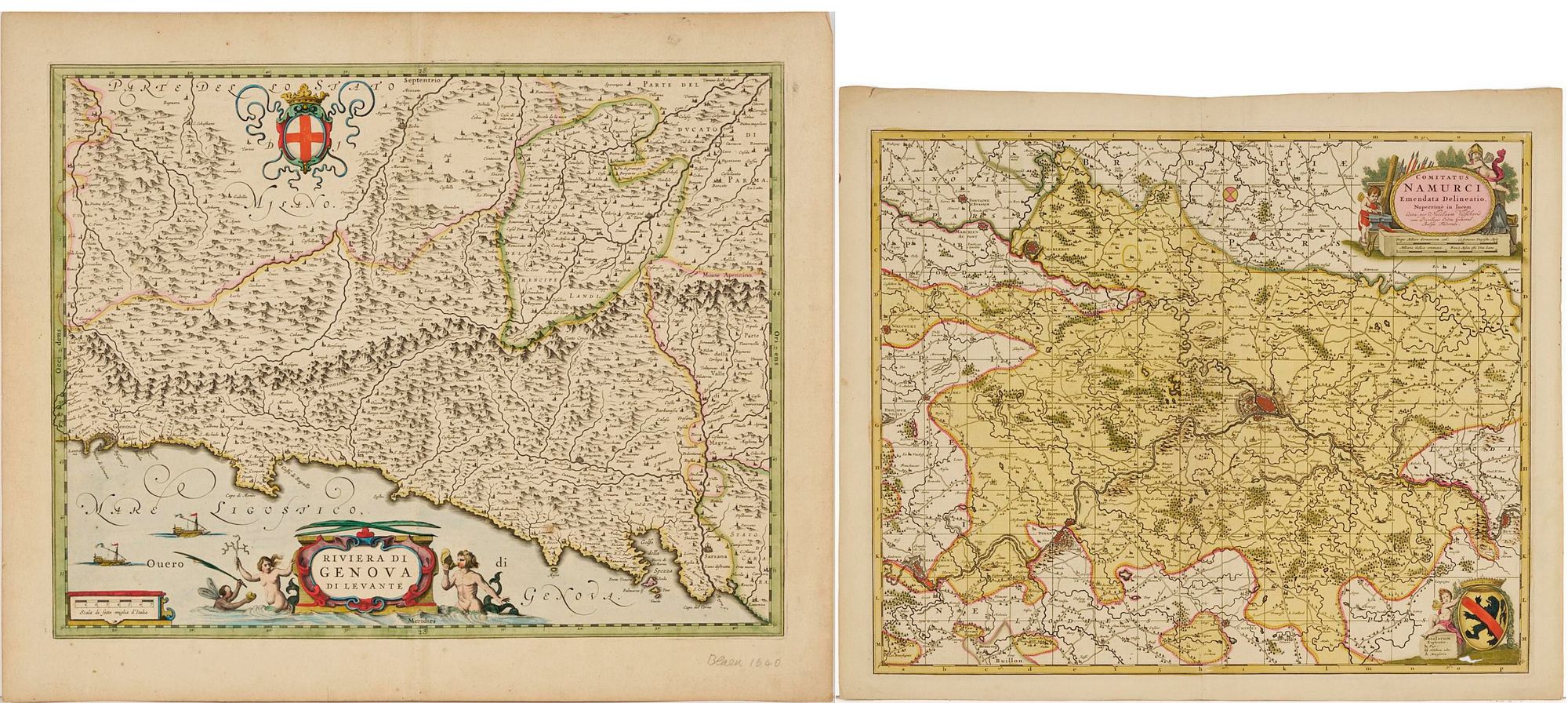
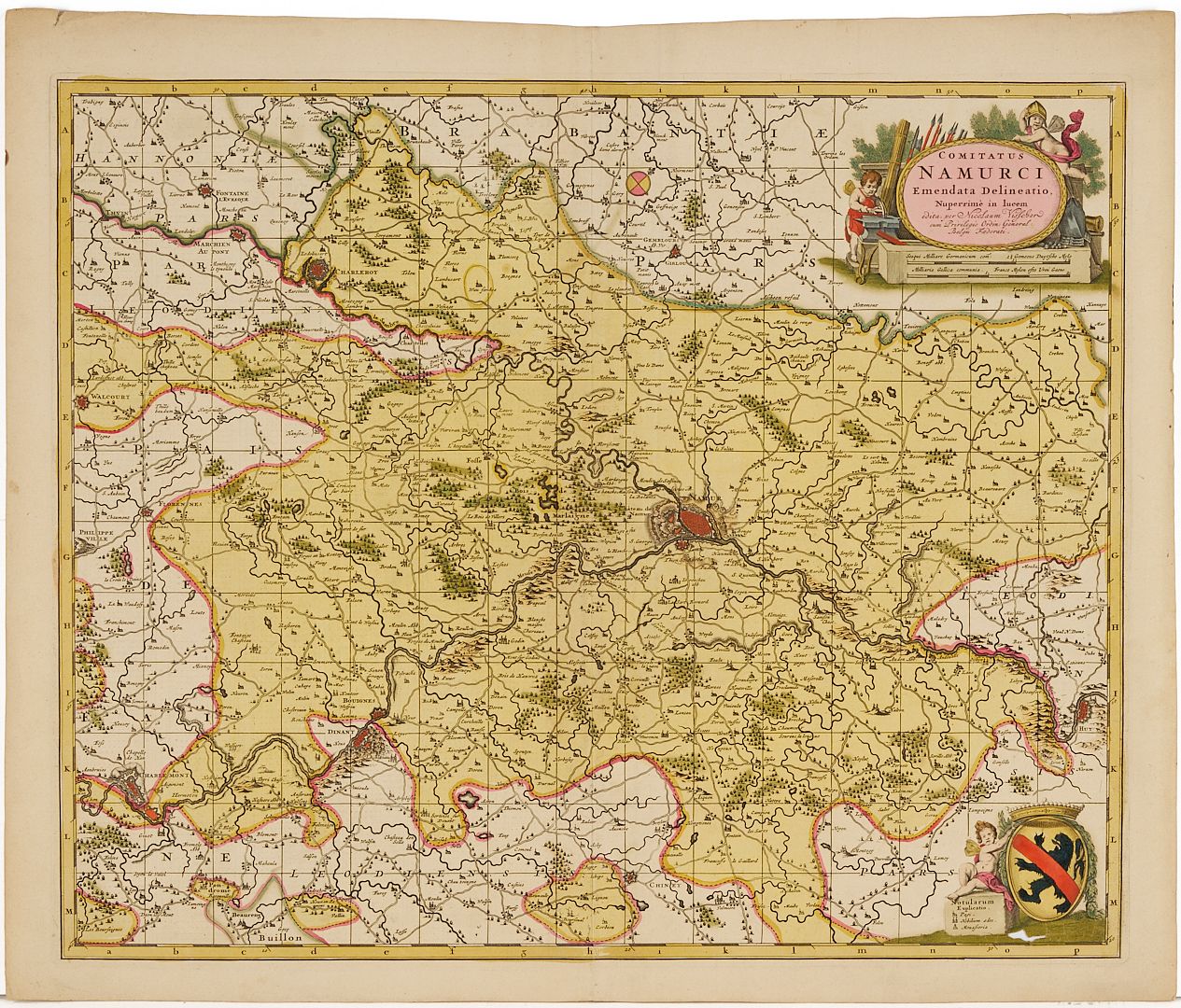
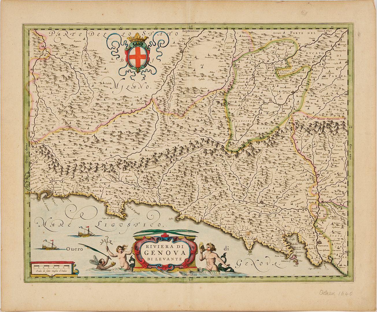
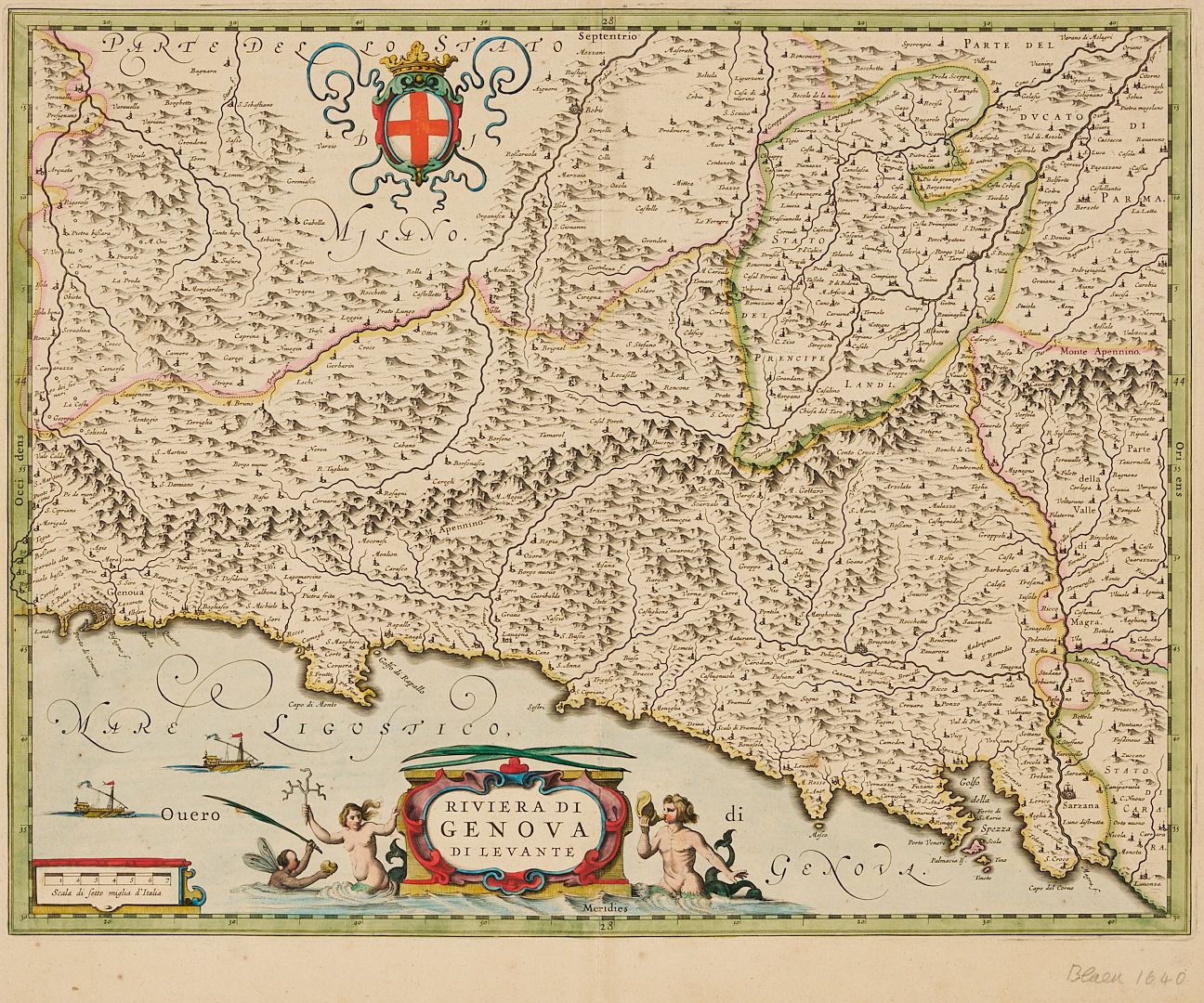
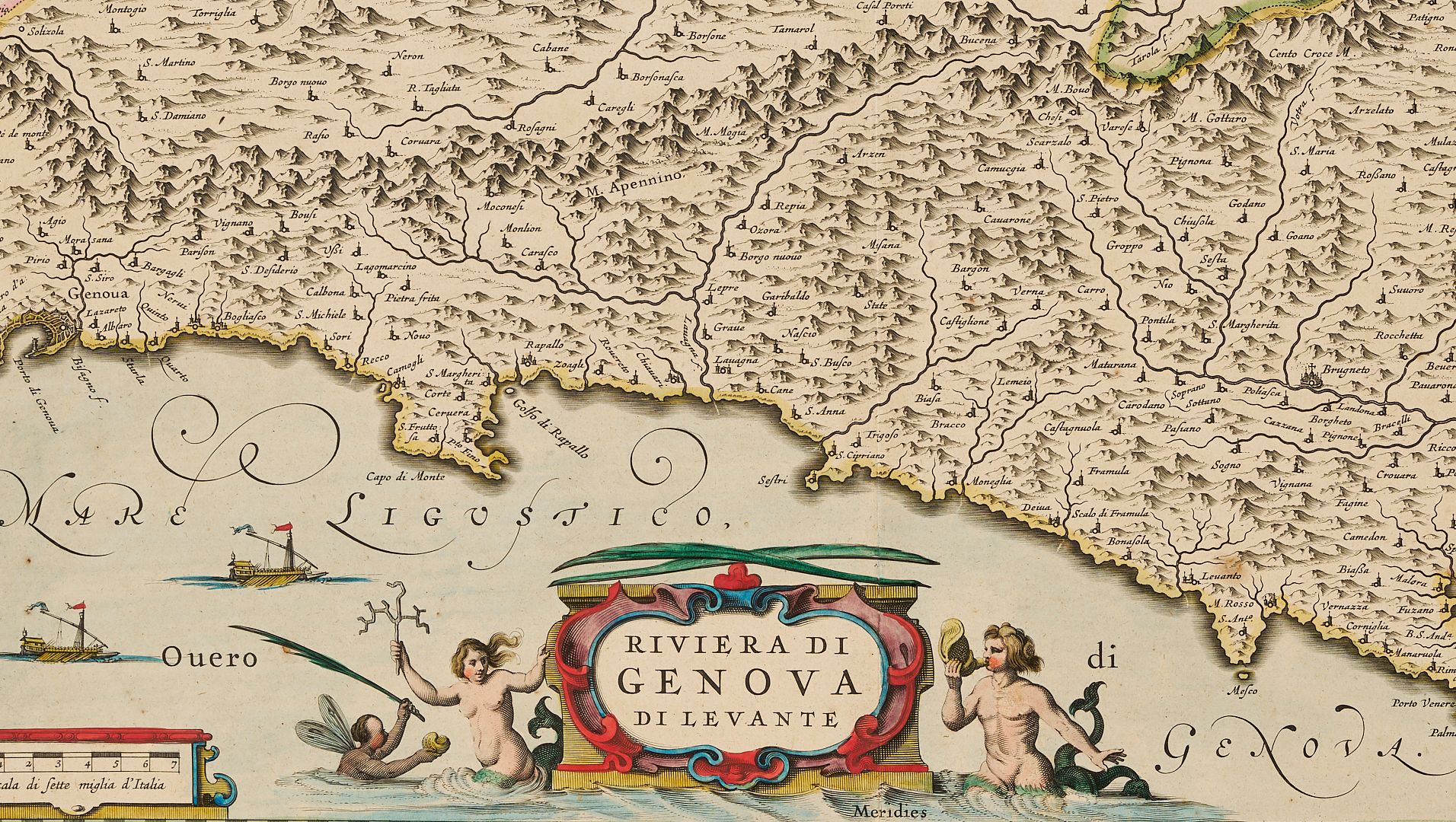
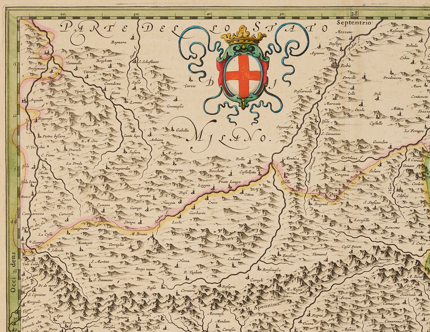
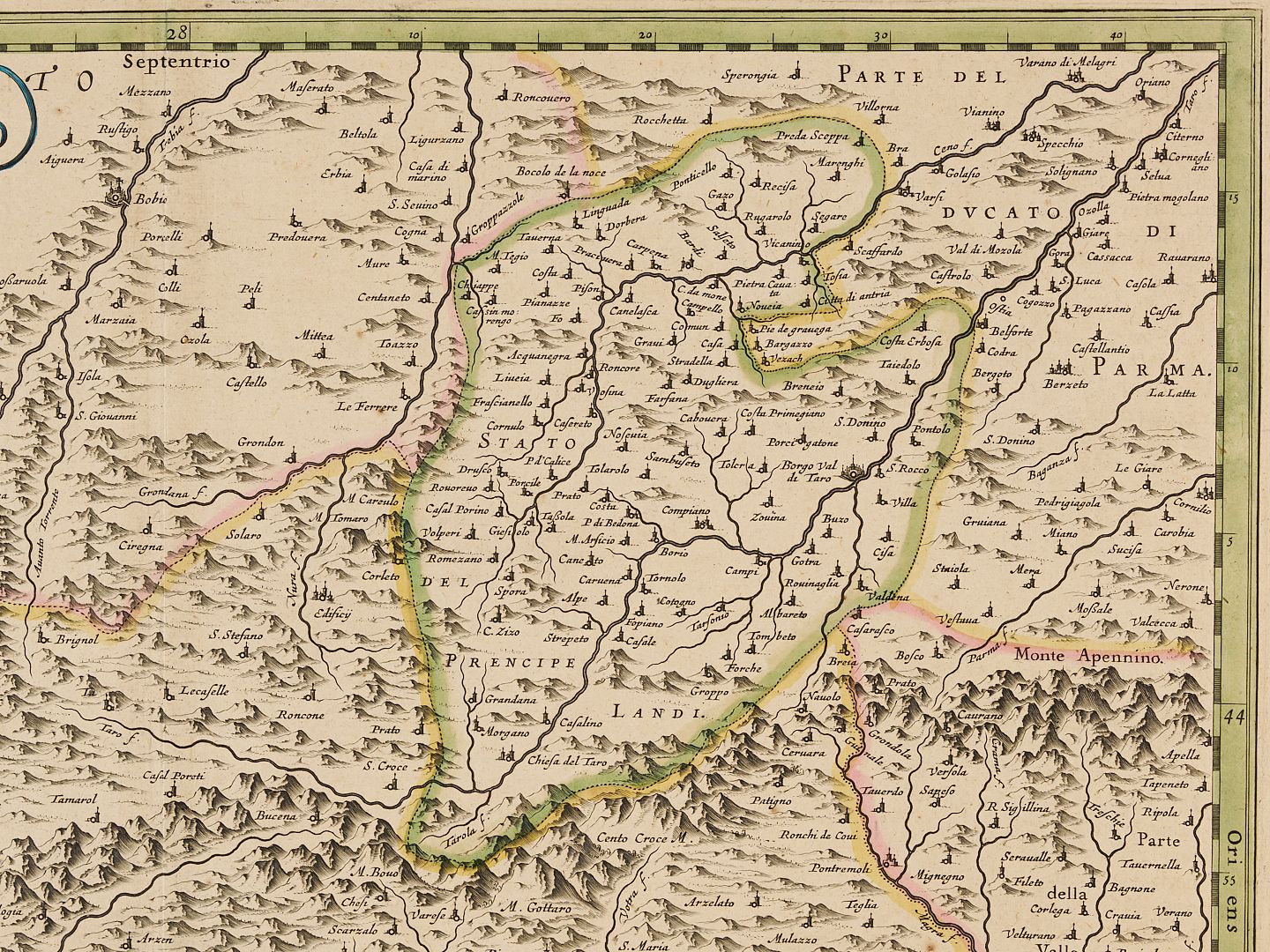
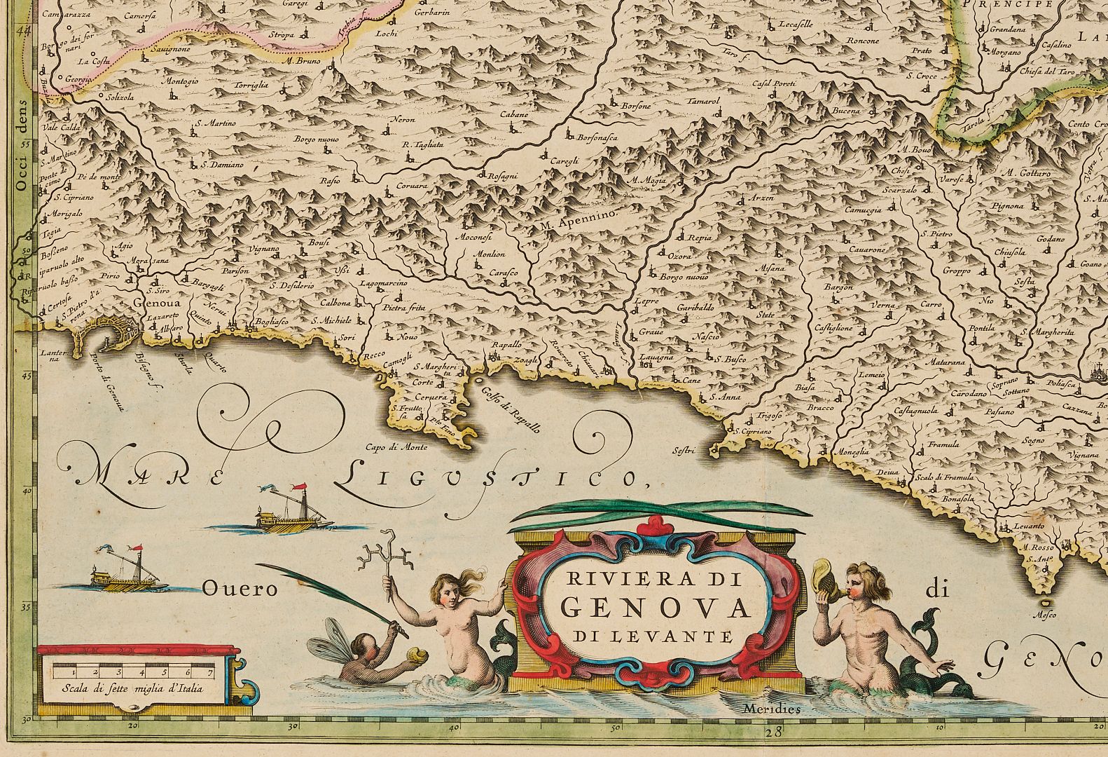
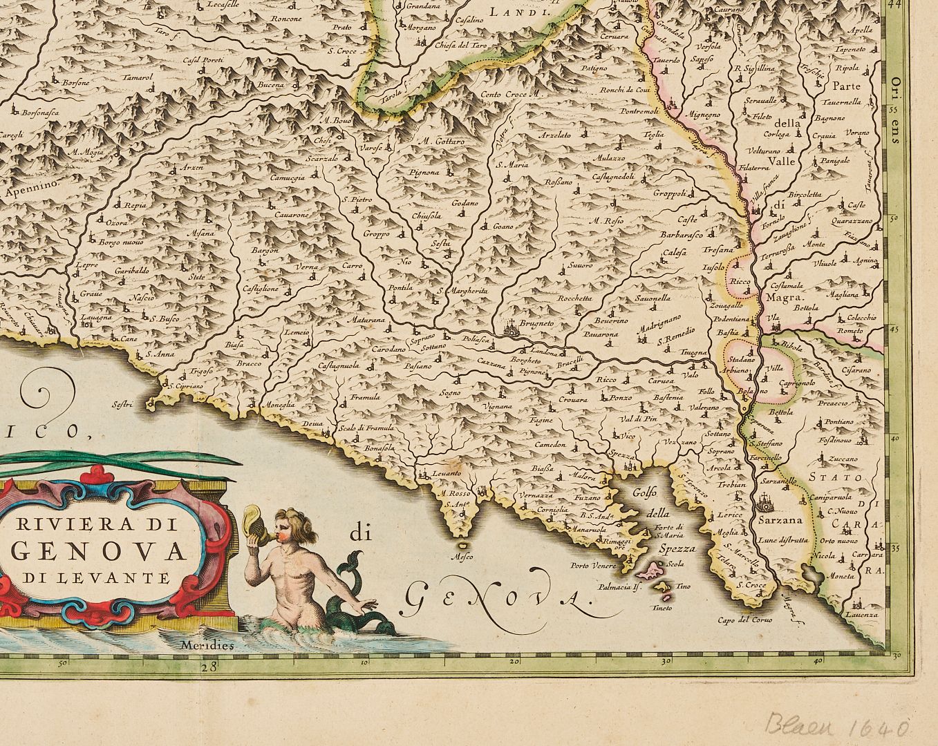
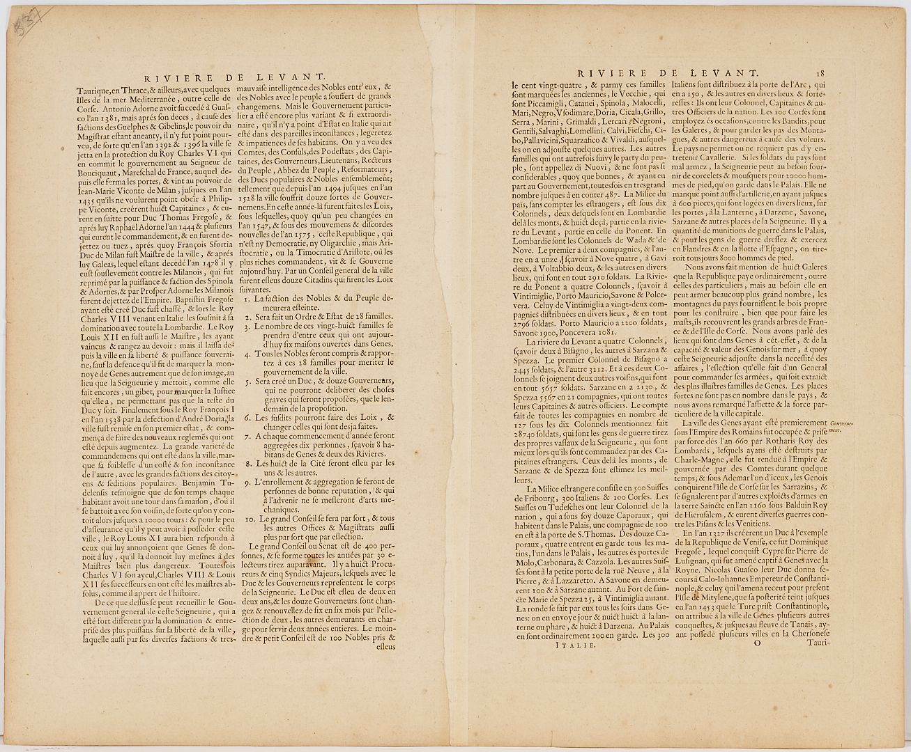
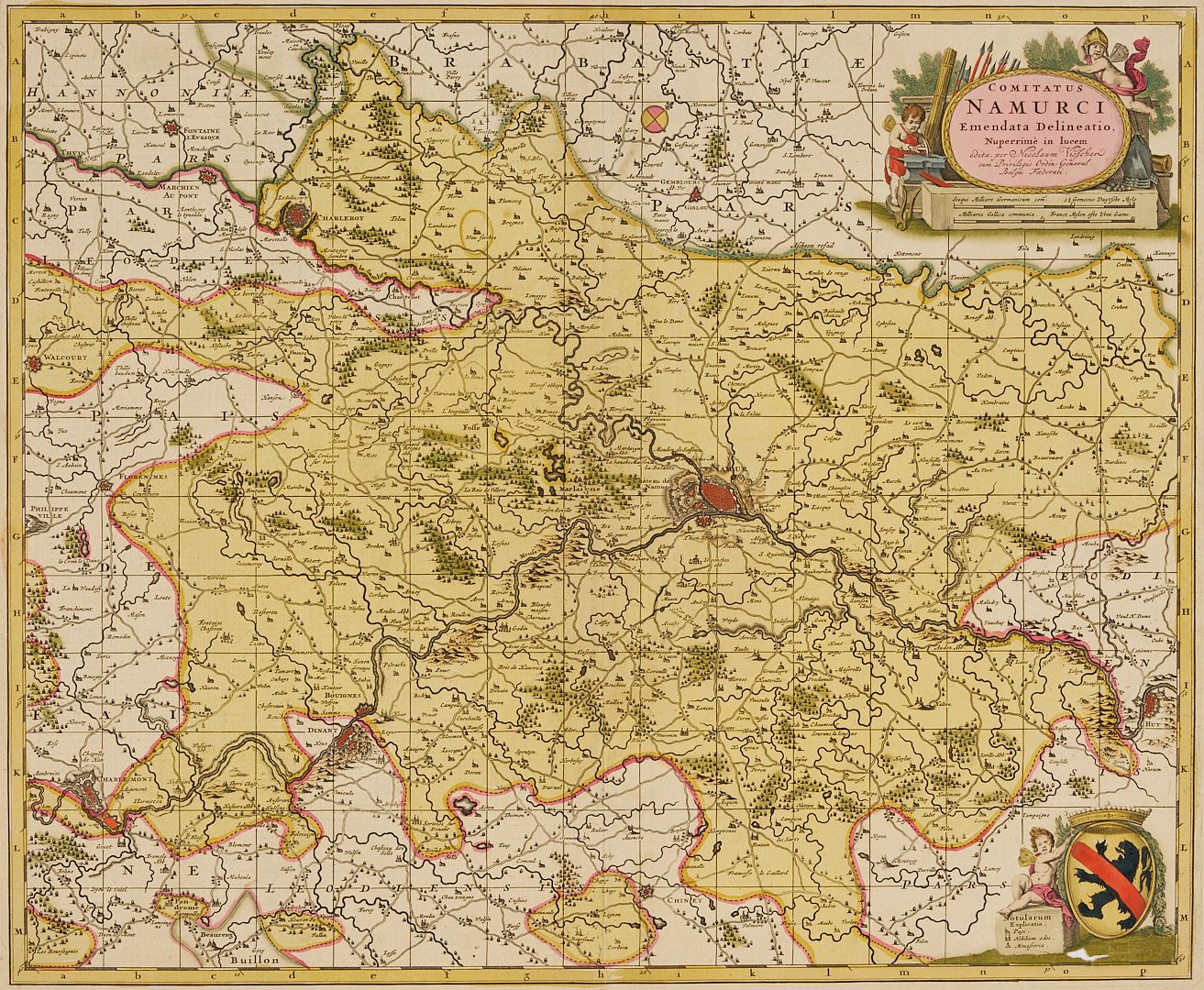
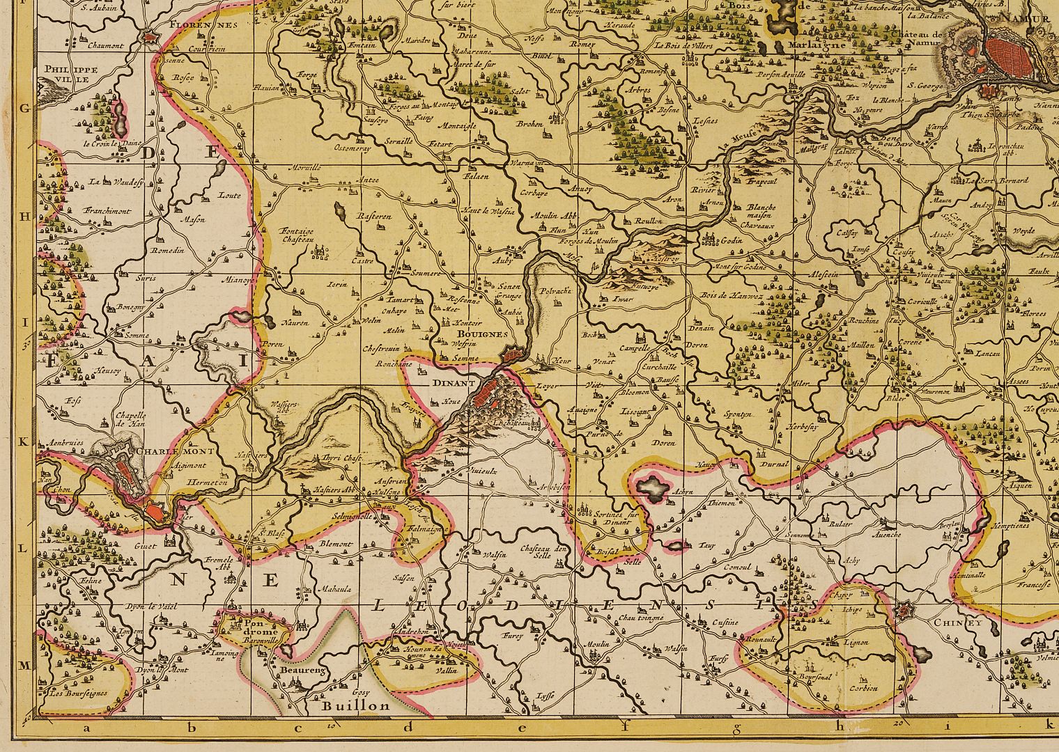
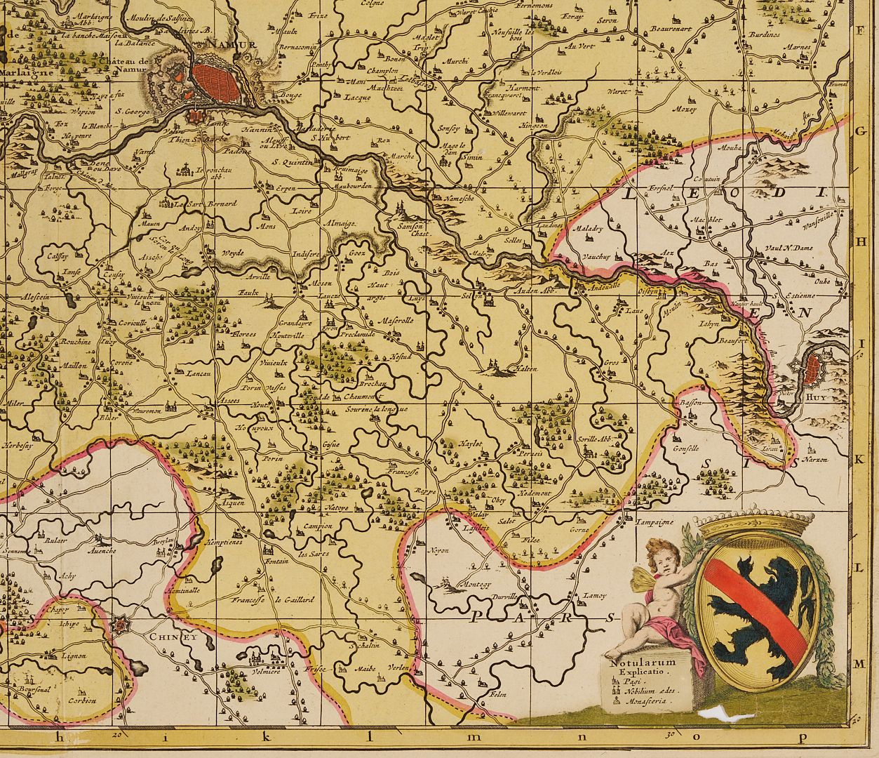
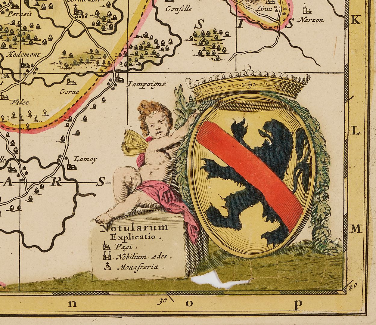
1st item: Joan Blaeu (1596-1673), RIVIERA DI GENOVA DI LEVANTE, regional map of Liguria depicting the coastal area from Genoua to Sarzana, embellished by decorative pictures and coat of arms, from Blaeu’s ATLAS MAJOR published Amsterdam, 1640. Unframed sheet 22 3/8 in. W x 18 3/8 in. H. Neatline 19 3/4 in. W x 15 1/4 in. H. Note: The famous Blaeu’s firm was founded in 1596 by Willem Janzoon Blaeu (1571-1638), then continued by his two sons Cornelius (1616-1648) and Joan (Johannis) (1596-1673). 2nd item: Nicholas Janszen Visscher (1618-1679), COMITATUS NAMURCI EMENDATA DELINEATIO, NUPERRIME IN LUCERN. Published by Frederick De Wit, c. 1705, Amsterdam. Engraved map of the province of Namur in Belgium, decorated with two cartouches: one flanked by two cherubs (one blacksmithing) and instruments of war above the distance scale, and the other a coat of arms with a cherub, and a fleur-de-lis compass rose, surrounded by a yellow border. Unframed sheet 24 1/2 in. W x 20 1/2 in. H. Neatline 22 1/4 in. W x 18 1/4 in. H. Note: The Visscher family was one of the most distinguished of all 17th-century cartographic firms, and a major player in the era now considered the golden age of Dutch mapmaking.
PROVENANCE: The estates of Walter and Dr. Mary Schatz, Nashville.
CONDITION: 1st item: Overall toning primarily to the edges. A few other small tears 1/4 in. to 1/2 in. L. and creases at edges, all outside of neatline. 2nd item: Overall toning to the page. A couple small tears 1/4 in. to 1/2 in. L. outside of neatline. 1 1/2 in. tear in map toward bottom right corner, minor loss.