SOLD! for $19,200.00.
(Note: Prices realized include a buyer's premium.)
If you have items like this you wish to consign, click here for more information:
Selling with Case- Low Estimate: $6,000.00
- High Estimate: $8,000.00
- Hammer Price: $16,000.00
- Share this:
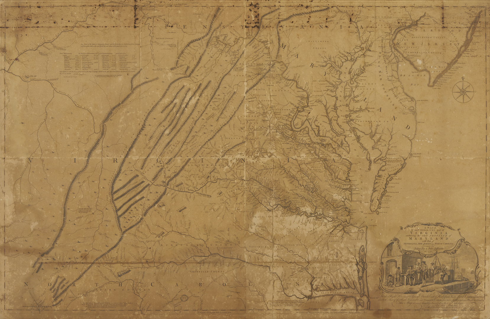
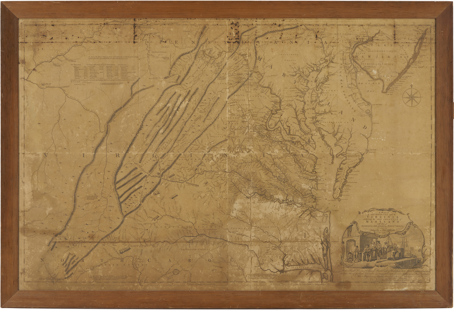
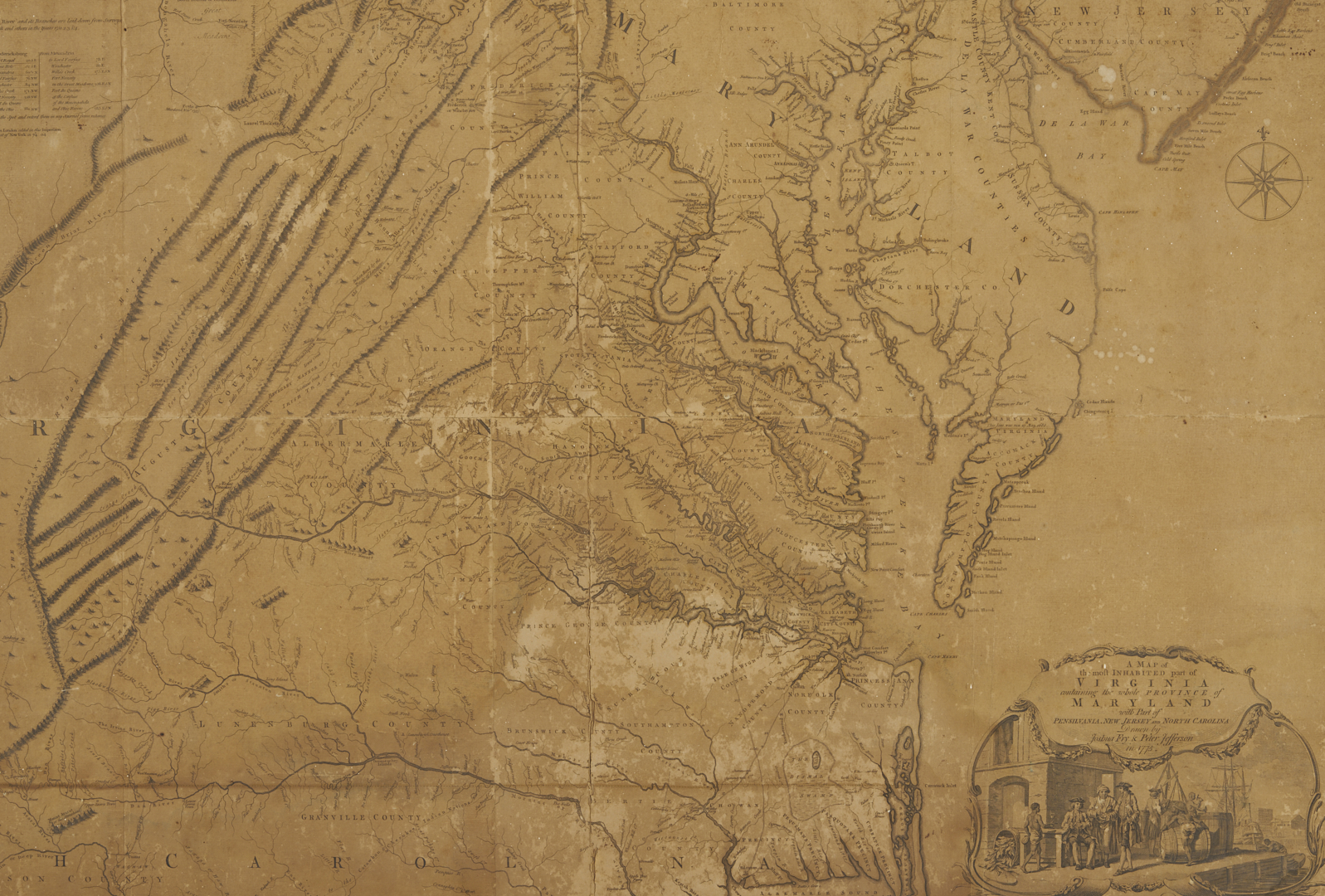
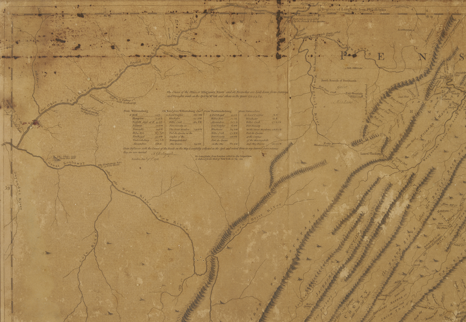
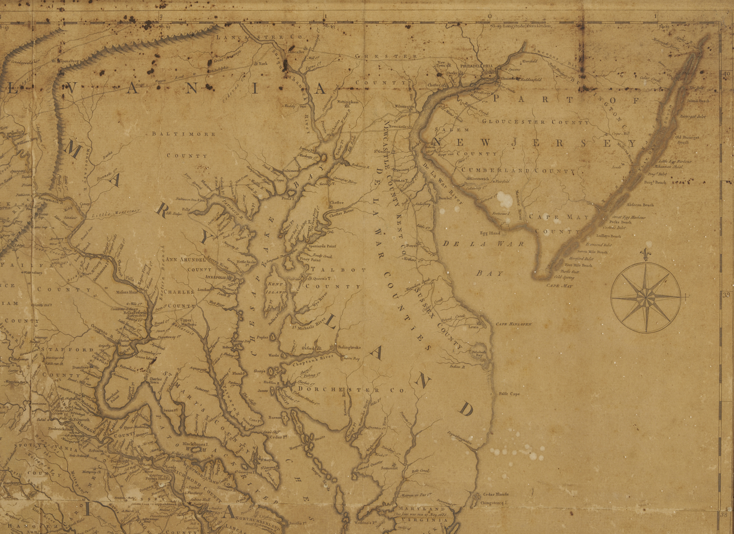
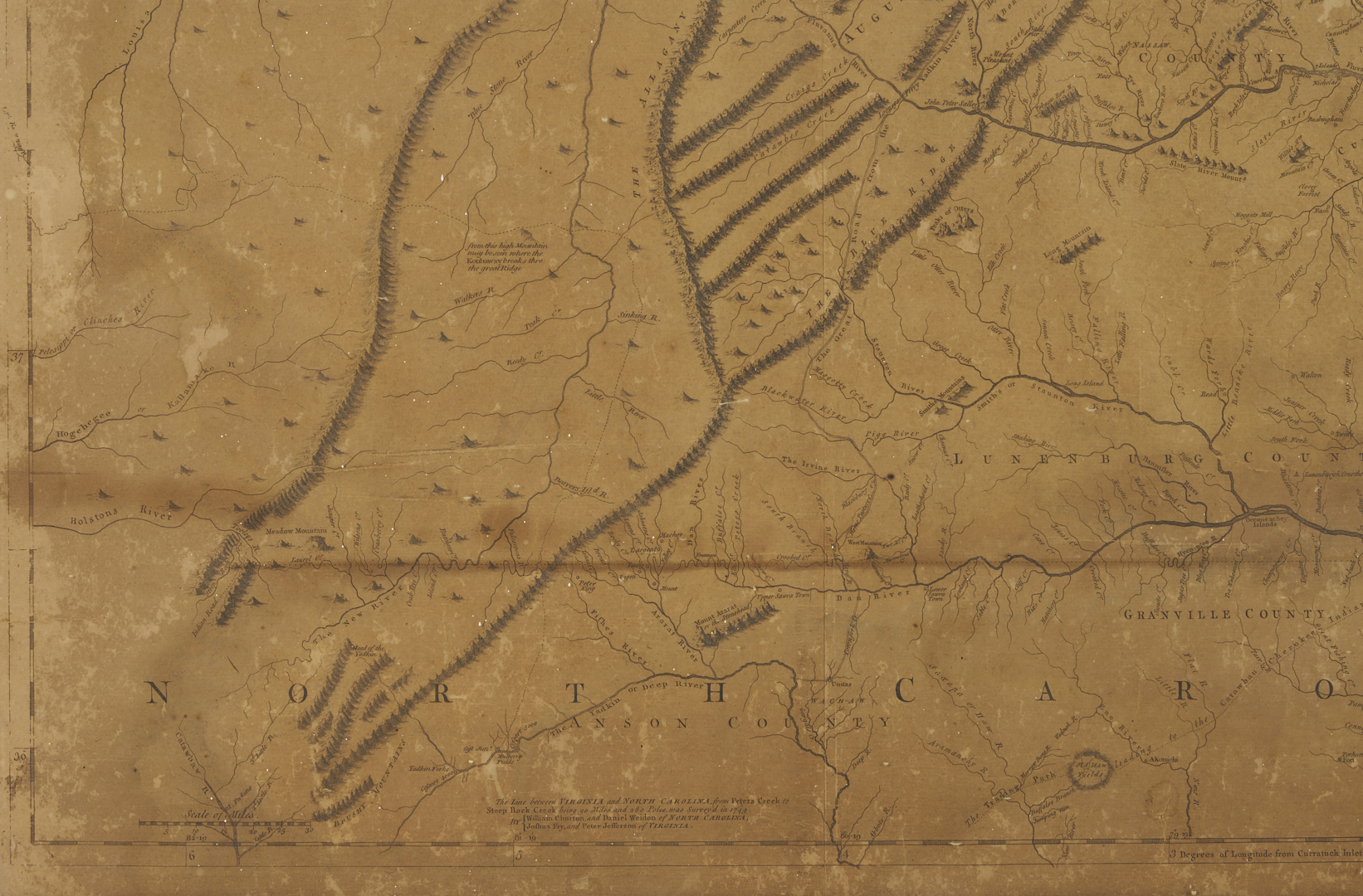
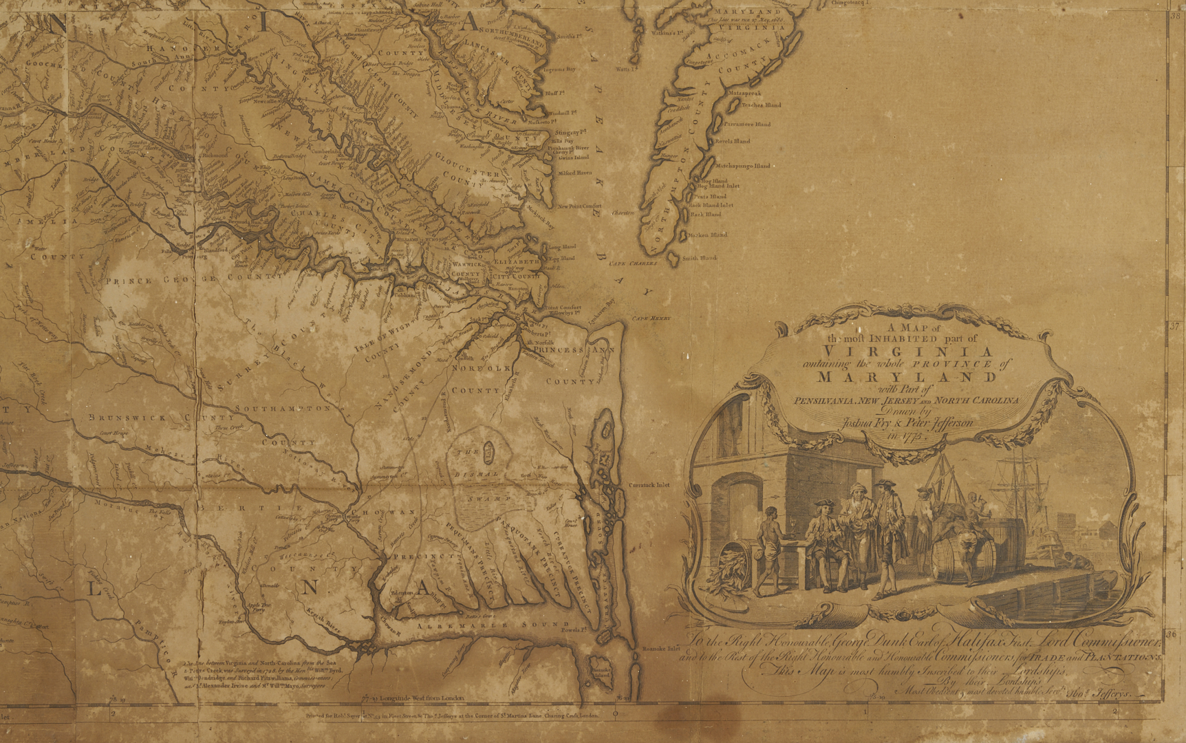
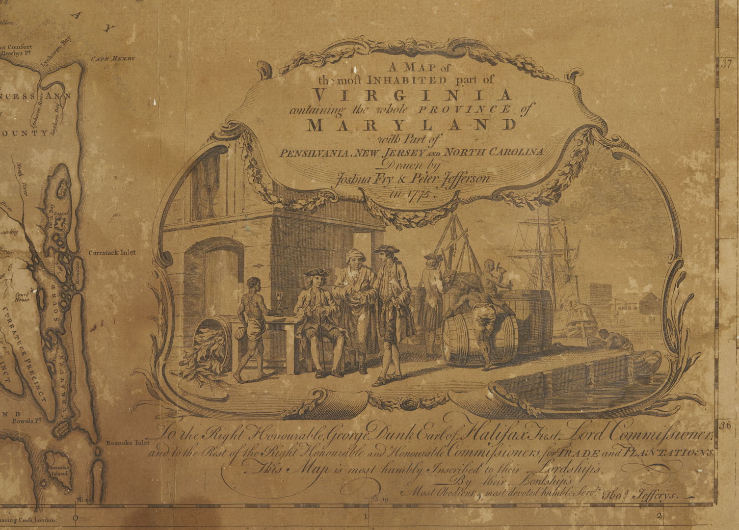
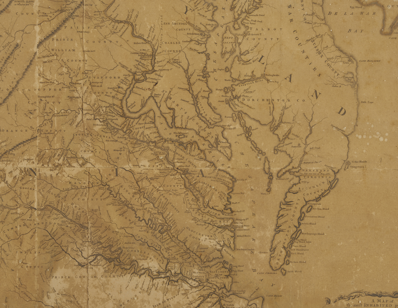
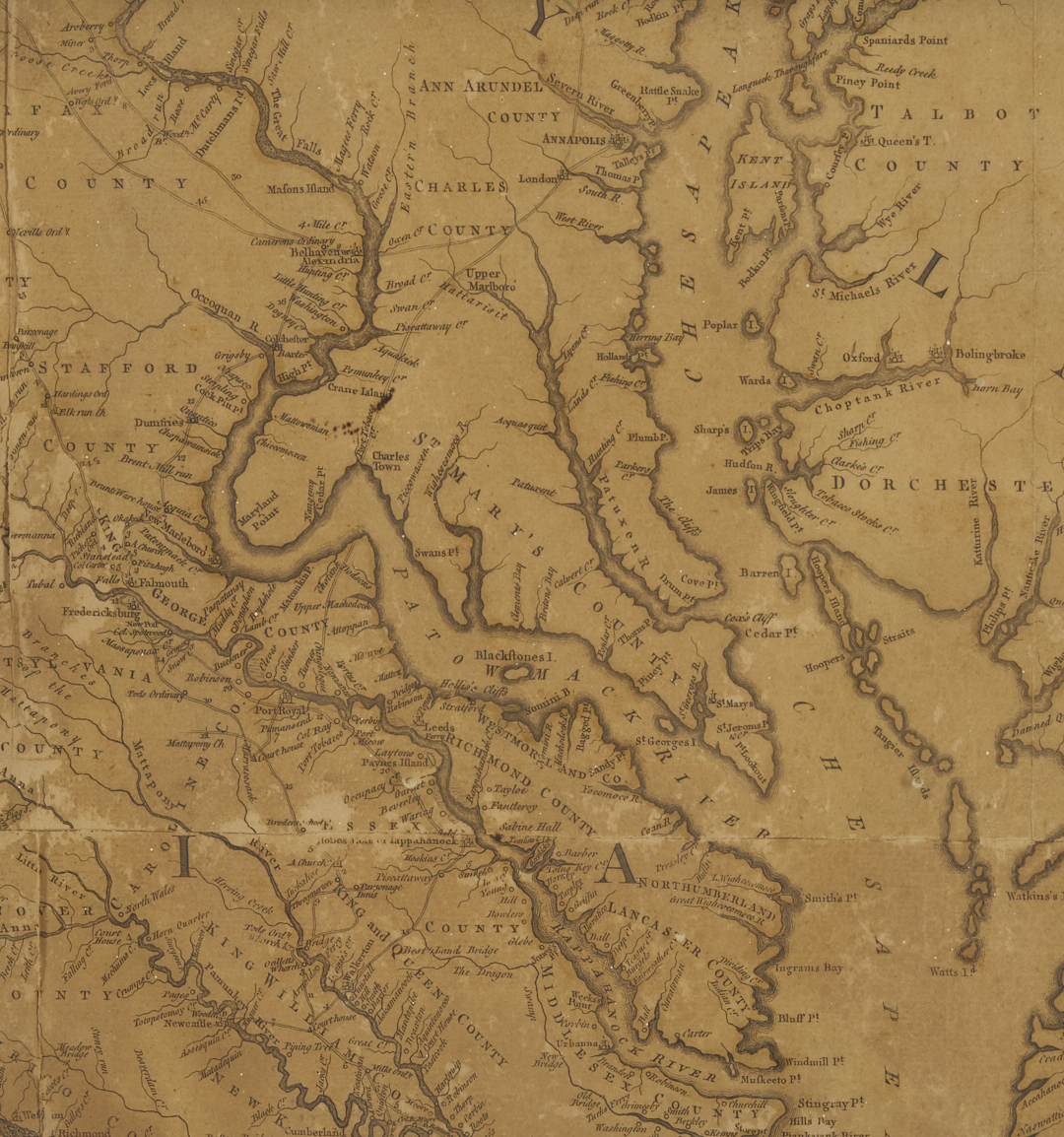
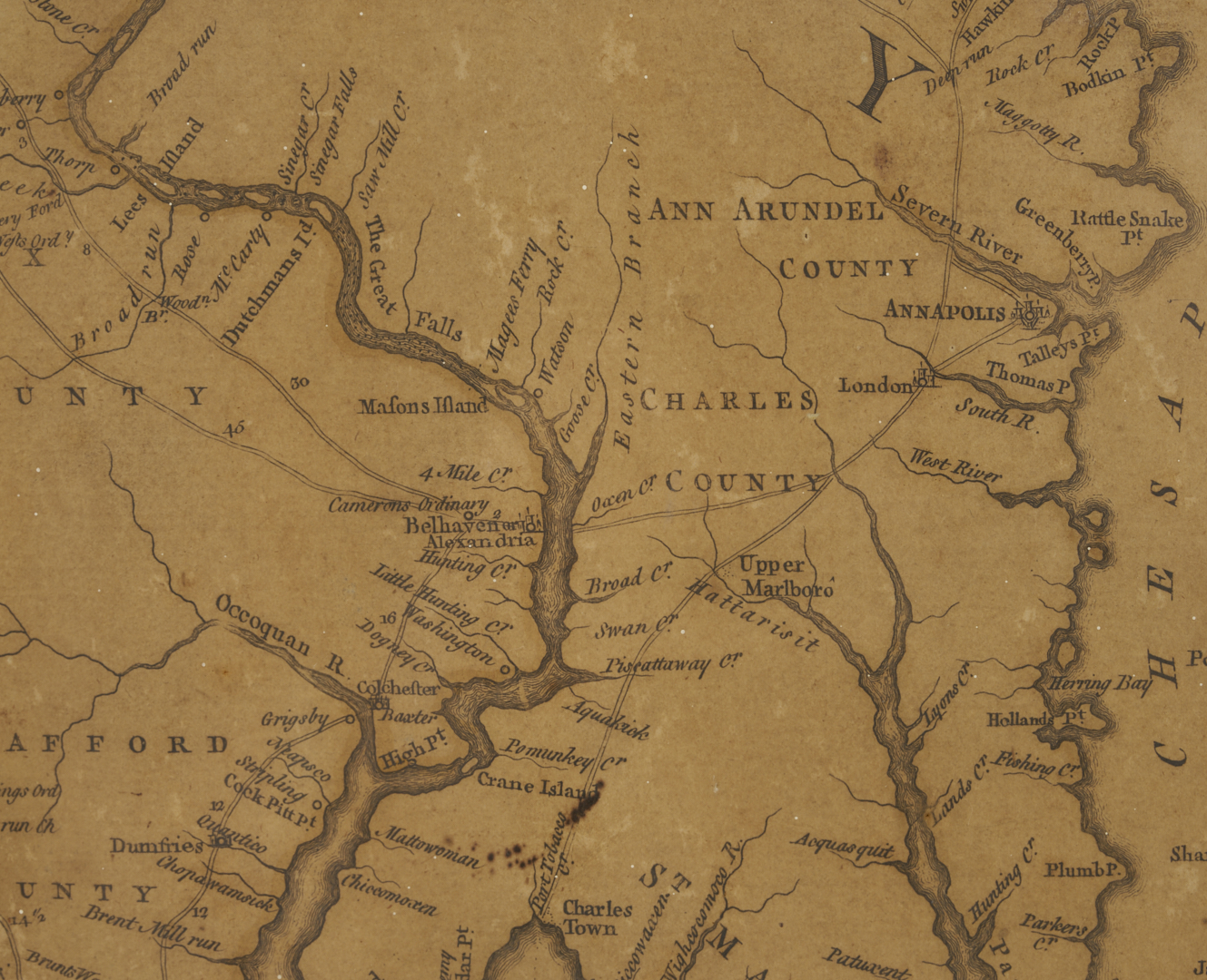
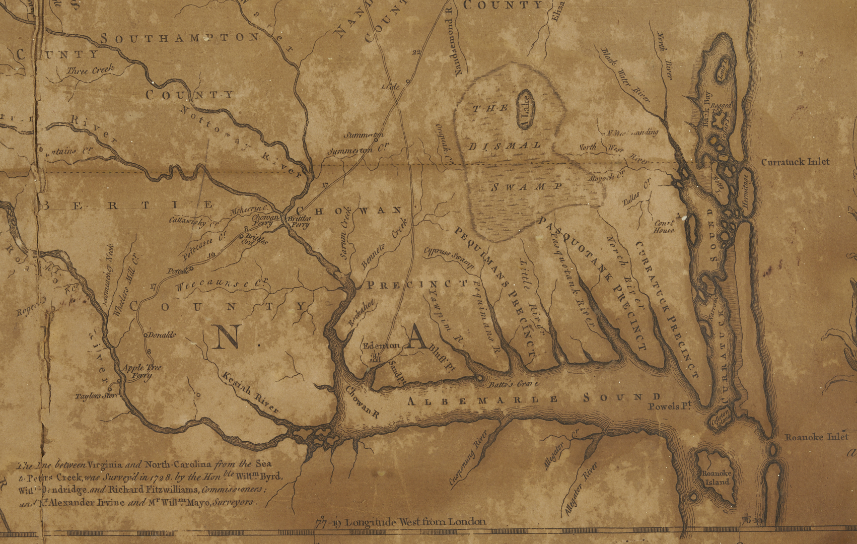
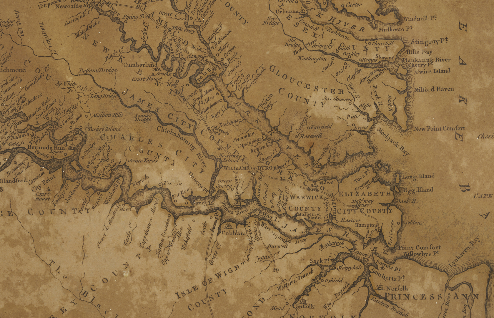
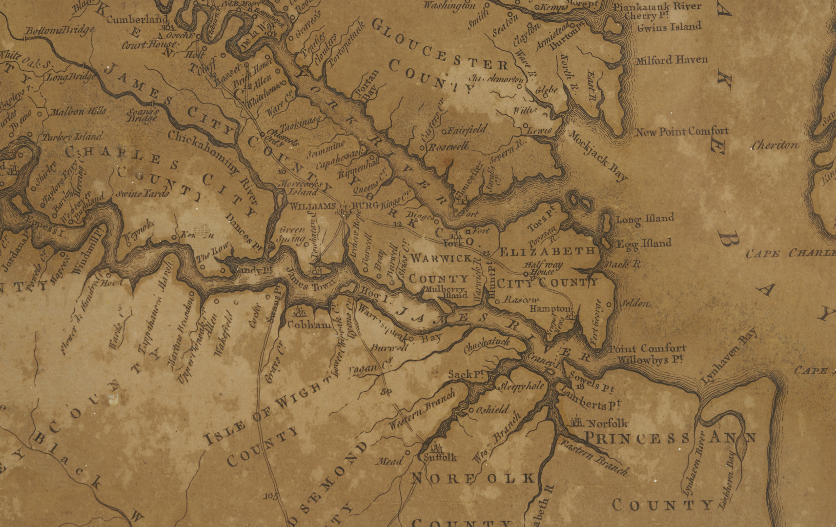
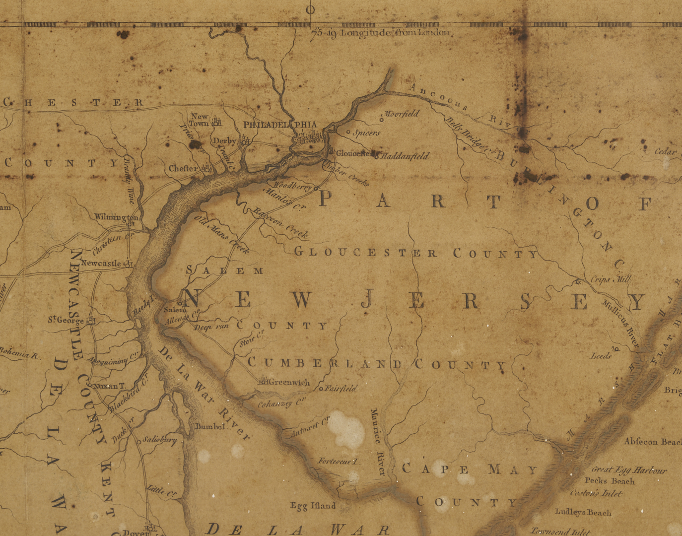
Joshua Fry (c. 1700-1754) and Peter Jefferson (1708-1757), A MAP OF THE MOST INHABITED PART OF VIRGINIA CONTAINING THE WHOLE PROVINCE OF MARYLAND WITH PART OF PENSILVANIA, NEW JERSEY AND NORTH CAROLINA. London, 1775. 6th state. Engraving on four laid-paper sheets, joined. This map, which the Library of Virginia calls “the most important map of Virginia drawn in the 18th century,” has descended in the family of, and is believed to have been originally owned by, Virginia Governor John Tyler, Sr. (1747-1813), the father of U.S. President John Tyler. Framed under glass in a wood frame. Sight: 48 1/2 in. H x 31 1/2 in. W. Framed: 52 1/2 in. H x 35 1/2 in.
Note: in the year this particular map was published, 1775, Virginia joined the Revolutionary War and Tyler, a young Virginia attorney and plantation owner, raised a company of troops. It is possible Tyler first learned of this map through his close friend and former school roommate, Thomas Jefferson, whose father, Peter, co-created it. The map, first published in 1753, included Peter Jefferson and Col. Joshua Fry’s completed border survey for the western bounds of the Northern Neck and a portion of the VA-NC dividing line, a project they first undertook in the late 1740s for acting Virginia Governor Col. Lewis Burwell at the request of the British Board of Trade and Plantations. Thanks to their cartography, for the first time, the entire Virginia river system was properly delineated, and the NE/SW orientation of the Appalachian Mountains was fully displayed.
Thomas Jeffreys engraved the map, and artist Francis Hayman and engraver Charles Grignion were commissioned to design and execute the map’s cartouche, illustrating both the tobacco and slave trade on which Virginia’s economy was based. The map was updated over the next several decades, and included contributions from surveyor Christopher Gist after Fry’s death in 1754. The sixth state of the map, represented here, was published in “The American Atlas” by Robert Sayer and John Bennett. Although other important maps from other makers followed in the next few years, the Fry-Jefferson map would dominate cartographical representations of Virginia until 1807. Sources: Henry Taliaferro and Margaret Pritchard, Degrees of Latitude: Mapping Colonial America, Williamsburg, VA: Colonial Williamsburg Foundation, 2002, no. 30, pg. 154-159. William P. Cumming, The Southeast in Early Maps, Chapel Hill: University of North Carolina Press, 1998, no. 281, 449, pg. 266-268; 332. The Library of Virginia website.
PROVENANCE: By descent in the family of Virginia Governor John Tyler, Sr. (1747-1813). Tyler served as a Revolutionary War militia captain, speaker of the House of Delegates, Judge of the State Admiralty and General Courts, Vice President of the Convention of 1788, and as Governor of Virginia from 1808 – 1811.
CONDITION: Heavily toned, with scattered abrasions. Dark scattered foxing to upper quarter of paper. Small hole upper left side, about 1/4 in diameter, appears backed with linen. Separations at vertical fold line running from top to bottom of map, starting between the letters L and V in Pennsylvania.