SOLD! for $224.00.
(Note: Prices realized include a buyer's premium.)
If you have items like this you wish to consign, click here for more information:
Selling with Case- Low Estimate: $300.00
- High Estimate: $400.00
- Hammer Price: $175.00
- Share this:
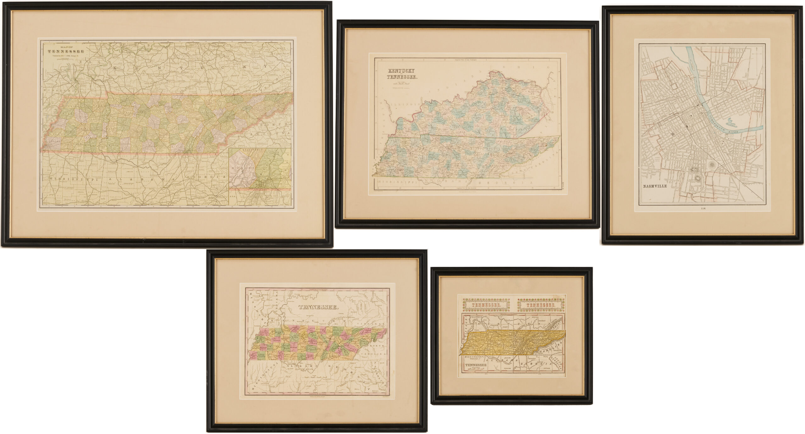
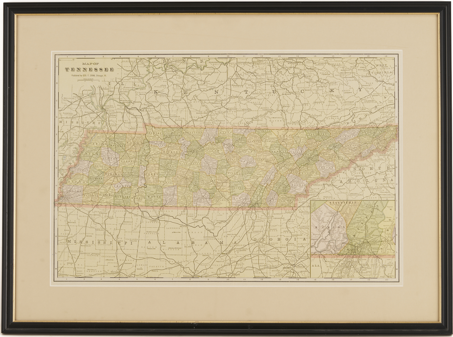
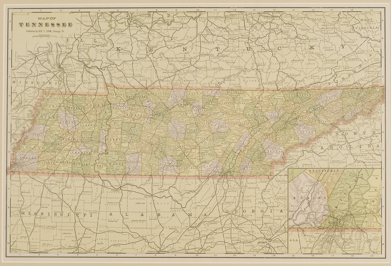
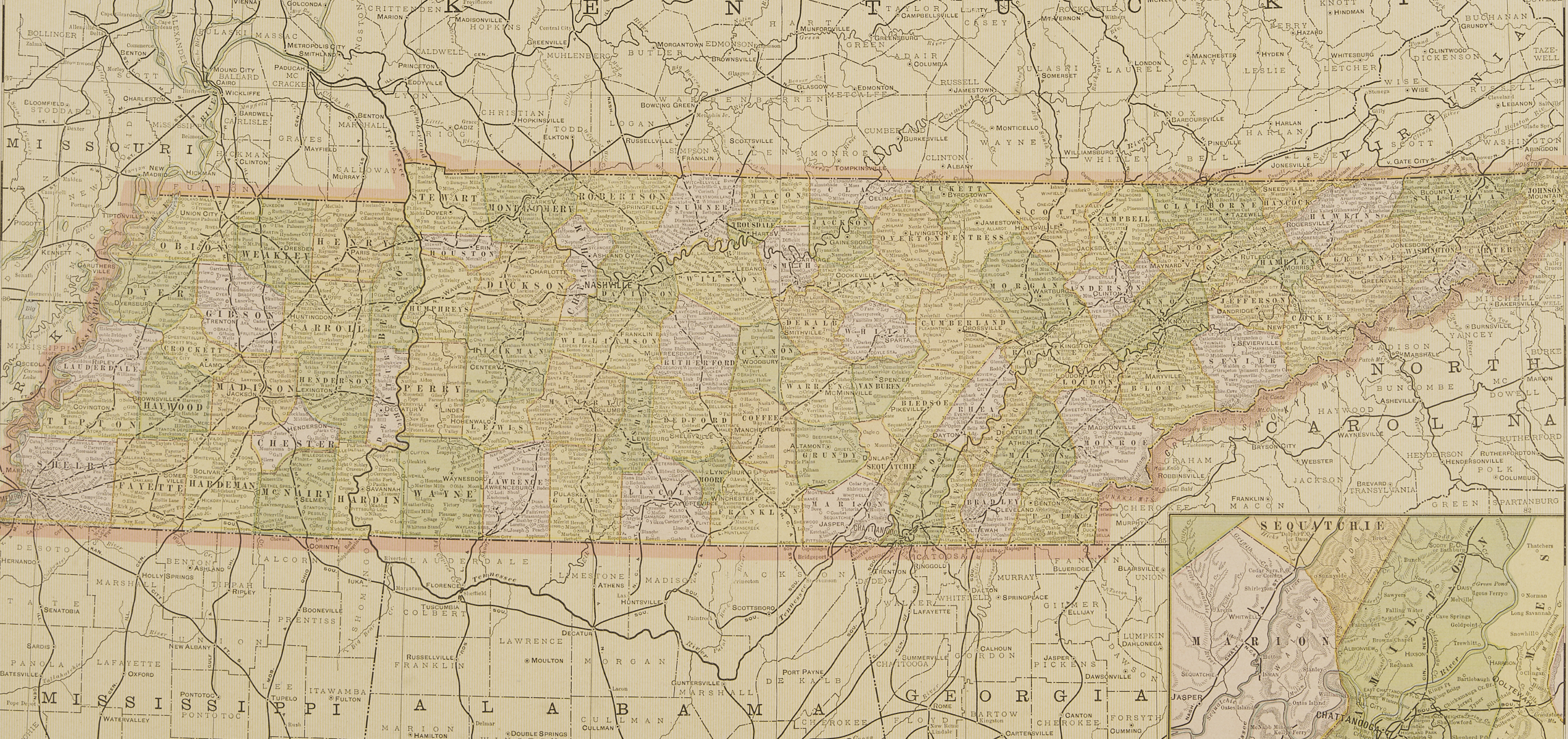
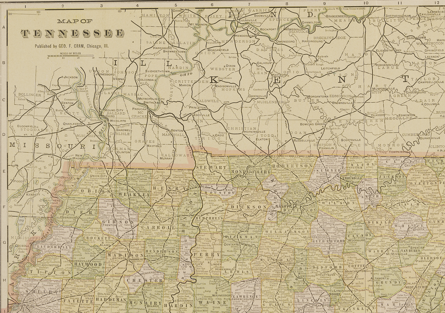
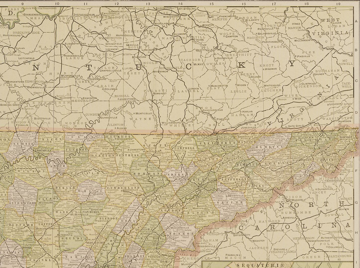
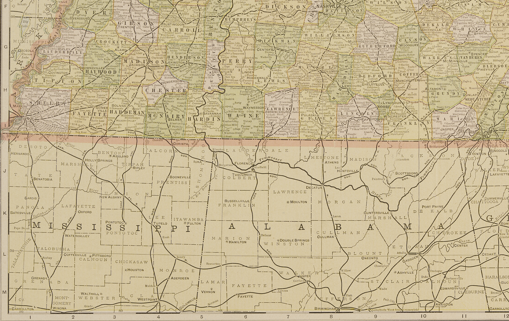
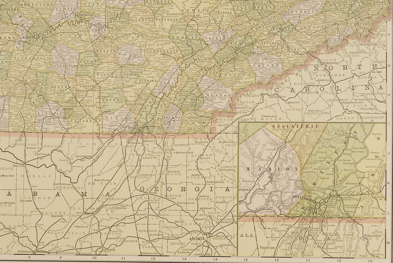
Grouping of five (5) framed maps of Tennessee and surrounding states, with Nashville. 1st Item: Map of Tennessee from “Cram’s Modern Atlas” by George Cram, county map inset with map of Chattanooga. Ca early 1900s, Sight 20 3/4 in. x 13 3/4 in. Framed: 26 1/2in. x 19 1/2 in.
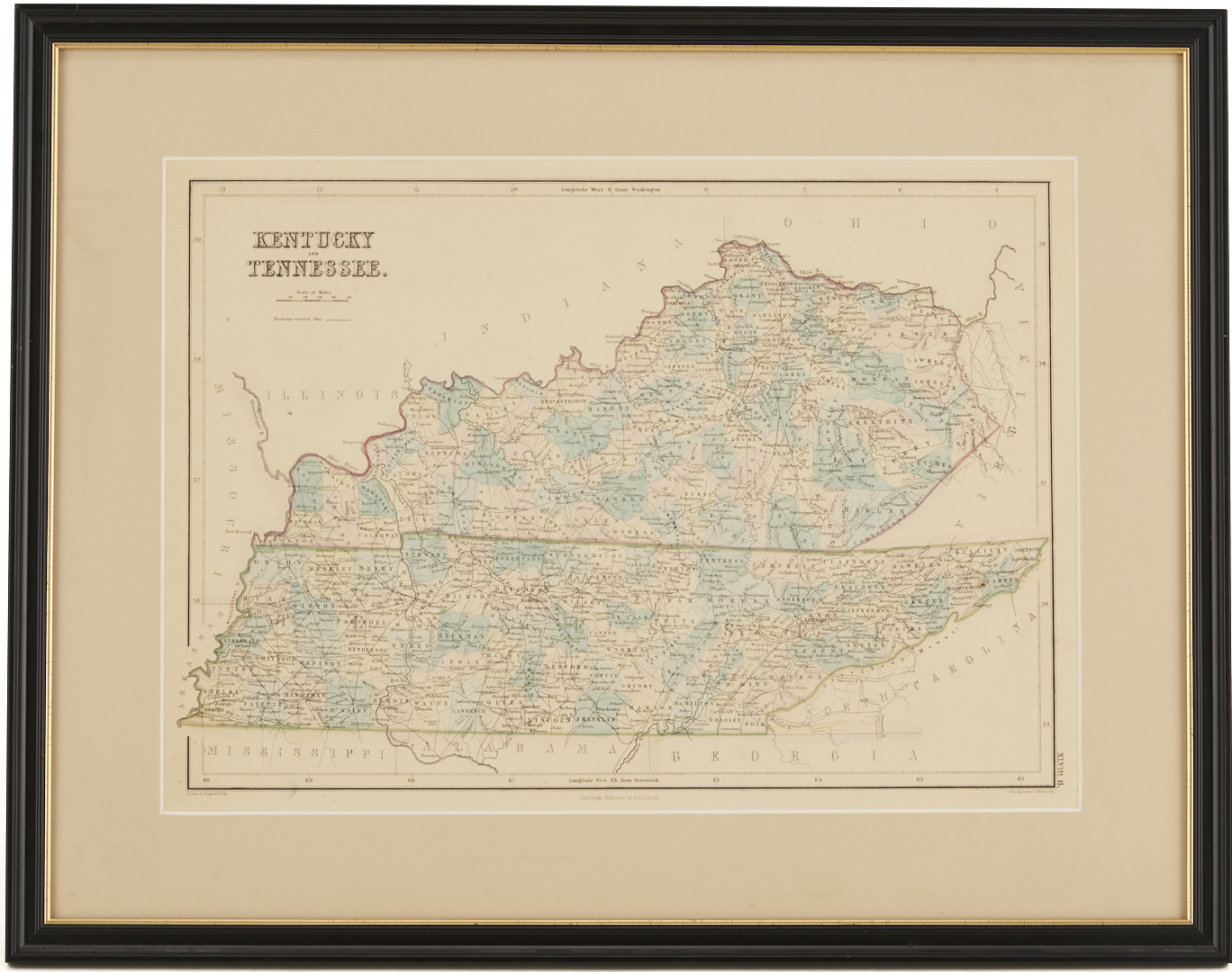
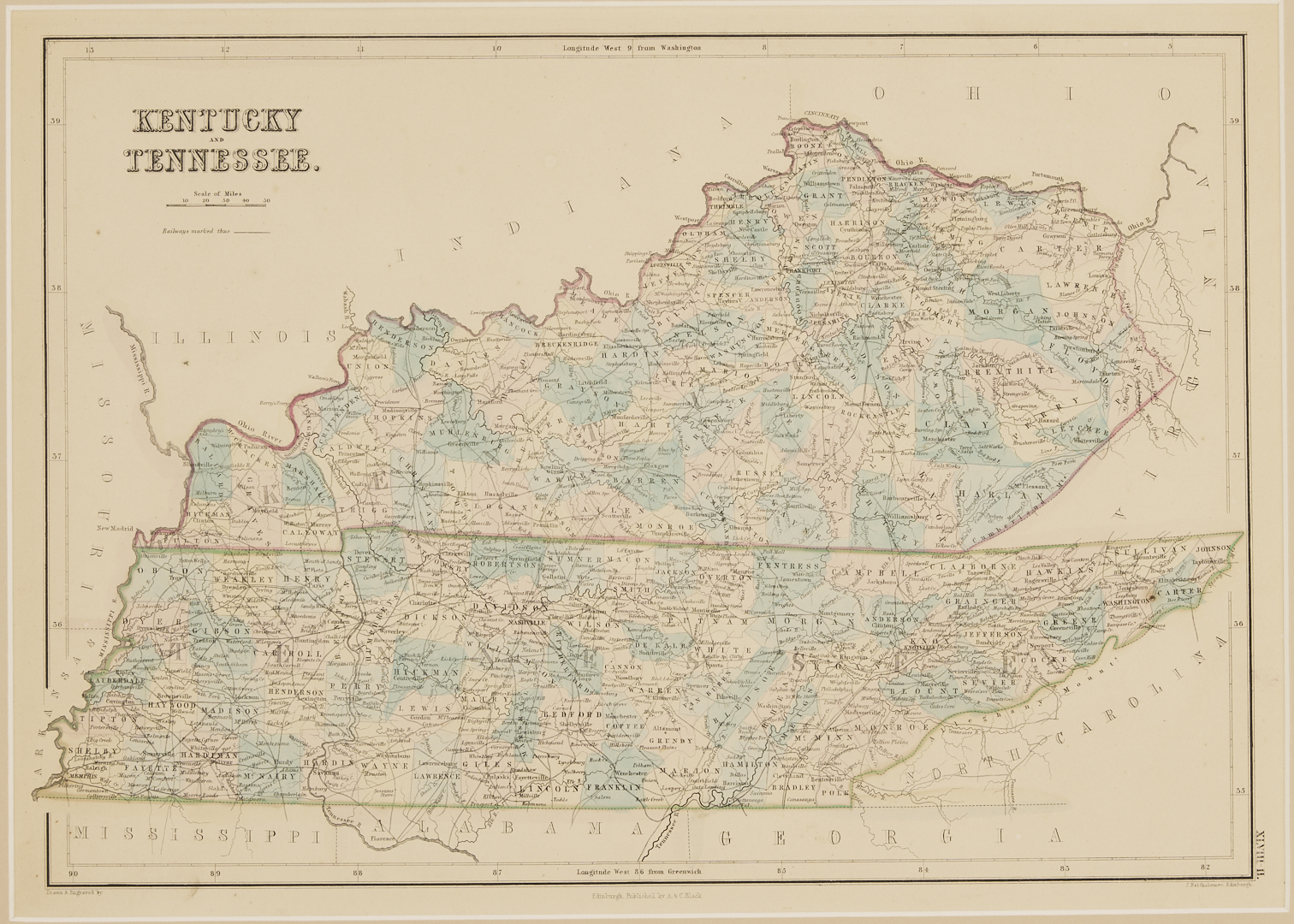
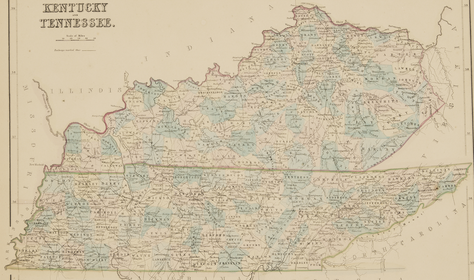
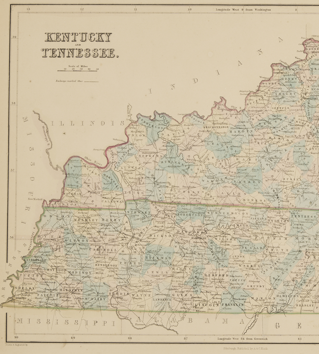
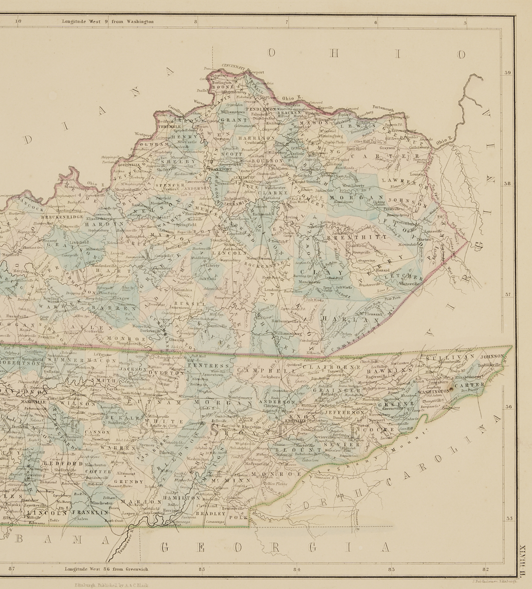
2nd Item: Map of Kentucky and Tennessee, by J. Bartholomew, printed A. & C. Black, Edinburgh, ca 1840-1850s. Matted and framed original sheet, Sight: 15 3/4 in. x 11 1/2 in.; Framed: 21 in. x 16 1/2 in.
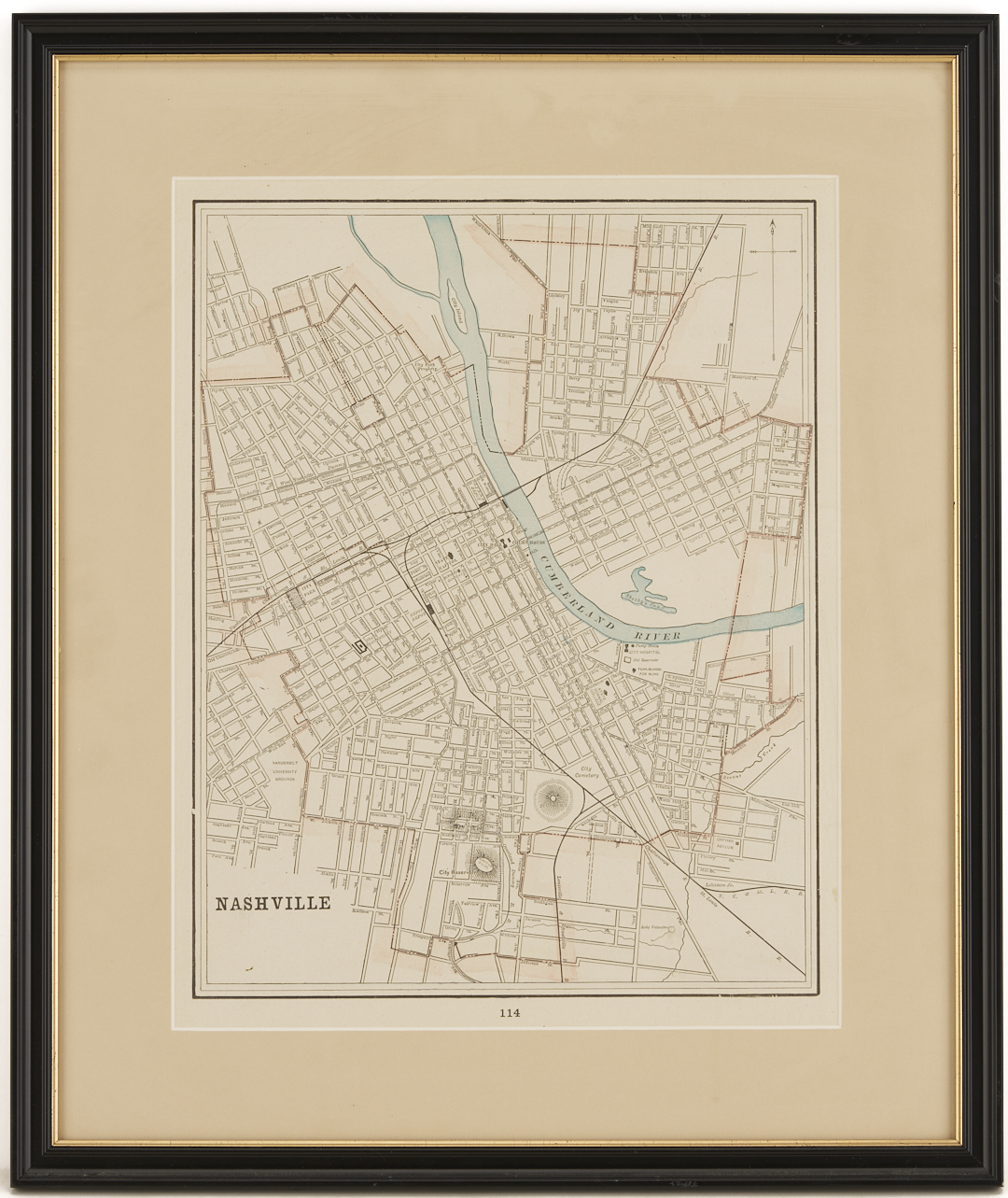
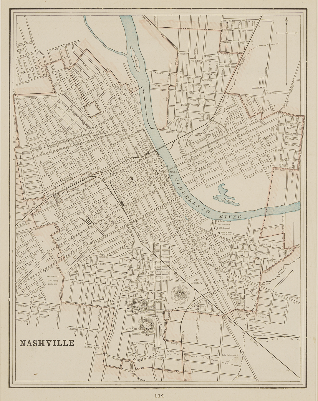
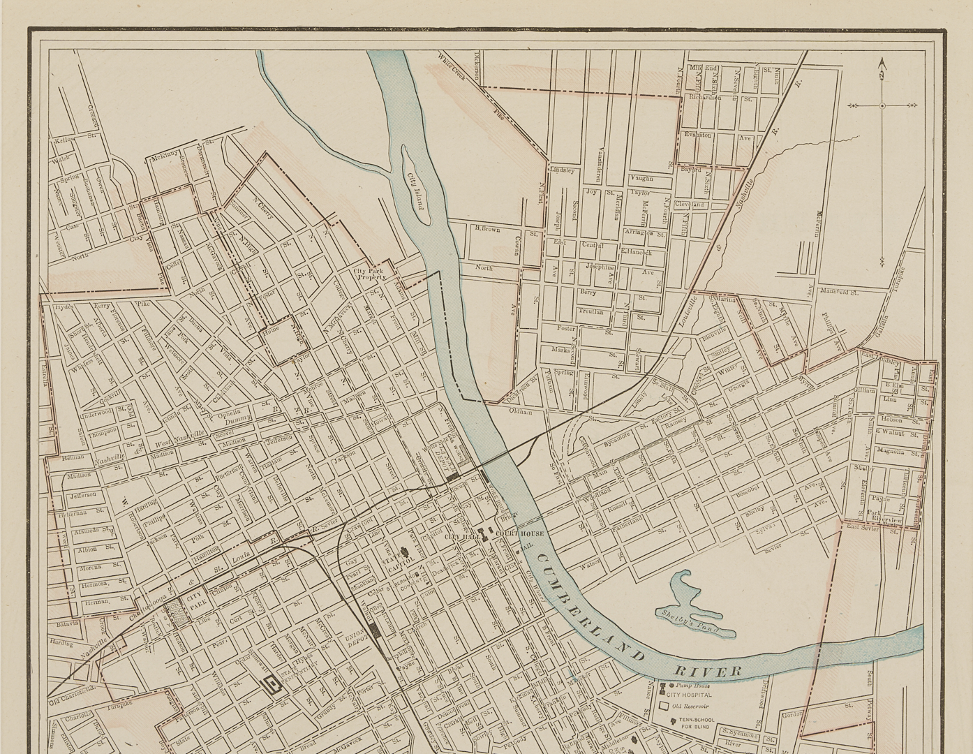
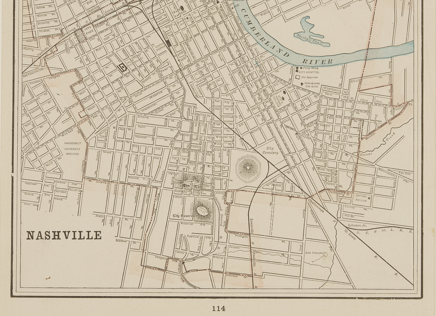
3rd Item: Map of Nashville, matted and framed page from “Cram’s Universal Atlas Geographical, Astronomical and Historical”, ca. 1894. Although not visible, has city of Memphis map on the reverse. Sight 13 3/4 in. x 10 3/4 in; framed: 19 in. x 16 in.
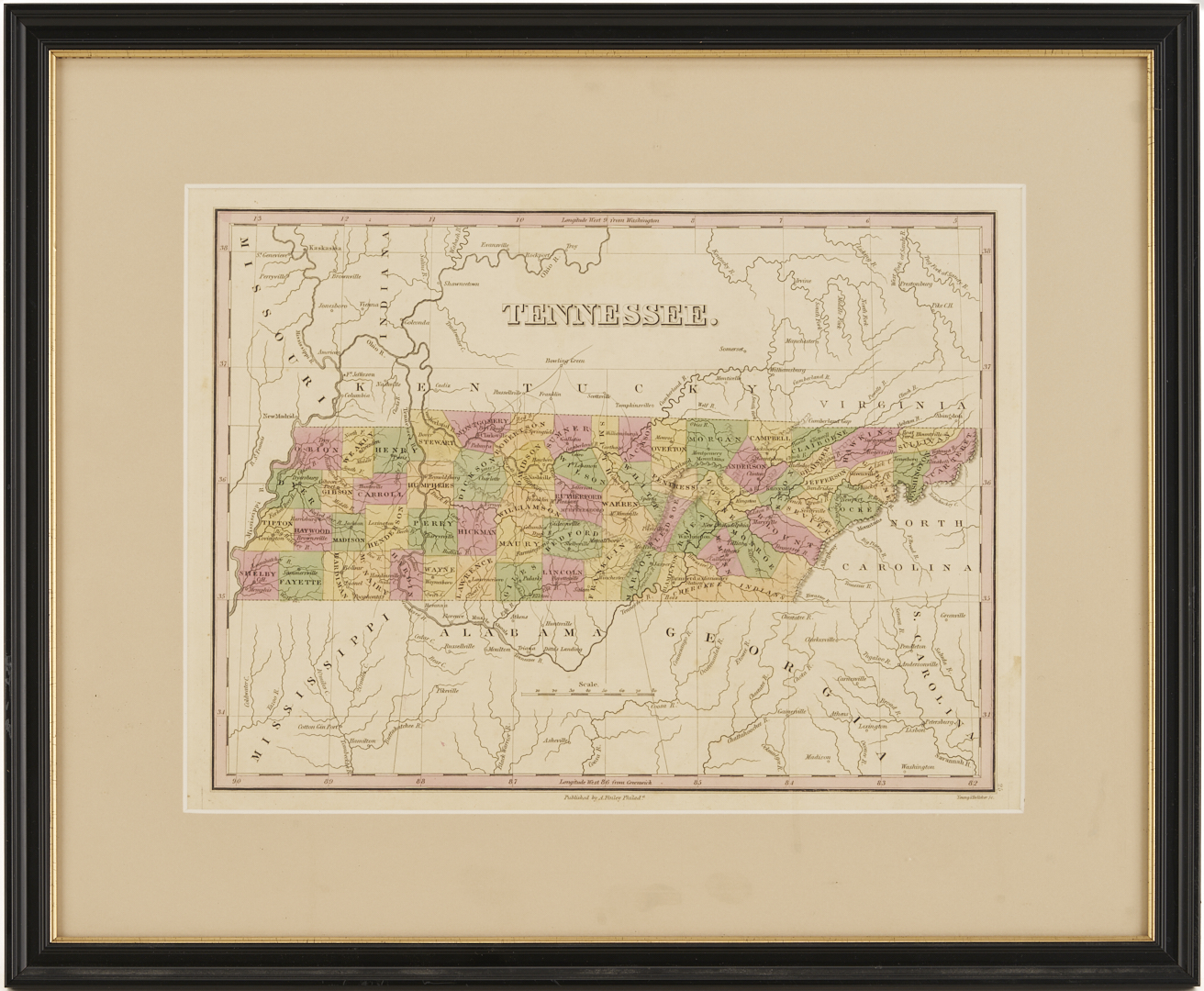
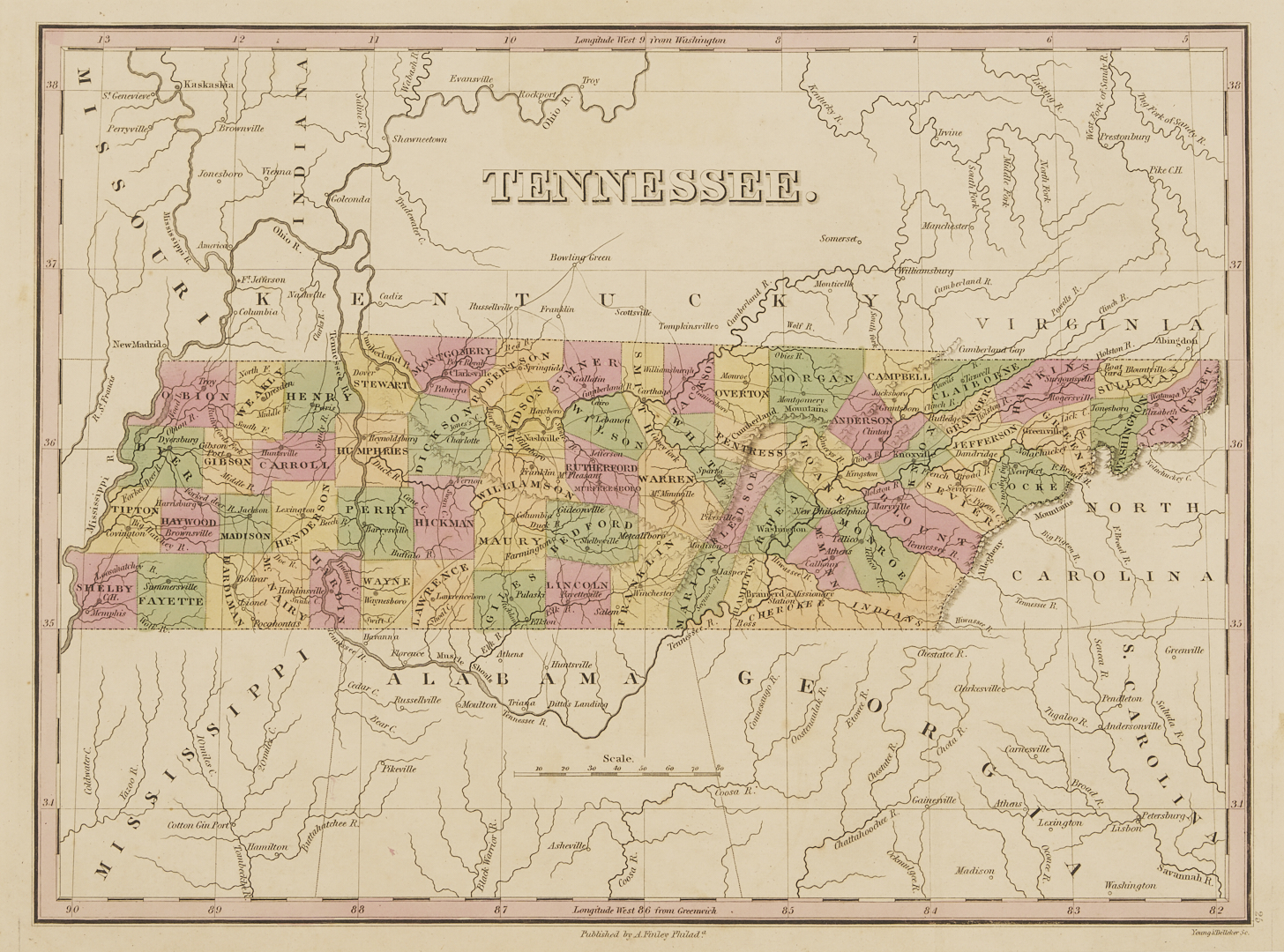
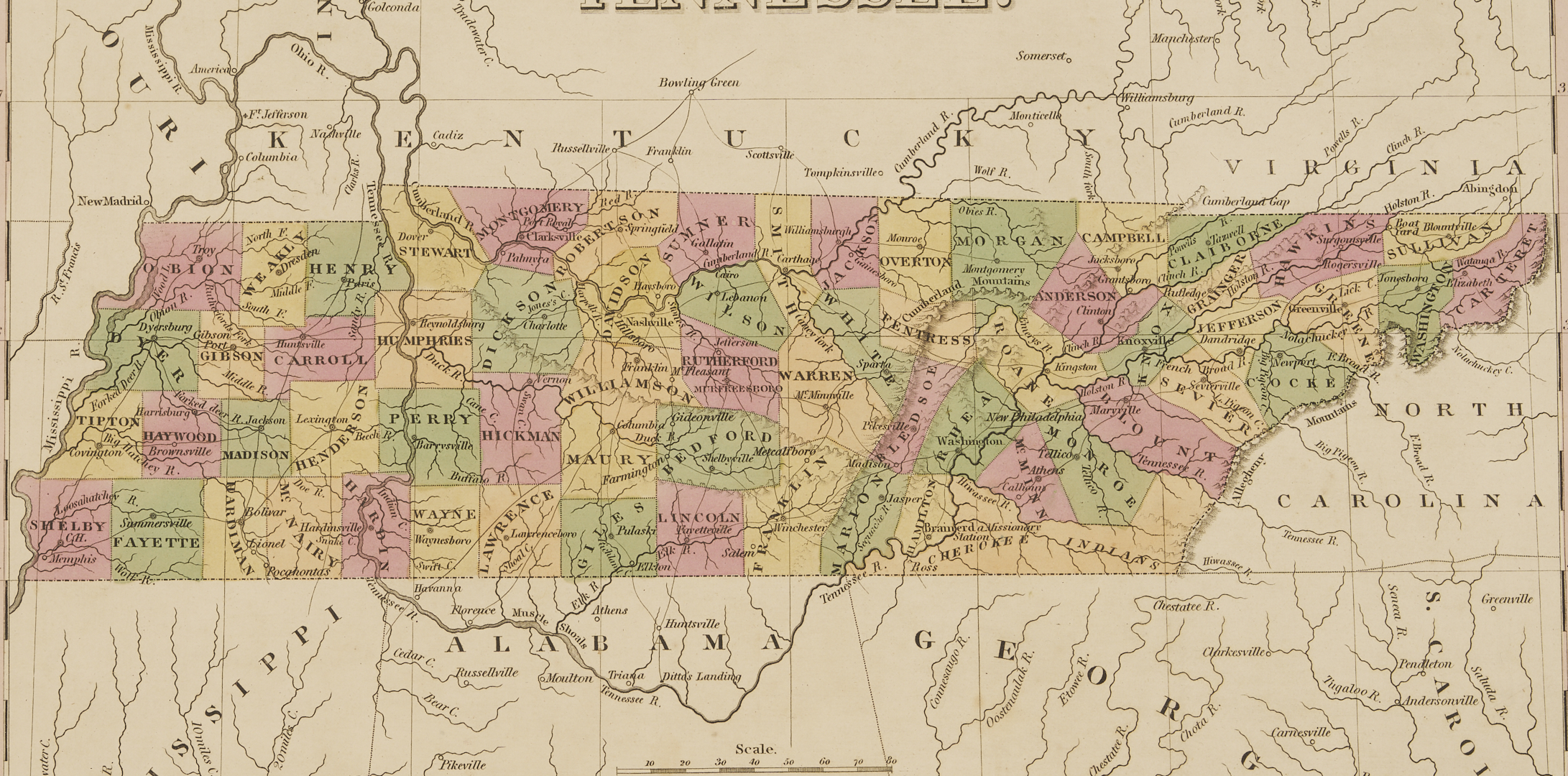
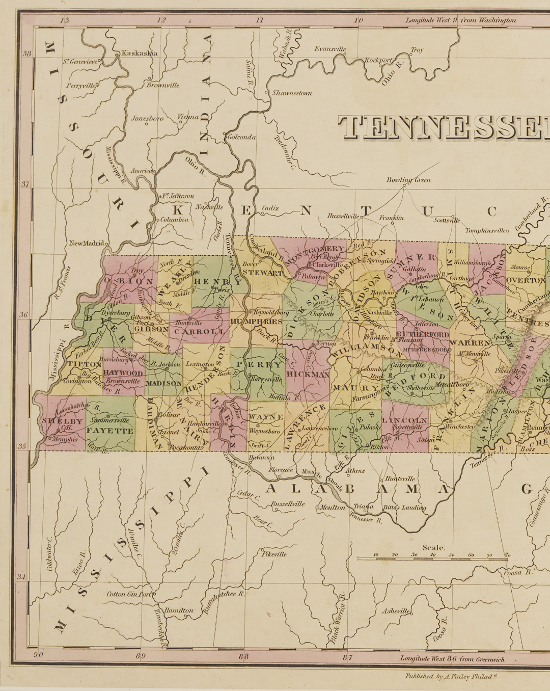
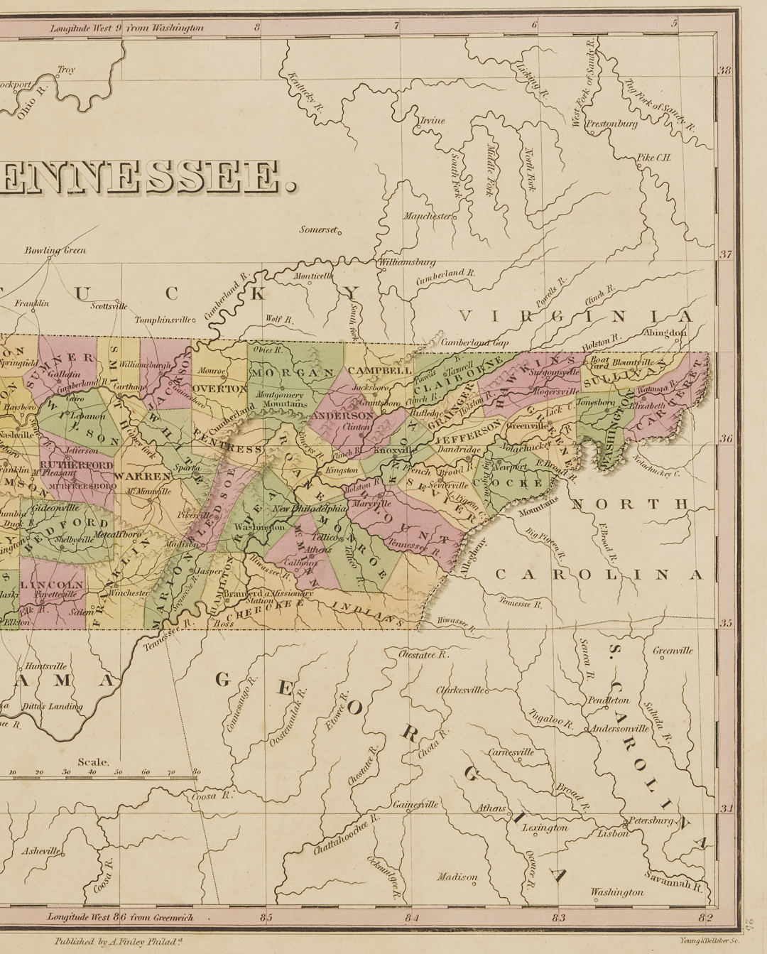
4th Item: Map of Tennessee, matted and framed original hand-colored page from the Atlas published by A. Finley Philada. Young & Delleker Sc., ca 1830’s. Counties of Benton and Lauderdale not present, each formed in 1835. Sight 12 1/4 in. x 9 1/4 in; Framed 17 1/2 in. x 14 1/2 in.
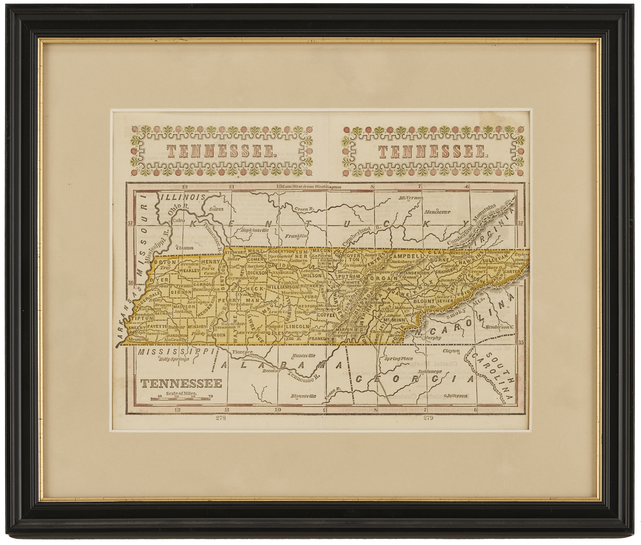
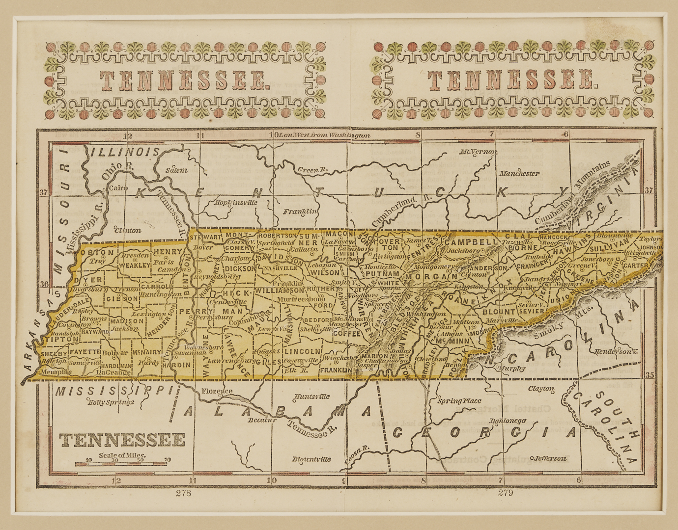
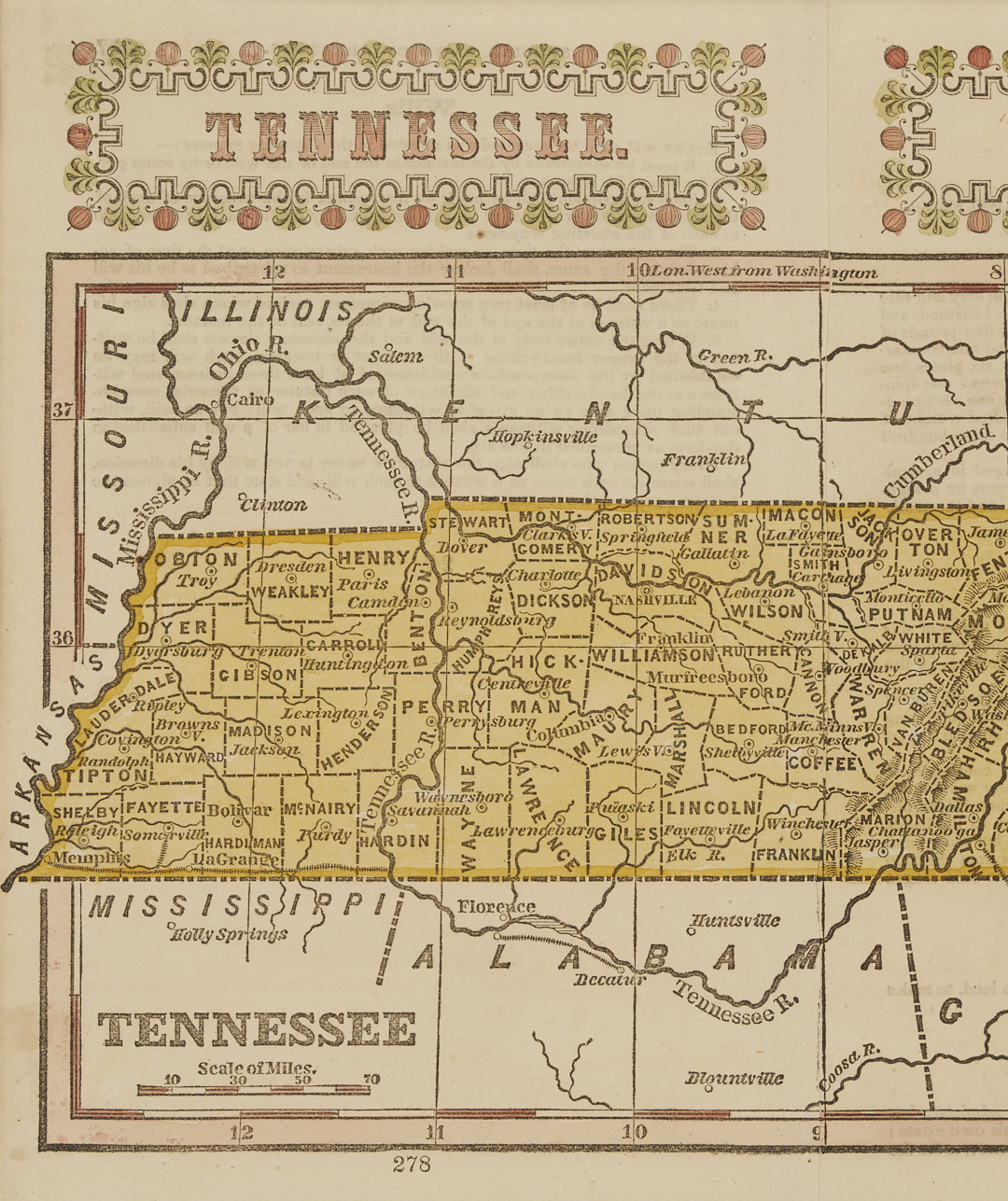
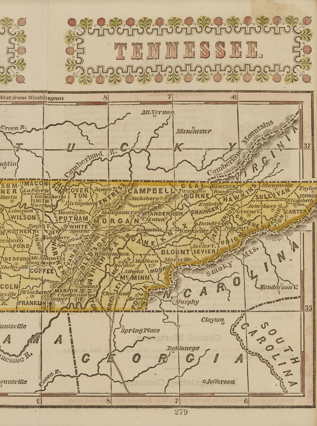
5th Item: Map of Tennessee, matted and framed, hand-colored pair of pages from D.W. Beadle’s The American Lawyer, and Business-Man’s Form-Book; Containing Forms and Instructions. Lewis County, founded late 1843, is absent. Sight: 8 1/2 in. x 6 1/2 in.; Framed: 12 3/4 in. x 10 3/4 in.
PROVENANCE: Private Nashville, Tennessee collection.
CONDITION: Each in excellent condition, slight toning to sheets, mild abrasions on frames.